
image
Wet Map
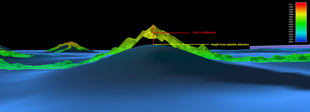
This vertical image, from a multibeam sonar survey in the Pacific Remote Islands Marine National Monument, shows an approximately 1,700 meter seamount height difference when compared to previous satellite altimetry.