
image
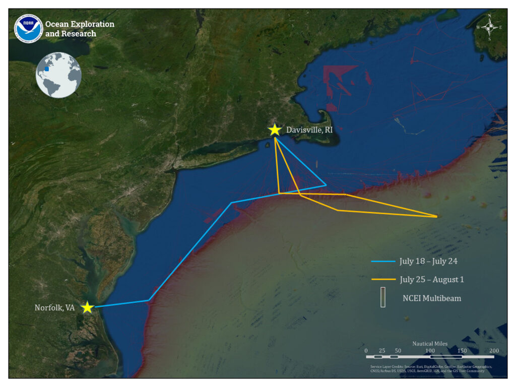
Expedition Map
Map showing the approximate route of NOAA Ship Okeanos Explorer during the two legs of the 2019 Technology Demonstration and current publicly available multibeam bathymetry data.
Official websites use .gov
A
.gov website belongs to an official government
organization in the United States.
Secure .gov websites use HTTPS
A
lock (
) or https:// means you’ve safely connected to
the .gov website. Share sensitive information only on official,
secure websites.
Map showing the approximate route of NOAA Ship Okeanos Explorer during the two legs of the 2019 Technology Demonstration and current publicly available multibeam bathymetry data.