
Exploring Deep-Sea Methane Seeps Along the Chile Margin
Past Expedition
Overview
From October 11 to December 5, 2024, an interdisciplinary and international team of researchers explored the unique geological and biological systems of the Chile margin during an ambitious expedition on Schmidt Ocean Institute’s Research Vessel Falkor (too) . With support from NOAA Ocean Exploration, one of the expedition projects focused on collecting data to unravel the complexities of methane seep systems — a type of cold seep and a significant contributor to oceanic carbon cycling — in this tectonically active region.
Project Details
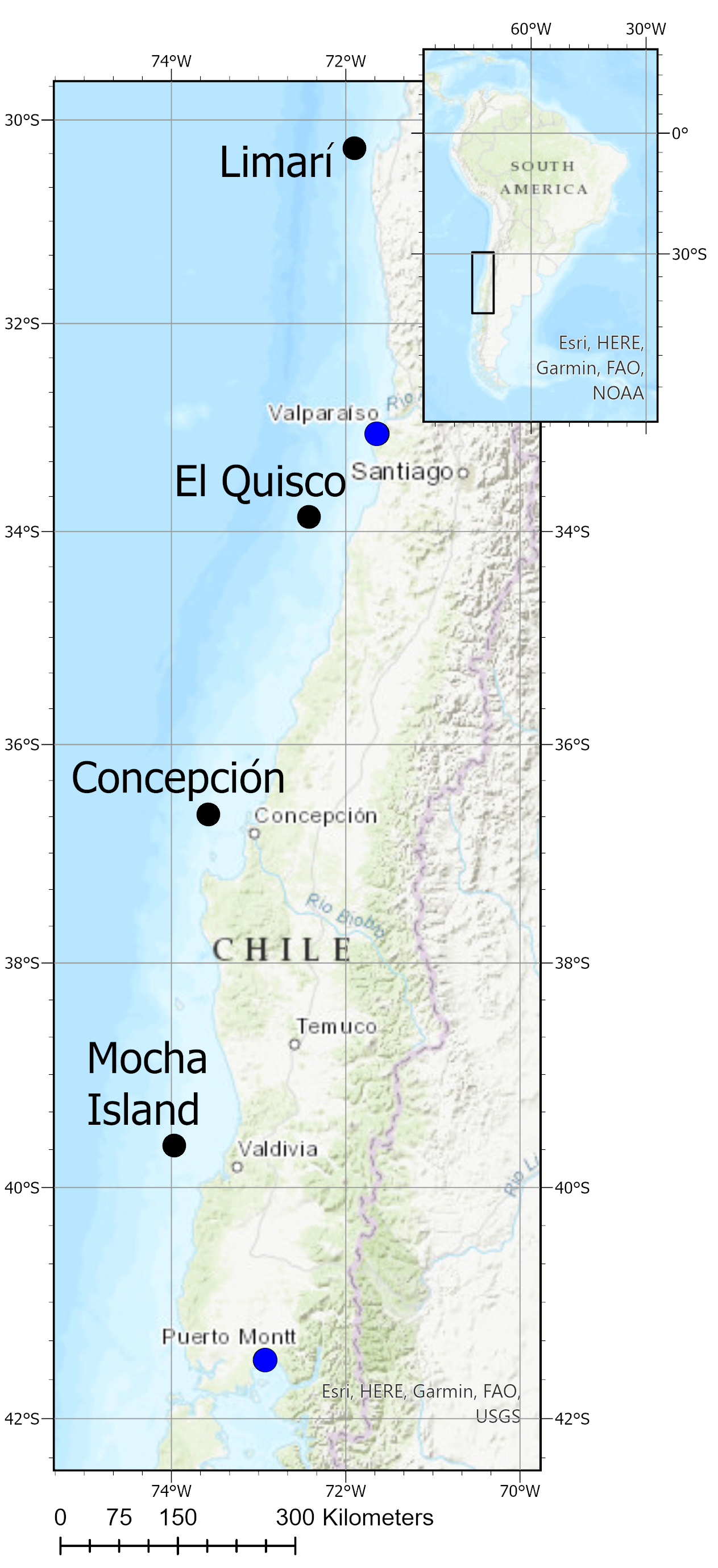
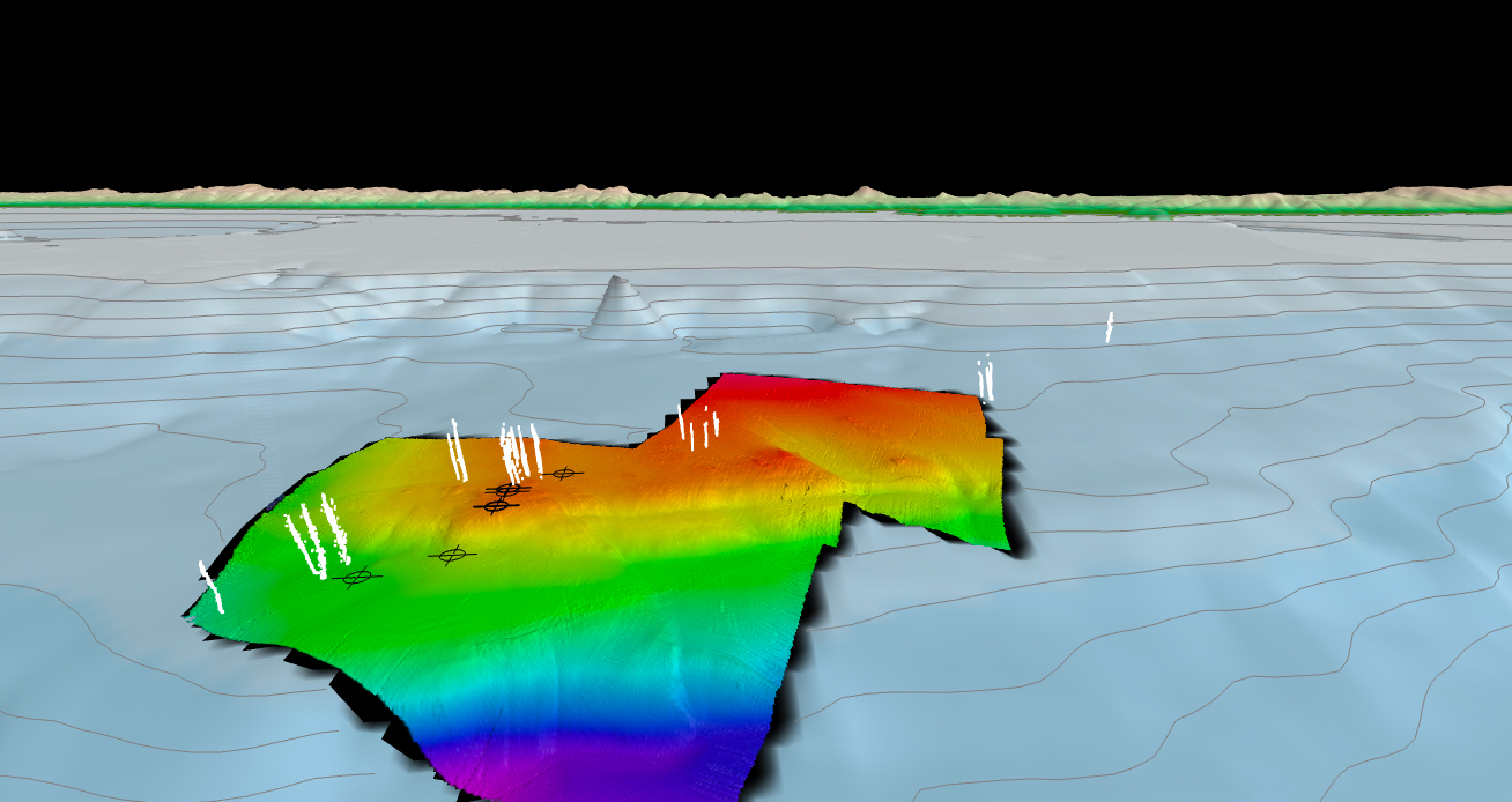
This project focused on mapping and characterization of methane seep ecosystems and their interactions with tectonic, climatic, and oceanographic processes along four key sites: Limarí Seeps, El Quisco Seep Area, Concepción Methane Seep Area, and Mocha Island Seep Area. Using advanced tools and techniques, the researchers surveyed the seafloor and subsurface structures.
- A high-resolution sub-bottom profiler was used to investigate the shallow subsurface structure of methane seepage. This state-of-the-art technology provided critical insights into the subsurface structure and geology while also informing the precise positioning of the sediment coring devices.
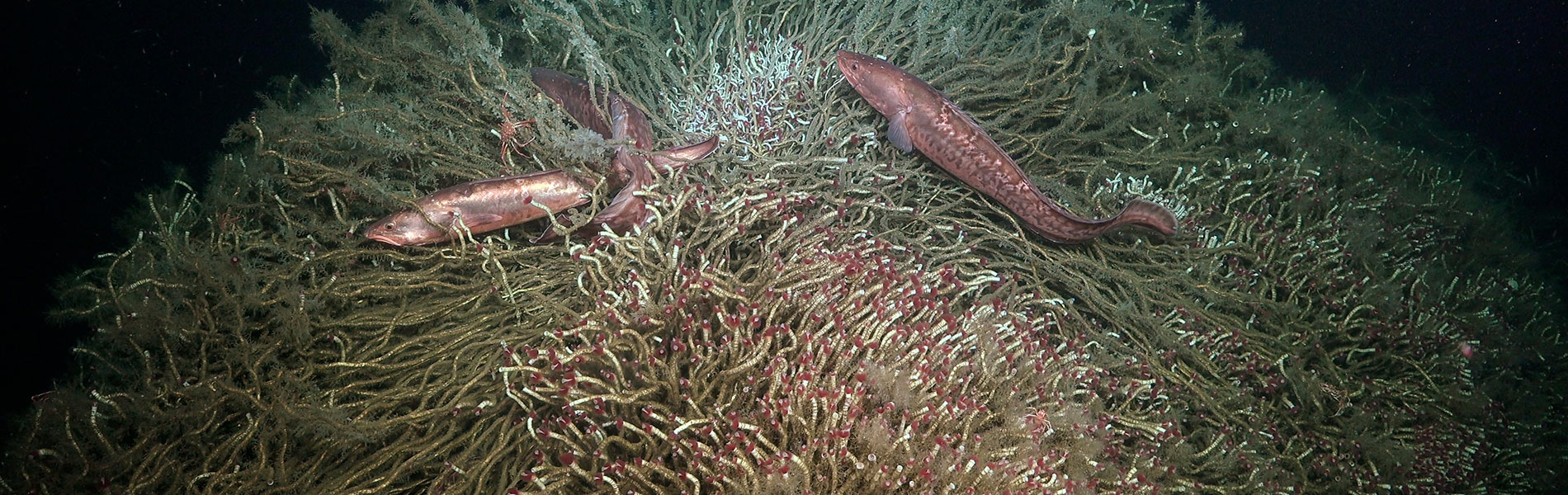
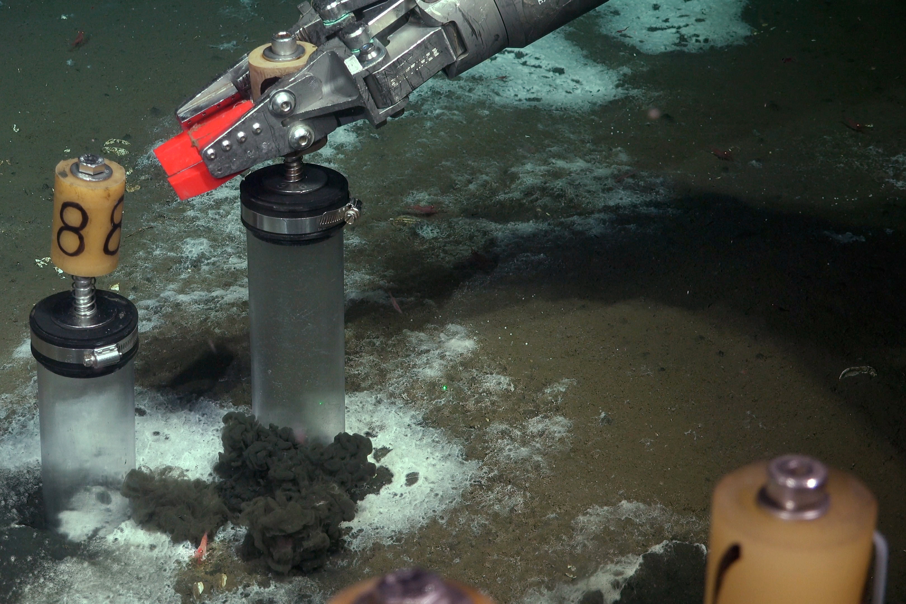
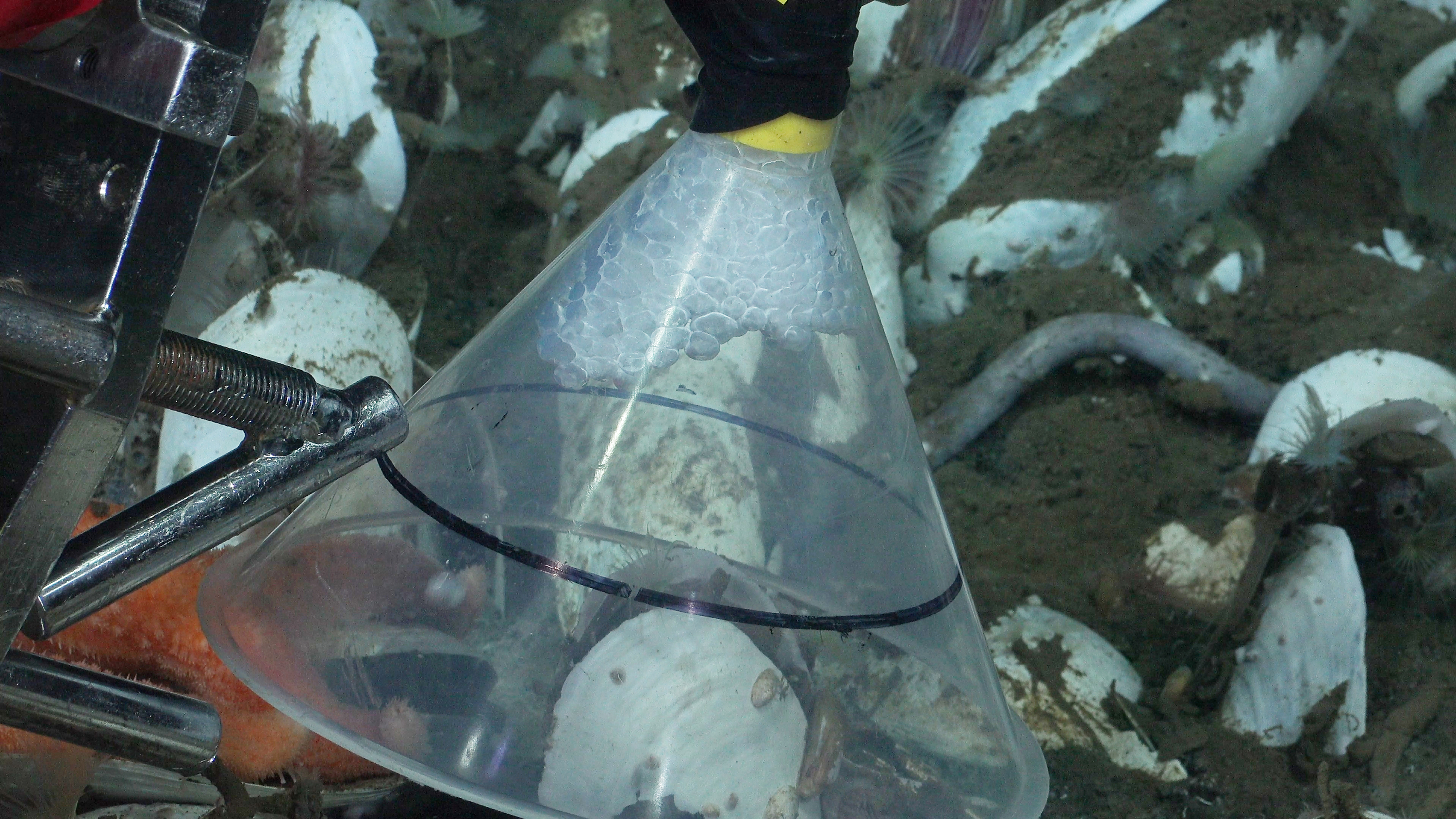
- Remotely operated vehicle (ROV) SuBastian was used for precise sampling and high-definition imaging of seep habitats. The ROV enabled the researchers to observe active methane emissions and collect samples from microbial mats and methane-derived authigenic carbonates.
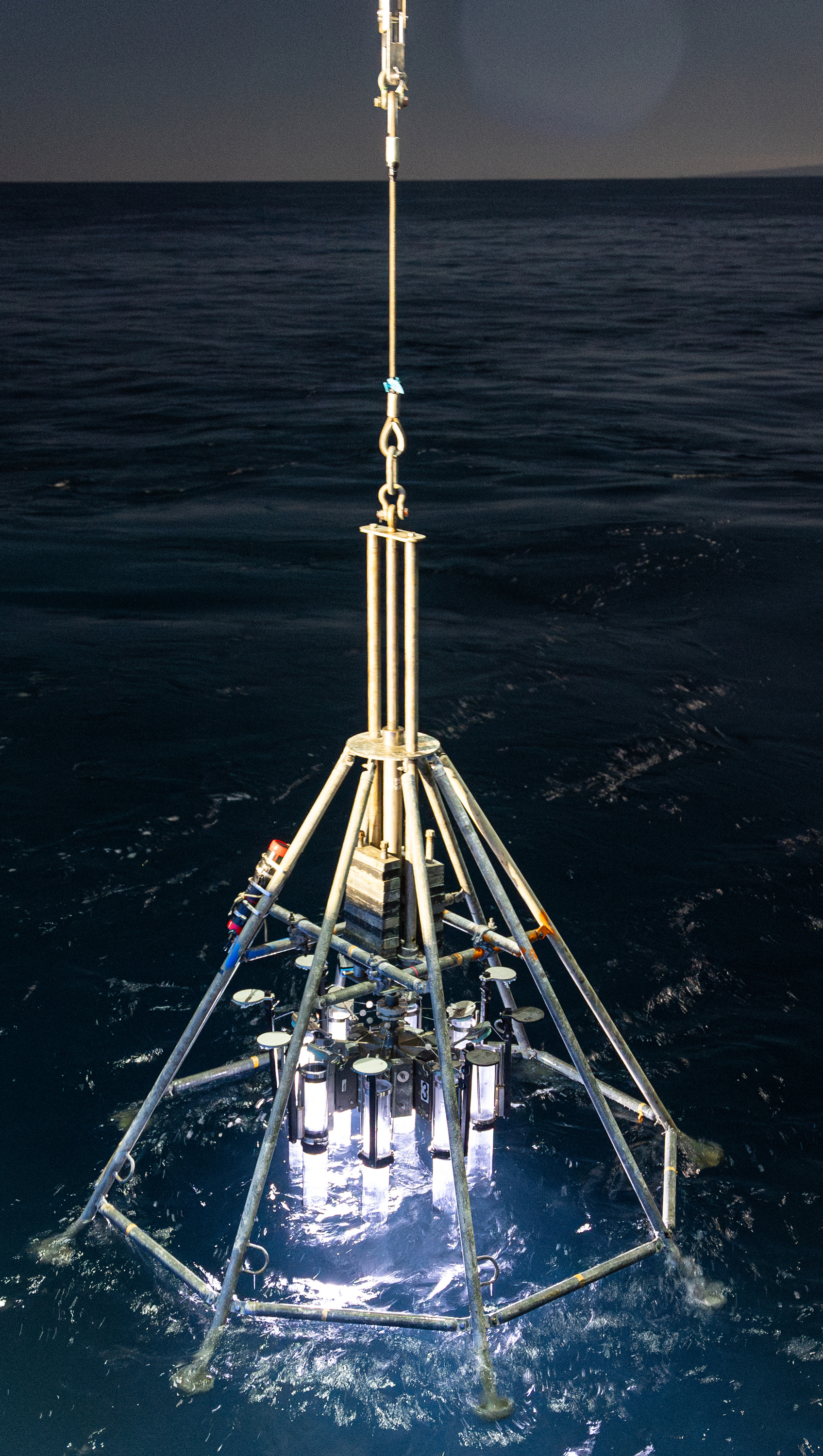
- Geochemical sensors and samplers were used to collect data on methane fluxes, fluid migration pathways, and the geochemical characteristics of the seep environments. Among the sensors was an in situ methane sensor, now known as SAGE (Sensing Aqueous Gases in the Environment) used for precise and real-time measurements of methane concentrations in the water column developed with support from NOAA Ocean Exploration.
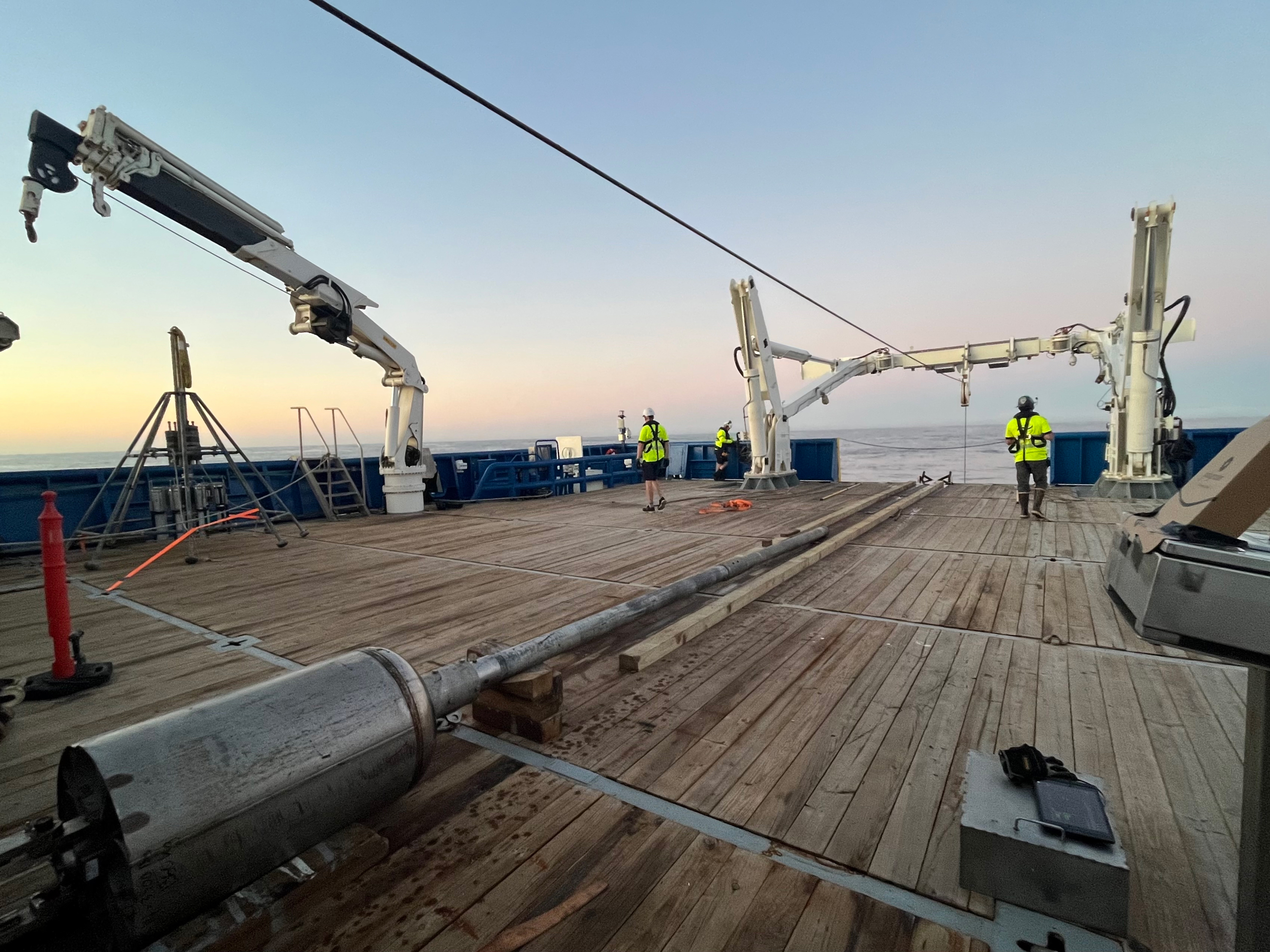
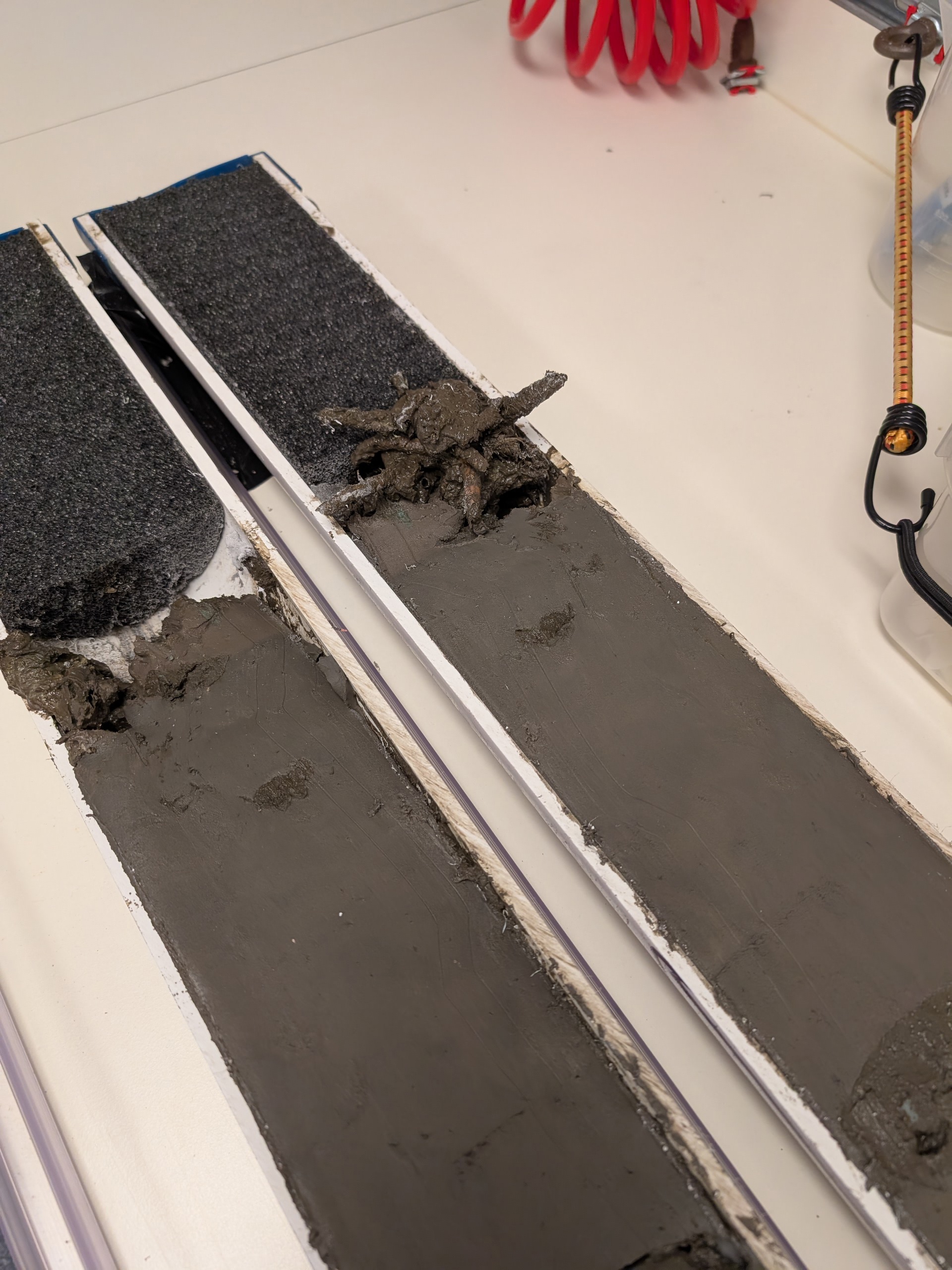
- Sediment coring devices were used to collect sedimentary records to reconstruct methane seepage history. This was the first time a large-diameter gravity corer that can collect samples up to 6 meters (20 feet) in length was deployed off Falkor (too).
- Shipboard and ROV-mounted multibeam sonar systems were used to map the seafloor and individual seeps.
Download largest version (jpg, 4.56 MB).
Download largest version (jpg, 2.86 MB).
Download largest version (jpg, 935 KB).
Multimedia
Featured multimedia assets associated with this project.
Education
Our Learn & Discover page provides the best of what the NOAA Ocean Exploration website has to offer to support educators in the classroom during this expedition. Each theme page includes expedition features, lessons, multimedia, career information, and associated past expeditions. Below are related top education themes for this expedition.
Resources & Contacts
-
Emily Crum
Communication Specialist
NOAA Ocean Exploration
ocean-explore-comms@noaa.gov