
2024 Dual DriX Project: Investigation of Tandem Uncrewed Surface Vehicle Operations for Seafloor Mapping Missions
Past Expedition
Overview
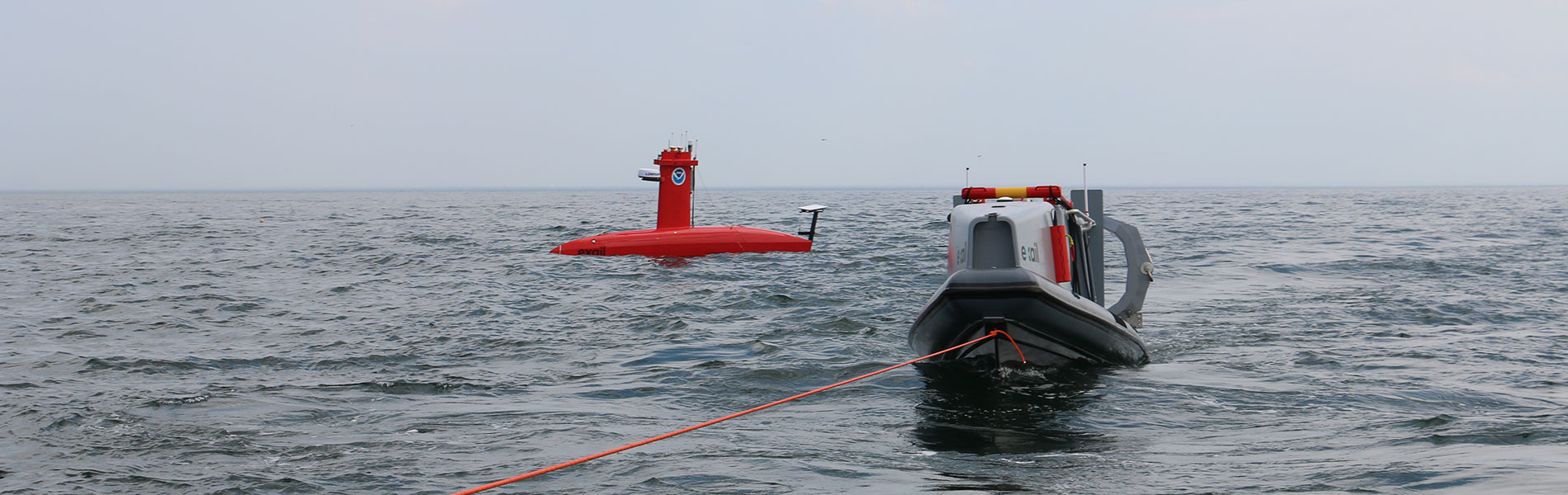
In October 2024, a team of government, academic, and industry partners will undertake an exciting effort to expand the capabilities of uncrewed systems in order to support NOAA missions to map, characterize, and explore the submerged waters of the United States. Co-led by the University of New Hampshire (UNH) and the NOAA Uncrewed Systems Operations Center, with support from the NOAA Ocean Exploration Cooperative Institute, several parts of NOAA, the Bureau of Ocean Energy Management, and Exail, this month-long seafloor mapping mission will test the use of two NOAA-owned DriX uncrewed surface vehicles (USVs) operated from a shorebased operations center. The project builds on work by UNH and NOAA undertaken since 2021 to operationalize DriX vehicles for gathering seafloor mapping data.
The month-long mission is focused on testing the concept of remotely operating multiple uncrewed vehicles from a shorebased operations center– a first for UNH, NOAA and the entire project team. This involves exploring the use of two simultaneous uncrewed surface vehicles, the maintenance and support of those vehicles, the safety of operations, the role of trained personnel in supporting operations, and more. From this exploration, the project team aims to better understand the efficiency of remotely operating multiple uncrewed vehicles for science missions and to develop protocols for future operations.
The mission is taking place in the Gulf of Maine, approximately 75 miles east of Boston (see map below). Each DriX uncrewed surface vehicle is equipped with high-resolution multibeam sonar, used to map the seafloor and detect objects in the water column or along the seafloor. They are capable of operating for upwards of three days at a time before returning to shore for routine checks and refueling. The shorebased operations center will be at the Center for Coastal and Ocean Mapping at the University of New Hampshire with an additional mobile servicing and support center in Provincetown, Massachusetts, at the tip of Cape Cod. By operating multiple vehicles at once the project team hopes to dramatically increase the efficiency of offshore survey operations, potentially increasing the area that can be mapped and explored in a given time, enhancing safety of operations, reducing operational costs, reducing environmental impacts, and improving the quality of life for personnel whose ocean surveying careers often require months at sea, all while increasing the volume and quality of data in areas that are important to our nation’s economic livelihood and general wellbeing. The DriXes will return to the mobile servicing center on Cape Cod when needed. Beyond testing this concept of operations, the collected mapping data will fill gaps in areas of great interest for its ecological and societal value.
Follow along on this website and on our social media channels for weekly updates on the mission.
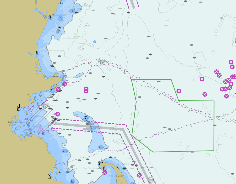
Download largest version (jpg, 313 KB).
Features

Multimedia
Featured multimedia assets associated with this project.
Education
Our Learn & Discover page provides the best of what the NOAA Ocean Exploration website has to offer to support educators in the classroom during this expedition. Each theme page includes expedition features, lessons, multimedia, career information, and associated past expeditions. Below are related top education themes for this expedition.
Resources & Contacts
- University of New Hampshire, Center for Coastal and Ocean Mapping
- NOAA Uncrewed Systems Operations Center
- NOAA Ocean Exploration
- NOAA Ocean Exploration Cooperative Institute
- NOAA Office of Coast Survey
- NOAA Office of Habitat Conservation
- Deep Sea Coral Research and Technology Program
- Bureau of Ocean Energy Management
- Exail
-
Emily Crum
NOAA Ocean Exploration
emily.crum@noaa.gov -
Ashley Hann
NOAA Uncrewed Systems Operations Center
ashley.hann@noaa.gov -
Robbin Ray
University of New Hampshire
Robbin.Ray@unh.edu