
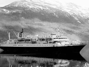
Seascape Alaska 5: Gulf of Alaska Remotely Operated Vehicle Exploration and Mapping (EX2306)
Past Expedition
Expedition Summary
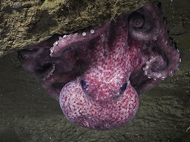
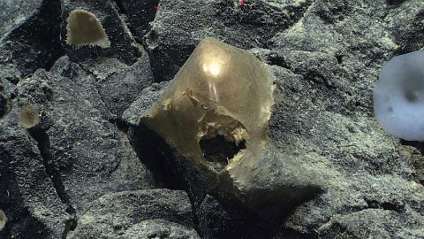
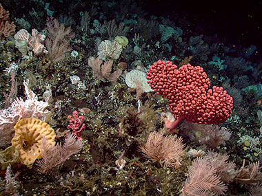
From August 23 – September 14, NOAA Ocean Exploration and partners conducted the fifth in a series of Seascape Alaska expeditions on NOAA Ship Okeanos Explorer. Operations during this 23-day expedition included 19 successful remotely operated vehicle (ROV) dives conducted in water depths ranging from 253 – 4,262 meters (830 – 13,983 feet), mapping of 28,287 square kilometers (10,922 square miles) of seafloor, and the collection of a wide variety of biological and geological samples. Altogether, data from the Seascape Alaska 5: Gulf of Alaska Remotely Operated Vehicle Exploration and Mapping expedition will contribute to our collective baseline understanding of the ocean, improving our ability to protect and manage marine ecosystems and furthering public awareness of the splendor, importance, and interconnectivity of the ocean to our everyday lives. View full expedition summary.
During the Seascape Alaska 5 expedition, the team navigated challenges ranging from rough weather to poor visibility, and completed 19 deepwater remotely operated vehicles (ROV) dives in the Gulf of Alaska and coastal fjords.
Operational Summary
- Days at sea: 23
- Full ROV dives: 19, ranging in depth from 253 – 4,262 meters (830 – 13,983 feet)
- Biological samples collected: 72 primary samples, 197 associates
- Geological samples collected: 32 primary samples, 13 associates
- Water samples collected for eDNA analysis: 70
- Seafloor area mapped: nearly 28,287 square kilometers (10,922 square miles)
- Science party participants: >50
- Live video views: Approximately 222,000
Download largest version (jpg, 302 KB).
Features
View Less
Multimedia
Featured multimedia assets associated with this project.
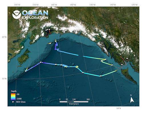
Dive Summary Map
The map below shows the location of dives during the expedition. Click on a dive number to access the update from that day.
Education
Our Learn & Discover page provides the best of what the NOAA Ocean Exploration website has to offer to support educators in the classroom during this expedition. Each theme page includes expedition features, lessons, multimedia, career information, and associated past expeditions. Below are related top education themes for this expedition.
Meet the Exploration Team
Learn more about the team members and their contributions to this project.


Expedition Data
Data collected during the expedition will be available in NOAA’s public data archives within 60-90 days of its completion and will be accessible via the NOAA Ocean Exploration Data Atlas.
Resources & Contacts
-
Emily Crum
Communication Specialist
NOAA Ocean Exploration
ocean-explore-comms@noaa.gov -
Keeley Belva
Public Affairs Officer
NOAA Office of Marine and Aviation Operations
keeley.belva@noaa.gov