
Autonomous Localization of Seafloor Fluid Flow Sources
Past Expedition
Overview
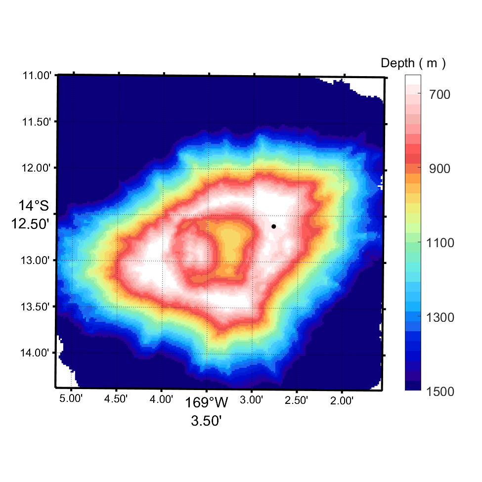
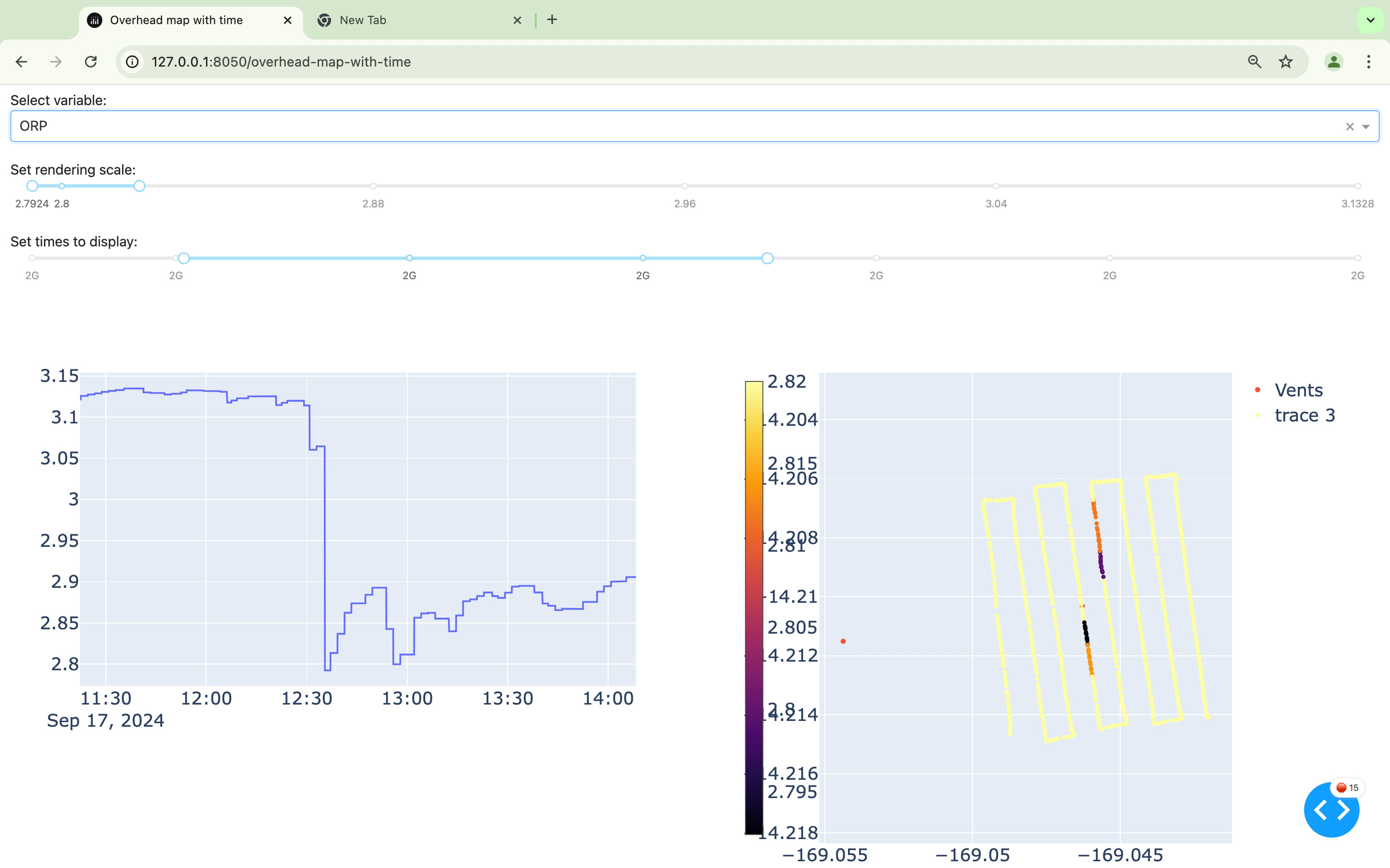
To streamline the process of locating seafloor fluid flow sites such as hydrothermal vents and cold seeps, this research team is developing a fully autonomous algorithm to enable autonomous underwater vehicles (AUVs) to trace biogeochemistry signatures in the water column that are indicative of vents and seeps using real-time data recorded by onboard sensors, independent of human operators. In September 2024, during a NOAA Ocean Exploration Cooperative Institute expedition on Ocean Exploration Trust’s Exploration Vessel Nautilus, they tested a prototype of their plume-tracing algorithm during two AUV Sentry dives at Vailulu’u Seamount in National Marine Sanctuary of American Samoa.
Download largest version (png, 2.72 MB).
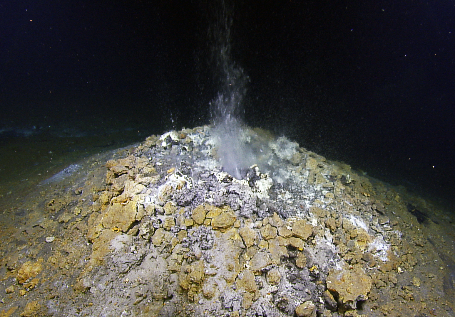
The team selected Vailulu’u Seamount for this test because of its known hydrothermal activity. Early in the expedition, remotely operated vehicle Hercules revisited a hydrothermal vent on the eastern rim of the volcano’s crater, first discovered in 2019, and confirmed that it was still active.
Download largest version (png, 153 KB).
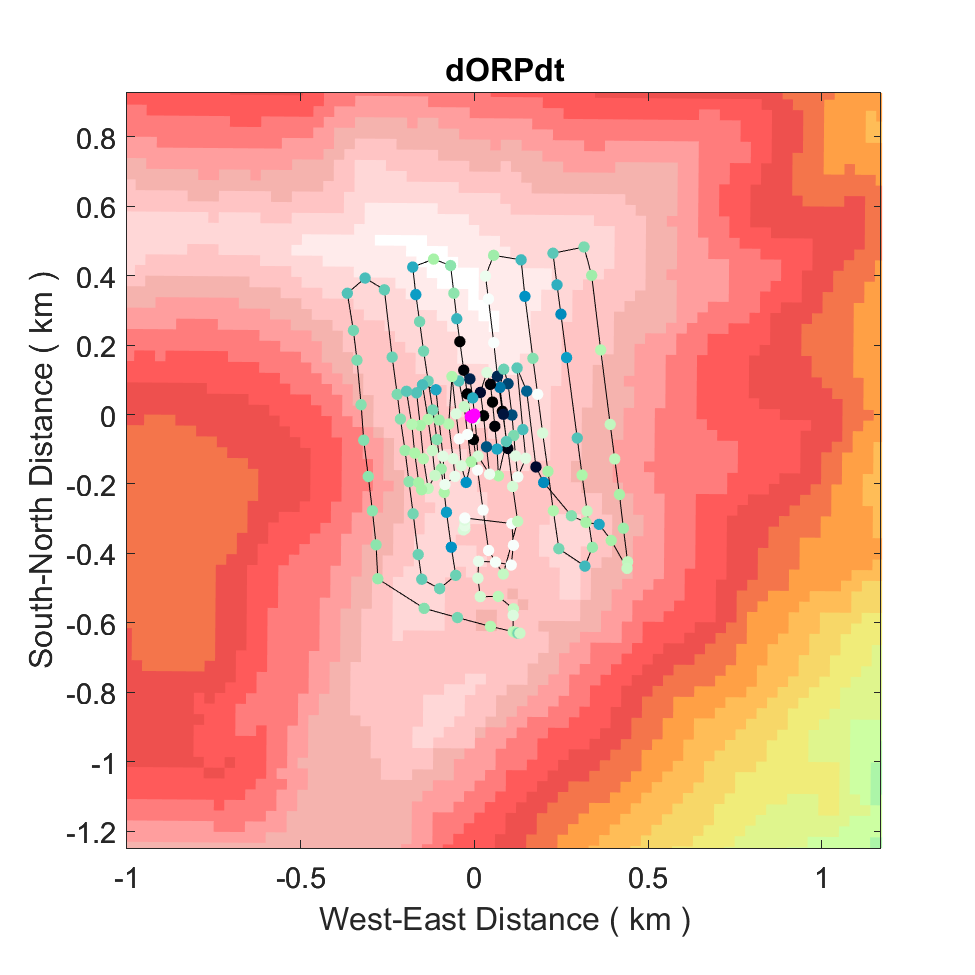
To conduct the tests, Sentry, equipped with sensors for detecting anomalies in the water column associated with hydrothermal discharge, was deployed in the area of the vent site. While Sentry followed its pre-programmed route to conduct water column surveys, flying several tens of meters above the seafloor, sensor data were transmitted to shore in near real time for analysis by the plume-tracing algorithm. The algorithm processed the data collected over these initial large-scale surveys, identifying potential vent source locations and determining coordinates for the centers and boundaries of small-scale follow-up surveys to target the most probable source areas. These coordinates were then communicated back to the ship, where the AUV navigators redirected Sentry, and the exploration continued.
Deployment of autonomous underwater vehicle Sentry from Exploration Vessel Nautilus during the E Mamana Ou Gataifale II — American Samoa expedition. Video courtesy of Autonomous Localization of Seafloor Fluid Flow Sources. Download largest version (mp4, 16.7 GB)
Education
Our Learn & Discover page provides the best of what the NOAA Ocean Exploration website has to offer to support educators in the classroom during this expedition. Each theme page includes expedition features, lessons, multimedia, career information, and associated past expeditions. Below are related top education themes for this expedition.
Resources & Contacts
-
Emily Crum
Communication Specialist
NOAA Ocean Exploration
ocean-explore-comms@noaa.gov