Coral, sponge, brittle stars, and other invertebrates in an Aleutian Islands coral garden.

Exploring Attu’s Underwater Battlefield and Offshore Environment

Past Expedition

Primary Goal

To bring attention to the World War II Battle of Attu (1943) through surveying and inventorying Attu’s maritime heritage sites. Additional goals include answering questions about Attu’s pre-war maritime history, contributing to our understanding of Attu’s marine environment and the history of Unangax̂ displaced by the U.S. government during the war, and providing a foundation for further work to locate U.S. and Japanese service personnel missing in action.

Dates
July 17 - 27, 2024
Location
Pacific Ocean
Vessel
Research Vessel Norseman II
Primary Technology
AquaPix Miniature Interferometric Synthetic Aperture Sonar (MINSAS; Kraken Robotics), SeaScout-2 towfish (ThayerMahan), BlueRov2 remotely operated vehicle (ROV; Blue Robotics, Inc.), underwater photogrammetry system MURAKUMO

Overview

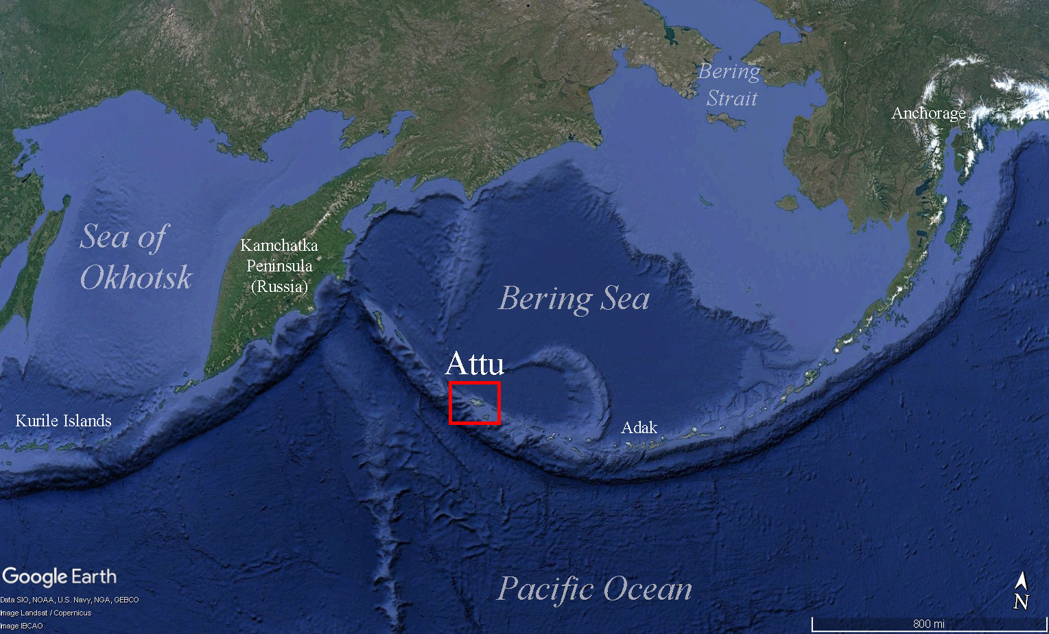
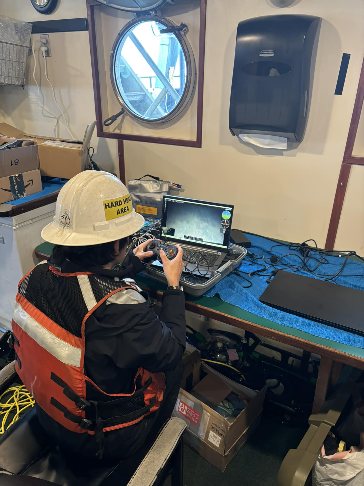
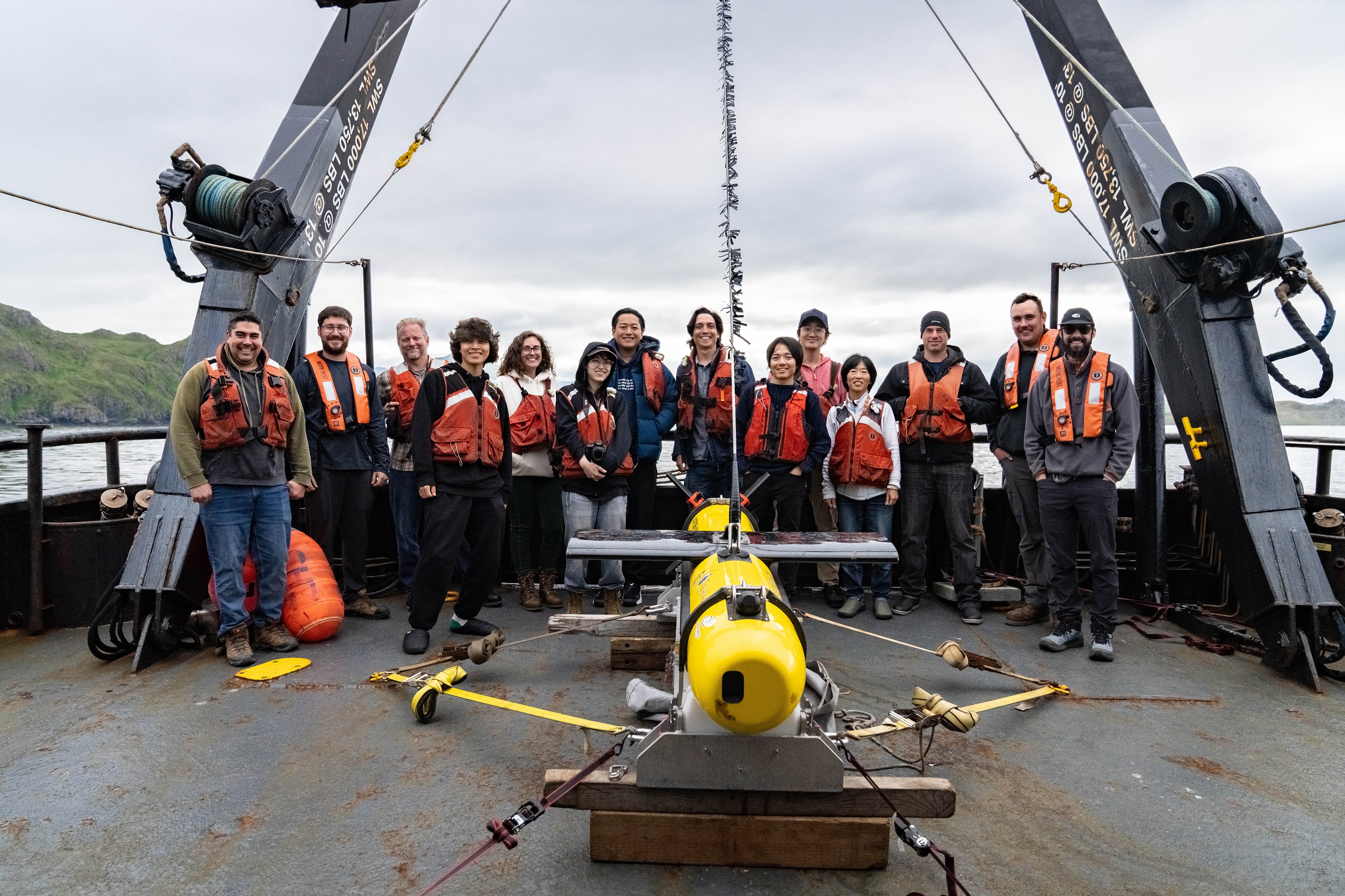
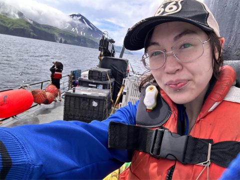
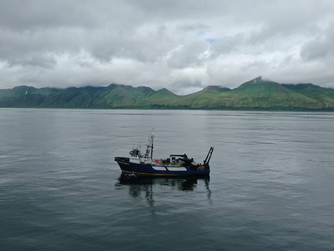
On July 17, 2024, the expedition team, consisting of archaeologists, hydrographers, and engineers, boarded the research vessel Norseman II at the Aleutian island of Adak. From there, the converted crabbing ship made the 49-hour steam to Attu, arriving in the early morning hours. Aided by years of archival research that preceded the expedition, the team wasted no time in getting started. A total of 12 synthetic aperture sonar (SAS) and multibeam surveys were conducted, including two aimed at imaging a specific wreck following its initial discovery. In all, the research team performed nearly 36.4 hours of sonar operations, corresponding to 435 linear kilometers and 35.3 km2 surveyed. The team focused on 11 locations around Attu, with water depths ranging from 15 meters (~40 feet) to 90 meters (~300 feet). The acoustic imaging was complimented by 21 deployments of the camera-equipped remotely operated vehicle (ROV), sent to photograph sonar targets of interest. Following the final SAS survey on July 24, with five days of extensive survey operations completed and terabytes of data, the expedition team bid Attu farewell, successfully completing the first underwater archaeology project in the island’s history.

Aleutians Map
A map showing Attu’s location within the Aleutians. Image courtesy of Exploring Attu’s Underwater Battlefield and Offshore Environment/Google Earth.
Download largest version (jpg, 476 KB).
Points of Interest
A map highlighting specific points of interest during the expedition. Image courtesy of Exploring Attu’s Underwater Battlefield and Offshore Environment/Google Earth.
Download largest version (jpg, 471 KB).

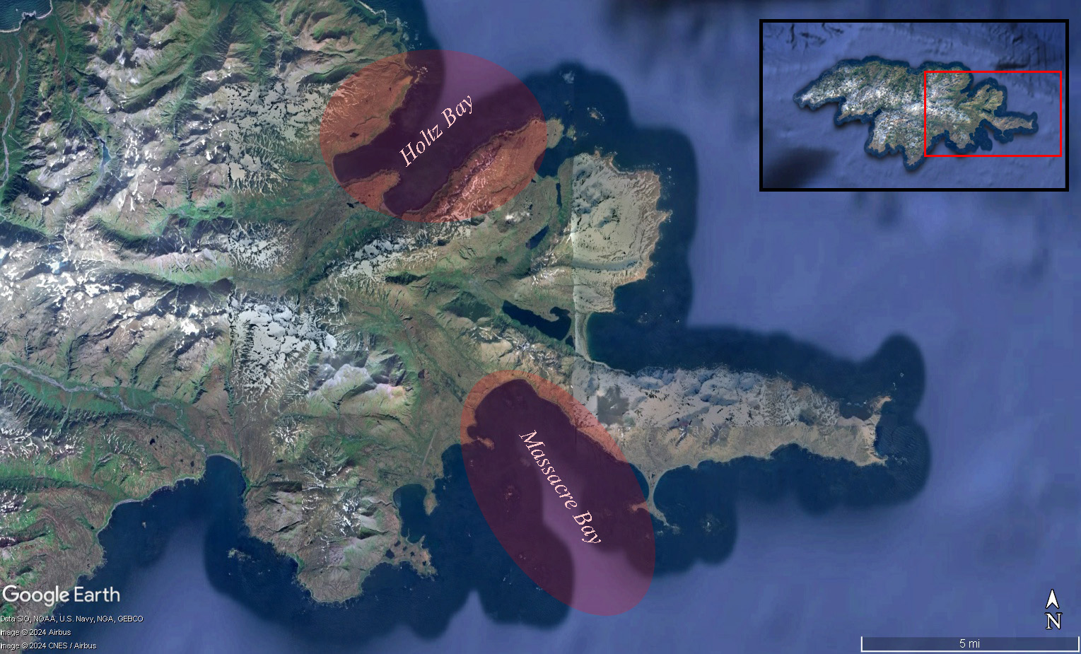
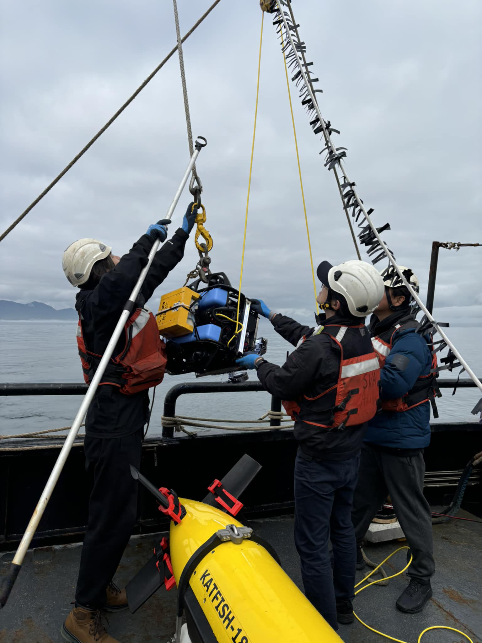
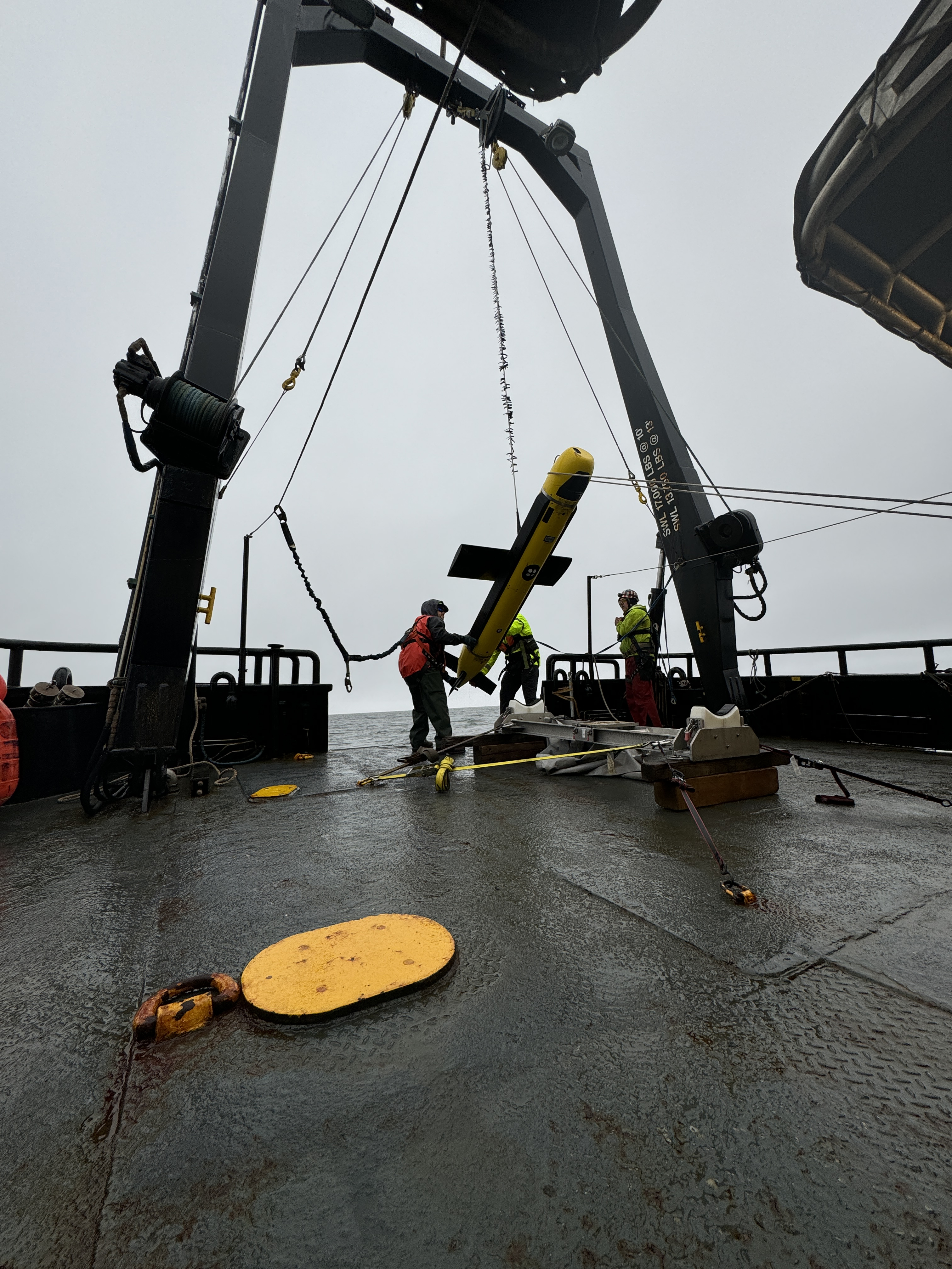
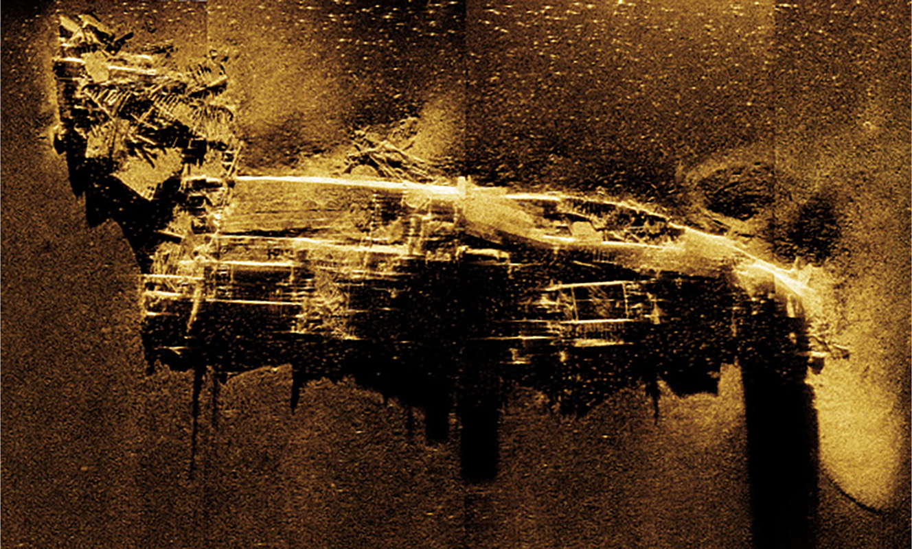
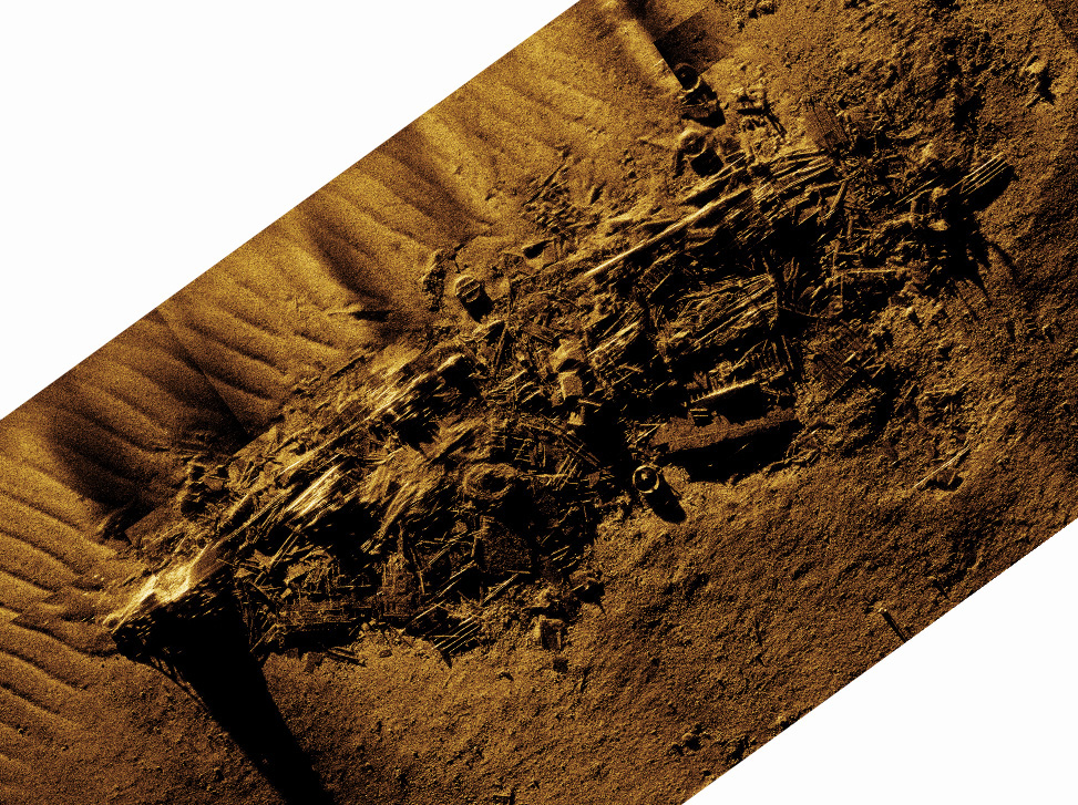
The initial survey work focused on the suspected location of the SS Dellwood, a U.S. Army cable layer that sank in July 1943. Hydrographers from ThayerMahan, Inc. deployed their SeaScout Katfish system, equipped with both cutting-edge synthetic aperture sonar (SAS) and more traditional multibeam sonar. Eighty-one years to the day of its sinking, the SS Dellwood was found in about 34 meters (110-115 feet) of water, though its physical state appeared far more disarticulated than expected. While the site is in an area of strong currents and ripping tides, the complete dismantling of the 3,000-ton vessel suggests that it may have been intentionally destroyed in hopes of making it less of a navigational hazard. A research consortium from Japan led by A.P.P.A.R.A.T.U.S., Inc. deployed their ROV and captured video footage of the severely damaged wreck site, while Norseman II’s captain held the research vessel in place. The optical imagery not only helped to validate the identification of the wreck as the remains of Dellwood, but will also be used to characterize the wreck’s ecology and serve as a valuable education product.

ROV Piloting
Targets of interest were documented using World Scanning Project’s MURAKUMO camera system attached to a BlueROV, which was piloted using a PlayStation-like controller and the live camera feed. Image courtesy of Exploring Attu’s Underwater Battlefield and Offshore Environment.
Download largest version (jpg, 732 KB).
BlueROV
Researchers reach for the BlueROV, a small remotely operated vehicle used during the expedition. Image courtesy of Exploring Attu’s Underwater Battlefield and Offshore Environment.
Download largest version (jpg, 591 KB).
Lowering SeaScout-2
Surveyors from Thayer Mahan and vessel crew from Support Vessels of Alaska are seen lowering the SeaScout-2, which carried the synthetic aperture sonar and multibeam echosounder. Image courtesy of Exploring Attu’s Underwater Battlefield and Offshore Environment.
Download largest version (jpg, 5.15 MB).

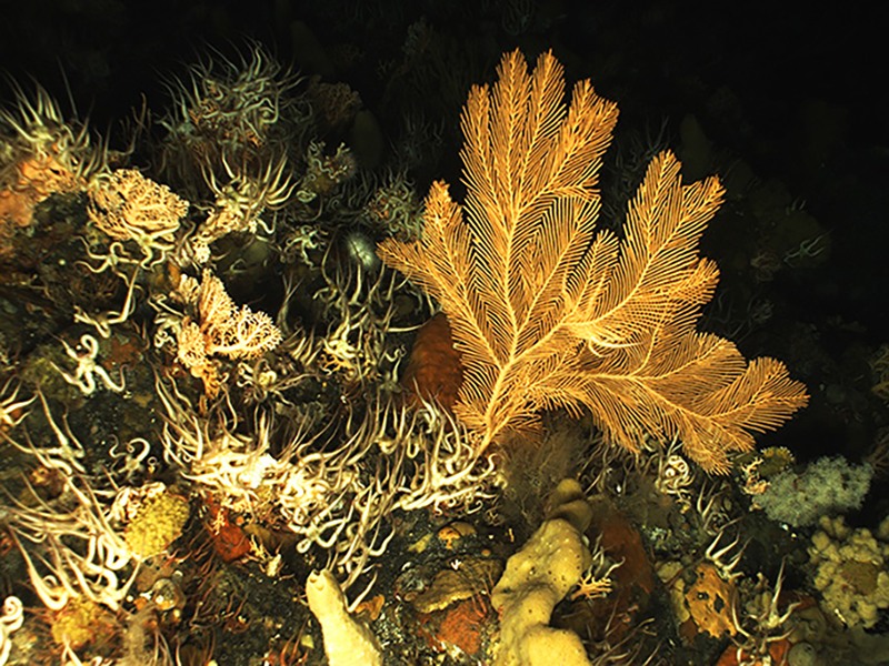
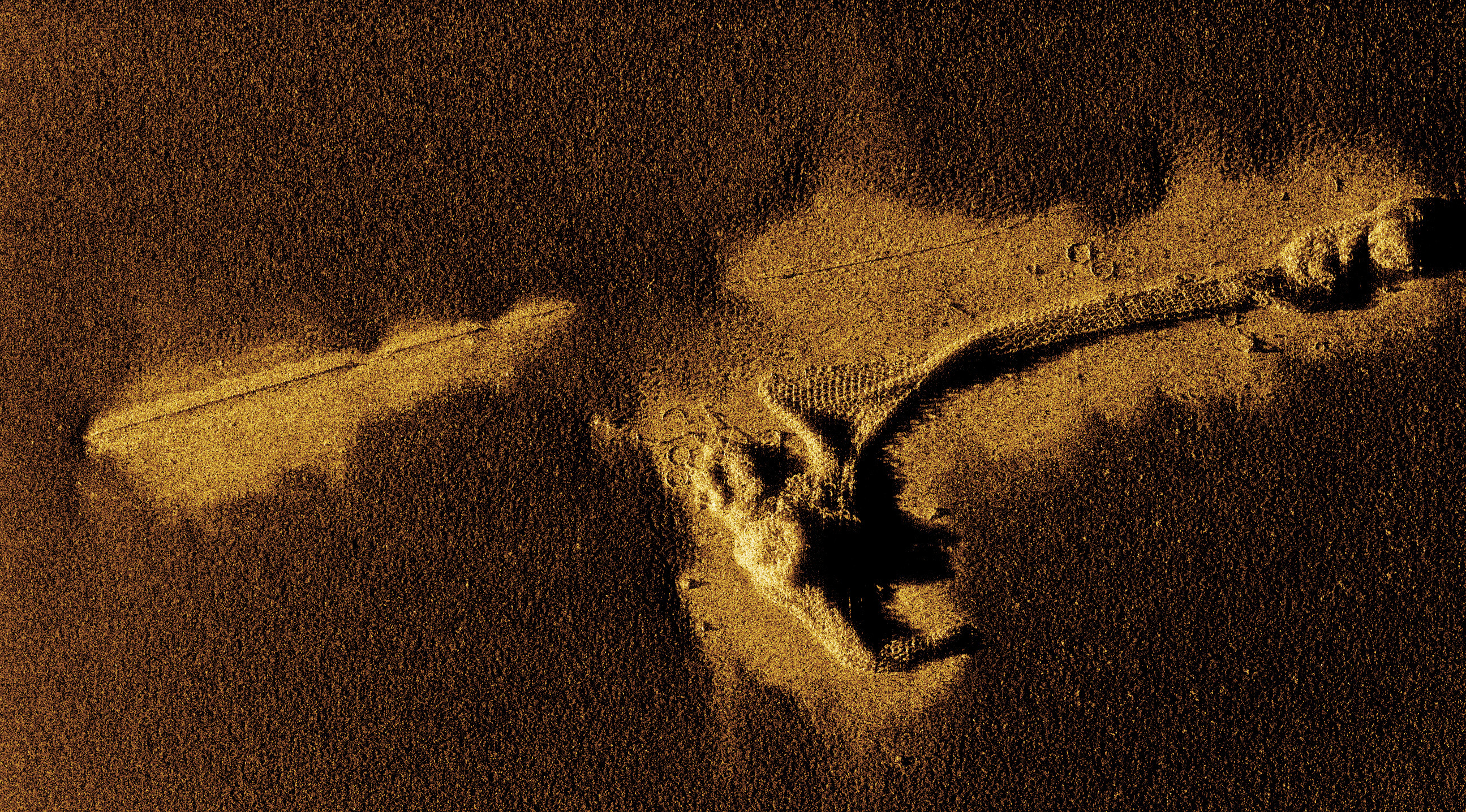
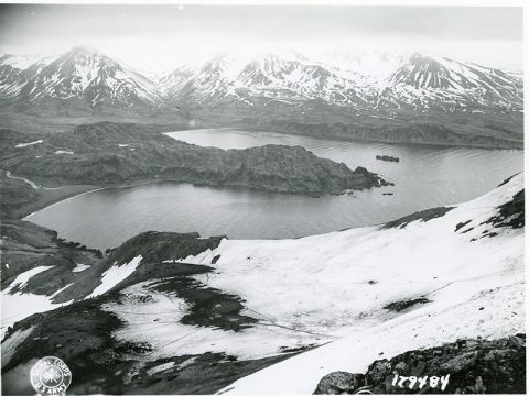
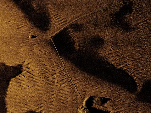
Subsequent survey work shifted to various locations within Massacre Bay, which served as the main landing site for the U.S. military during the Battle of Attu (1943), and later, became a hub for postwar military activity. While no wrecks were definitively identified in the field, the seafloor is littered with vestiges of World War II activity. This includes dozens of anchors, mooring blocks, and sunken buoys, as well as examples of materials used in the construction of infrastructure, such as timbers, piping, and cable. The immediate identification of these objects was made possible by the data’s resolution, demonstrating the benefits of SAS for underwater archaeology surveys. Perhaps the most interesting Massacre Bay find were the numerous examples of anti-submarine netting that could be clearly discerned. With the centimeter-scale resolution offered by SAS imagery, the interconnected metal rings of these nets, resembling chainmail armor, were seen in stunning detail. Often these harbor defenses were completely removed, as bays and ports returned to peacetime use. This does not appear to be the case, as the sunken net segments cover hundreds of meters of seafloor in Massacre Bay. Several targets were further investigated using the ROV, including a suspected landing craft. The photographic documentation revealed that this object was more likely a chassis, potentially for a flatbed trailer used in transporting construction materials. Here, the utility of combining acoustic (sonar) and optimal (ROV) imagery was made especially apparent.

Features

The image depicts a smiling man sitting on the edge of a section of a boat. He is giving a thumbs-up gesture while holding a camera. The man is wearing a black jacket, a red life vest, gray sweatpants, and brown work boots. The weather appears partly cloudy. The boat has a predominantly white structure with blue trim. Behind the man, there is a set of white stairs leading to another level of the boat. The open water is visible on the right side of the image, with a coastline featuring green hills in the distance. A red life preserver ring is mounted on the railing at the edge of the boat.
When I first heard about an opportunity to join an expedition to Attu to help look for World War II (WWII) shipwrecks, I wasn’t sure whether to believe it or not. I’d been interested in WWII since I was little.
October 25, 2024
Serene landscape with a body of water, green hills, and cloudy mountains with sunlight rays.
As I sit here at the long mess table, amongst the busy laptops, it has suddenly dawned on me that I am, indeed, sitting at a 14-person table… on a redesigned commercial king crab boat… in the middle of the Ring of Fire’s northern arc.
October 25, 2024
The image shows a person taking a selfie on a boat, with a mountainous landscape and ocean in the background. The person is wearing a hat with the number 66, glasses, a blue jacket, and an orange life vest. They also have a dark lip piercing. Behind them on the boat are crates and red flotation devices. Another person stands farther back, wearing a life jacket and looking towards the water. The background features a snow-capped mountain partially obscured by clouds, with green cliffs along the coastline.
This trip was an intense, emotional, and incredible experience all around. To be so far out on the Aleutians was something I had only dreamed of. Previously I’d only ever been so far out as Umnak Island or Nikolski. Despite even my parents having first met in Adak, I had never gotten a chance to visit prior to this expedition. And although Attu was, of course, the main highlight and focus of our expedition, I really can’t express enough how much it meant to my family and to me. For our ancestors and future generations as well.
October 24, 2024
View More View Less
U.S. ship in Holtz Bay, Attu. c. 1943-1944.
On June 7, 1942, in conjunction with the naval advance on Midway Island, the Japanese military landed on Attu (Atux̂) and quickly imprisoned the indigenous Unangax̂ population
October 16, 2024
Atux̂ villagers in 1935.
The maritime history of Atux̂ (indigenous endonym for Attu) is not limited to World War II, as 3,000 years before the battle, ancestral Sasignan, likely from the Rat Islands to the east, came to the island via boats. They brought with them a several thousand year history of maritime focus and knowledge of seascapes that shaped individual and community identities for all Unangax̂ (indigenous endonym for Aleut) past and present in the Aleutian Islands.
October 14, 2024
Coral, sponge, brittle stars, and other invertebrates in an Aleutian Islands coral garden.
In the offshore environment of the Aleutian Islands, where there can often be a paucity of hard bottom substrate for settling larvae, shipwrecks often become areas of high biological diversity. The artificial substrate these shipwrecks provide can be home to many species of fish and mobile fauna, but also to deep-sea or cold-water corals.
October 10, 2024
Synthetic aperture sonar imagery of anti-submarine net mooring observed on the seafloor.
The destructive images of shipwrecks and the nearly frozen-in-time Massacre Bay seafloor bring a physical realness to Attu’s wartime past that may help bring awareness to this oft-forgotten chapter of history.
October 4, 2024
Research vessel Norseman II in Massacre Bay.
This project seeks to bring attention to the World War II Battle of Attu (1943) through ocean research and exploration. Surveys of the seafloor will be executed using synthetic aperture sonar (SAS), an emergent form of marine remote sensing technology.
September 26, 2024

Multimedia

Featured multimedia assets associated with this project.

Education

Our Learn & Discover page provides the best of what the NOAA Ocean Exploration website has to offer to support educators in the classroom during this expedition. Each theme page includes expedition features, lessons, multimedia, career information, and associated past expeditions. Below are related top education themes for this expedition.

Meet the Exploration Team

Learn more about the team members and their contributions to this project.

Principal Investigator, East Carolina University
Co-principal Investigator, East Carolina University
Co-principal Investigator, University at Buffalo
Marine Surveyor, ThayerMahan, Inc.
Photographer, World Scan Project

Resources & Contacts