

Deep Connections 2019: Exploring Atlantic Canyons and Seamounts of the United States and Canada
Past Expedition
Overview
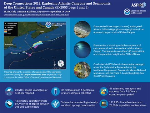
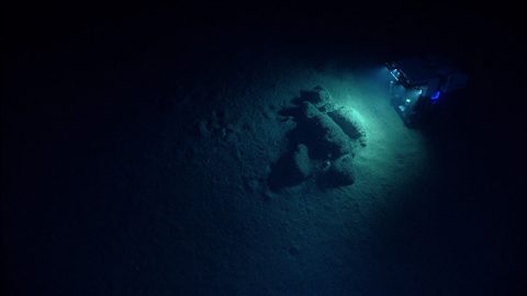
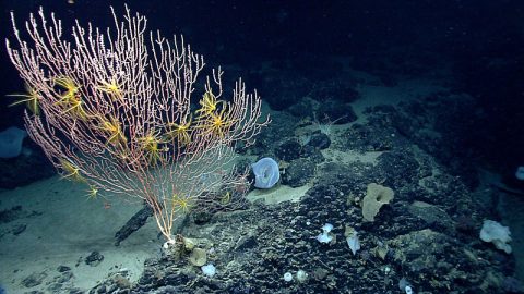
From August 6 through September 15, 2019, NOAA and partners conducted a telepresence-enabled ocean exploration expedition on NOAA Ship Okeanos Explorer to collect critical baseline information about unknown and poorly understood deepwater areas of the U.S. and Canadian Atlantic continental margin.
Features

View Less

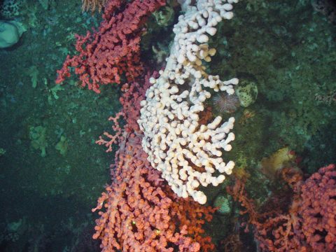
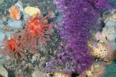
Multimedia
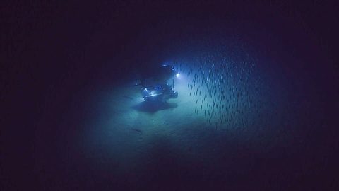
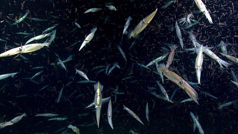
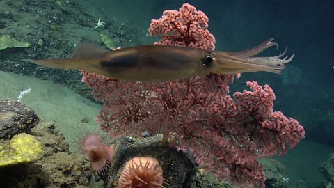
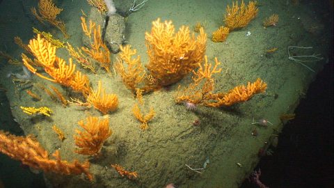
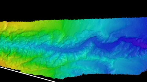
Featured multimedia assets associated with this project.
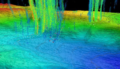
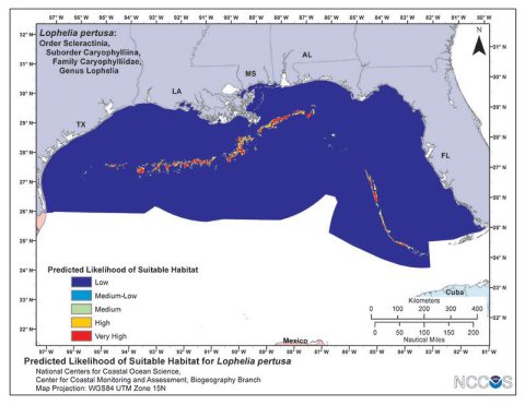
Dive Summary Map
The map below shows the location of dives during the expedition. Click on a dive number to access the update from that day.
Education
Our Learn & Discover page provides the best of what the NOAA Ocean Exploration website has to offer to support educators in the classroom during this expedition. Each theme page includes expedition features, lessons, multimedia, career information, and associated past expeditions. Below are related top education themes for this expedition.
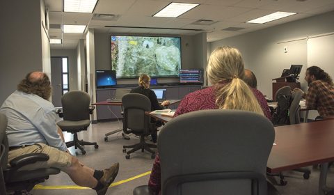
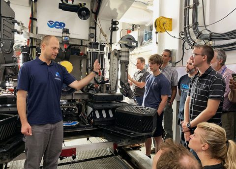
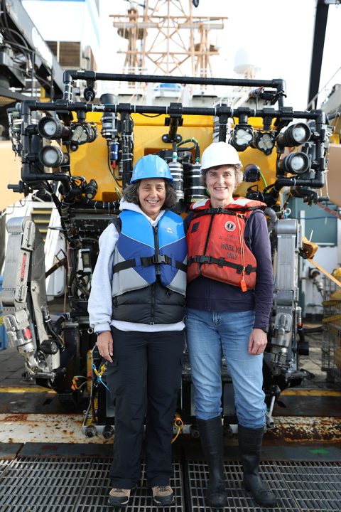
Meet the Exploration Team
Learn more about the team members and their contributions to this project.

Leg 1
Leg 1
Leg 2
Leg 2
Leg 2

Leg 2
Resources & Contacts
-
NOAA Office of Ocean Exploration and Research
Emily Crum
Office: (843) 460-9772 | Mobile: (202) 424-0081
Email Address: emily.crum@noaa.gov -
NOAA Office of Marine and Aviation Operations
David Hall
Public Affairs Officer
Office: (301) 713-7671
Email Address: david.l.hall@noaa.gov -
NOAA Office of National Marine Sanctuaries
Vernon Smith
National Media Coordinator
Office: (301) 713-3125 x248
Email Address: vernon.smith@noaa.gov -
NOAA National Marine Fisheries Service
John Ewald
Director of Public Affairs
Office: (301) 427-8029
Email Address: john.ewald@noaa.gov -
NOAA Greater Atlantic Regional Fisheries Office
Jennifer S. Goebel
Public Affairs Officer
Office: (978) 281-9175
Email: jennifer.goebel@noaa.gov -
NOAA Northeast Canyons and Seamounts Marine National Monument
Jennifer Anderson
NEPA Coordinator
Office: (978) 281-9226
Email: jennifer.goebel@noaa.gov -
U.S. Fish and Wildlife Service
Terri Edwards
Public Affairs Chief
Office: (413) 253-8324
Email: terri_edwards@fws.gov -
Fisheries and Oceans Canada
Stephen Bornais
Communications Advisor, Media Relations
Maritimes Region
Fisheries and Oceans Canada
Office: (902) 471-6797
Email: Stephen.Bornais@dfo-mpo.gc.ca