
For Educators
Seafloor Mapping
Explore Seafloor Mapping
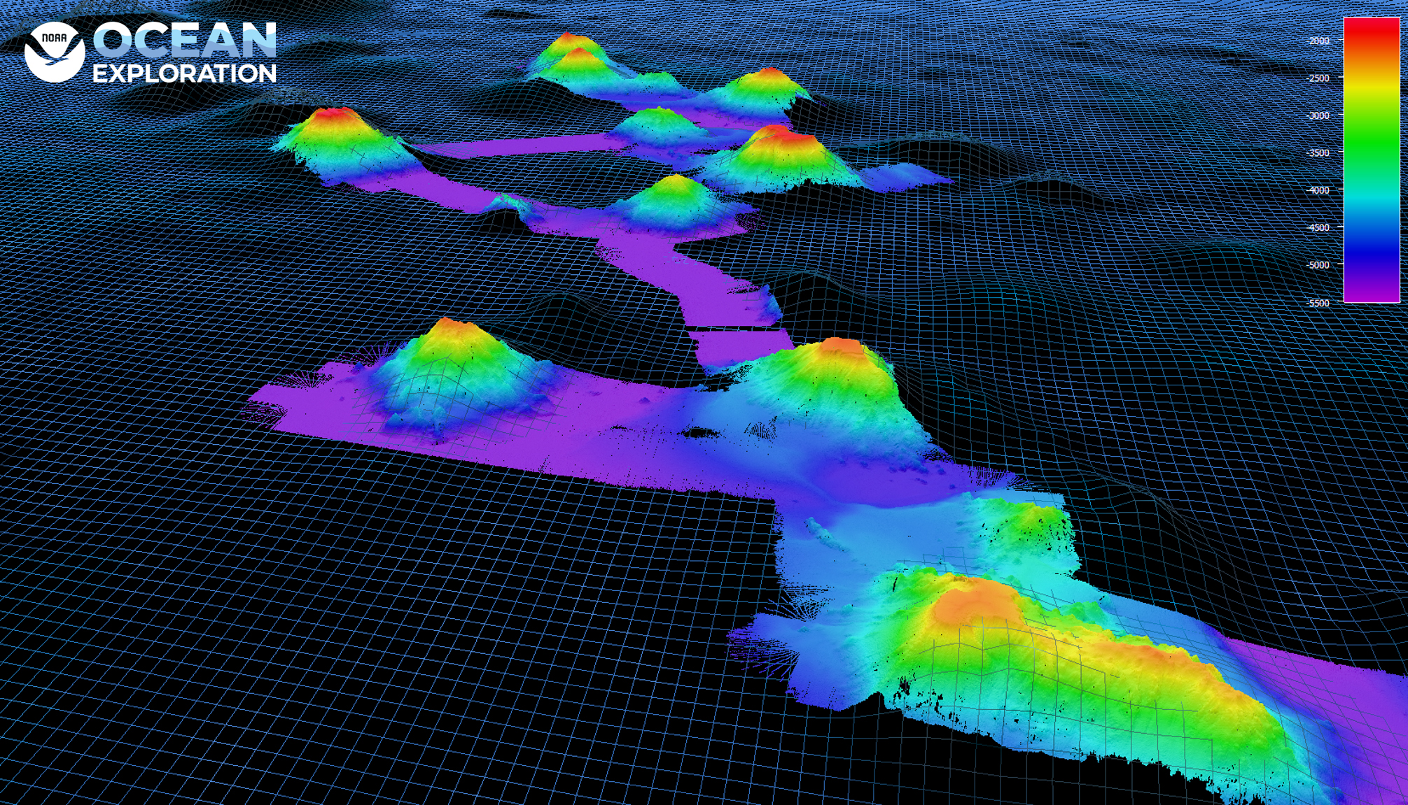
A key part of exploration is creating maps to plan efficient and safe expeditions. Multibeam sonars collect high-resolution data using multiple, simultaneous sonar beams (sound waves) in a fan-like pattern or “swath.” Multibeam sonar data allow teams to spot previously unseen features on the seafloor such as seamounts, deep-sea sandwaves, faults, ancient coral reefs, shipwrecks, and more.
View the sections below to further explore ocean exploration education resources on seafloor mapping.
Featured Resources