
Ocean Science for Everyone
Seafloor Mapping
Learn About Seafloor Mapping
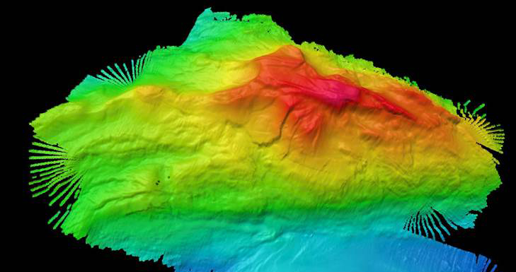
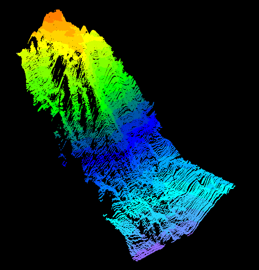
A key part of exploration is creating maps to plan efficient and safe expeditions. Multibeam sonars collect high-resolution data using multiple, simultaneous sonar beams (sound waves) at once in a fan-like pattern or “swath.” Multibeam sonar data allow teams to spot previously unseen features such as seamounts, deep-sea sandwaves, faults, ancient coral reefs, shipwrecks, and more.
Featured Multimedia
Seafloor Mapping
All Resources
Are you an educator?
NOAA Ocean Exploration engages educators, students, and the general public to enhance America’s ocean literacy through the excitement of ocean discovery. Dive in here to explore deep-sea phenomena and resources to support classroom instruction and inspire students to better understand our ocean planet.