

Paleolandscapes and the ca. 8,000 BP Shoreline of the Gulf of Mexico Outer Continental Shelf
Past Expedition
Overview
During this mission, scientists conducted remote sensing and sub-bottom profiler surveys to determine if people were living along the now-submerged northwestern Gulf of Mexico and coastal Texas and Louisiana as early as 13,000 years ago, with the objective of adding more information to an overwhelming puzzle. With additional information, they can determine what a place was like, what life would have been like there, and what the people that would have been there were like as well.
Features
And so here we are, back on dry land after 12 exciting days at sea. It’s been a productive couple of weeks; in total we have acquired 668 line kilometers of data, surveyed all the grids that had been planned, and even had time to conduct survey at a few extra areas.
June 17, 2019
This trip has made me admire the scientists who have paved the way. Research is an art form, with a multitude of juggled levels that have to come together to perform the research. From the science side, the grant side, the business side, the always present Murphy’s Law side, and the emotional side, continuously working together until the “completed side” or the conclusion.
June 7, 2019
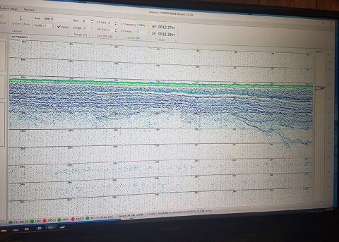
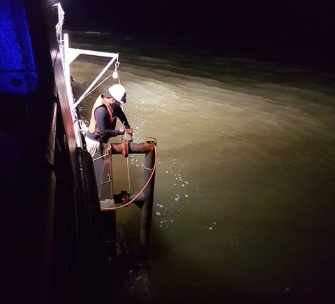
When looking for submerged landscapes below the seafloor, the main geophysical tool we use is a sub-bottom profiler. It can also show where there is a major change in angle and character of deposits, such as the cut of an ancient river channel, which has been filled by mud and sands.
June 5, 2019
View Less
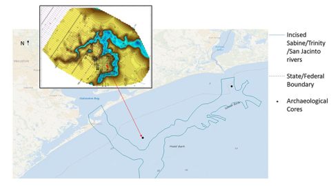
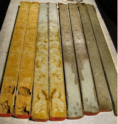
For this project, we started with two locations that were previously identified through archaeological mapping and exploration projects. Both were from the same water depth (about 50 feet), and both dated to about the same time period, 8,500 BP or about 10,500 years ago.
June 3, 2019
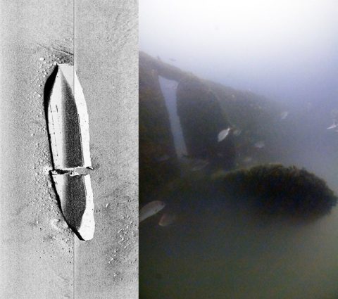
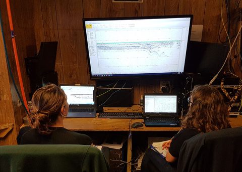
How do you look for something that doesn’t want to be found? Since the river valleys and channels aren’t visible to the naked eye, we use different remote-sensing tools to image them.
June 3, 2019
After a flurry of activity during mobilization, and some adjustment of equipment set up and computer settings, we’ve settled into a routine.
June 3, 2019
This project is starting from a handful of puzzle pieces that tell us people were living along the northwestern Gulf of Mexico and coastal Texas and Louisiana as early as 13,000 years ago. Our objective is to add more information to this overwhelming puzzle.
June 3, 2019
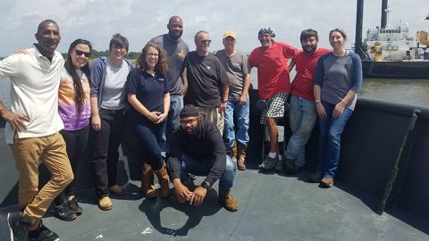
Mobilization is the act of getting a vessel and its crew ready to sail. We took a photo that can be best described as “happy scientists about to leave port” but it seems dishonest to imply that we’re doing this alone.
June 1, 2019
Multimedia
Featured multimedia assets associated with this project.
Meet the Exploration Team
Learn more about the team members and their contributions to this project.

Principal Investigator / Marine Archaeologist, Coastal Environments, Inc.
Geoservices Director, Wessex Archaeology, UK
Senior Marine Geophysicist, Wessex Archaeology, UK
Archaeological Field Technician, Coastal Environments, Inc.