

Guam: A Biogeographic and Maritime Cultural Landscape Exploration of a World War II Amphibious Battlefield
Past Expedition
Overview
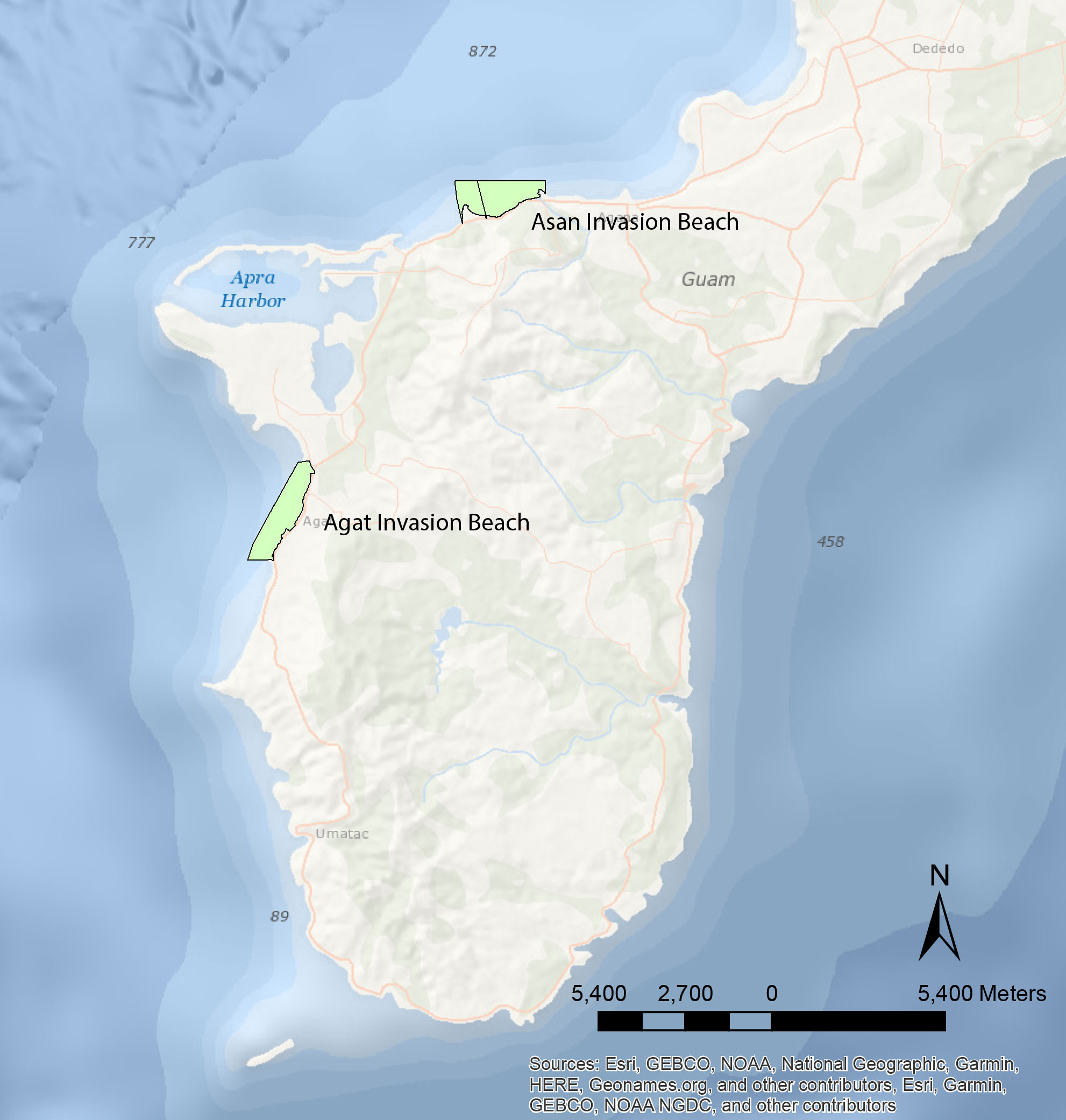
In 2023, a team of researchers conducted fieldwork on Guam in War in the Pacific National Historical Park to further our understanding of one of the most significant invasions of the World War II (WWII) Pacific theater as well as how it may have shaped the natural environment in the area today.
Guam was a strategic military location for both the United States and Japan during the war. And, in July 1944, U.S. troops invaded and secured the Japanese-held island.
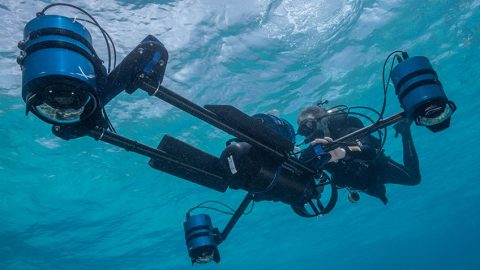
During this two-part project, the research team used ship-based instruments, an uncrewed surface vessel, and divers to identify, map, and document submerged resources related to the invasion (e.g., shipwrecks, aircraft, amphibious vehicles, and artillery). They also collected data to assess war-related impacts on the coast, seafloor, and barrier coral reef to investigate how damage to the reef may have impacted the island’s ecosystem and coastal vulnerability.
Download largest version (jpg, 1.2 MB).
Part 1: January 27-February 25, 2023
From January 27-February 25, 2023, a team of researchers exploring Guam’s World War II (WWII) underwater battlefield located and documented blasting sites and identified over 280 targets that warrant further investigation.
Download largest version (jpg, 12.7 MB).
Download largest version (jpg, 3.9 MB).
Download largest version (jpg, 885 KB).
This fieldwork was done during the first part of a two-part project. The objectives of the project are to inventory submerged material (including shipwrecks, aircraft, amphibious vehicles, artillery, and other artifacts) related to the 1944 invasion of Guam and to study how WWII-related activities have altered the coral reef ecosystem and coastal processes on Guam today.
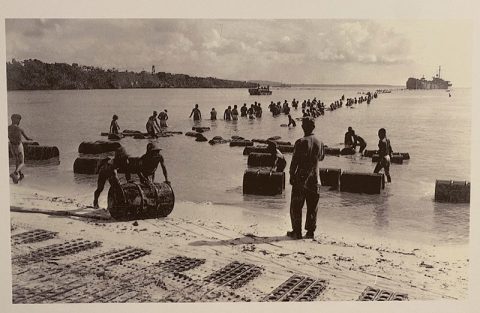
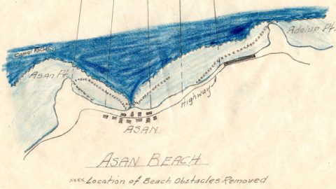
The most exciting result of this winter’s fieldwork was the unexpected discovery of a clear line of blast craters inside the barrier reef off Asan. The locations of these craters correspond with the positions of Japanese obstacles destroyed by U.S. underwater demolition teams (UDTs) shown on a historic map. Other evidence of blasting by UDTs included a 200-foot area of the barrier reef off Agat that enabled tank landing ships (LSTs) to beach to offload cargo. To document the sites, the researchers used photography, photogrammetry, a multibeam sonar system on an uncrewed surface vessel (USV), and high-precision Global Navigation Satellite System (GNSS) equipment.
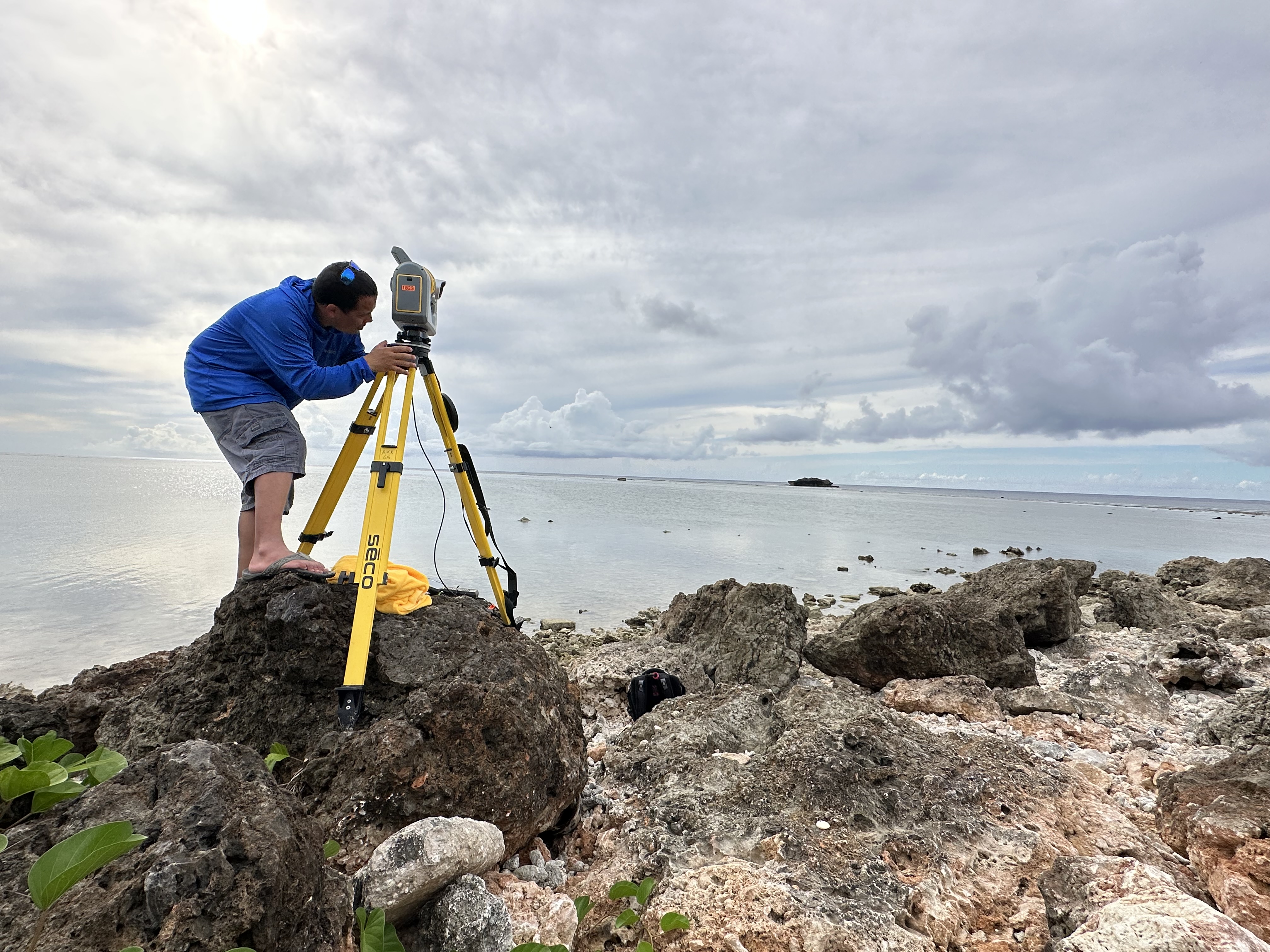
This blast damage to Guam’s offshore environment, 80 years later, is a reminder of the military activities that took place there and provides evidence that such activities can have lasting environmental impacts. To search for indications of potential blast-related coastal impacts (e.g., erosional hot spots) and to establish a baseline for future comparison, the team also used the GNSS equipment and a scanning total station to conduct coastal elevation surveys.
In addition, using vessel-based side-scan sonar and a magnetometer, the team found almost 250 targets. While some of these targets may be unrelated man-made objects or natural features, the amount of data collected and the supporting archival research suggest the likelihood of discovery of cultural resources is high. Data were also collected in shallower waters with the USV and its multibeam sonar system. These data are still being analyzed for additional targets. This summer, divers will closely investigate and document each individual target.
Today, the landing beaches of Asan and Agat are part of War in the Pacific National Historical Park. Documenting the remains of the battle and understanding the impacts of erosion and sea level rise that the park is now experiencing — and can anticipate in the future — will help park managers preserve and manage its resources (both submerged and on land).
Ultimately, this project will expand our knowledge of one of the most significant invasions of the Pacific Theater — and a turning point in WWII — both from historical and ecological perspectives.
Check out the story map to learn more about the first part of this project.
Published March 30, 2023
Part 2: July 27-August 23, 2023
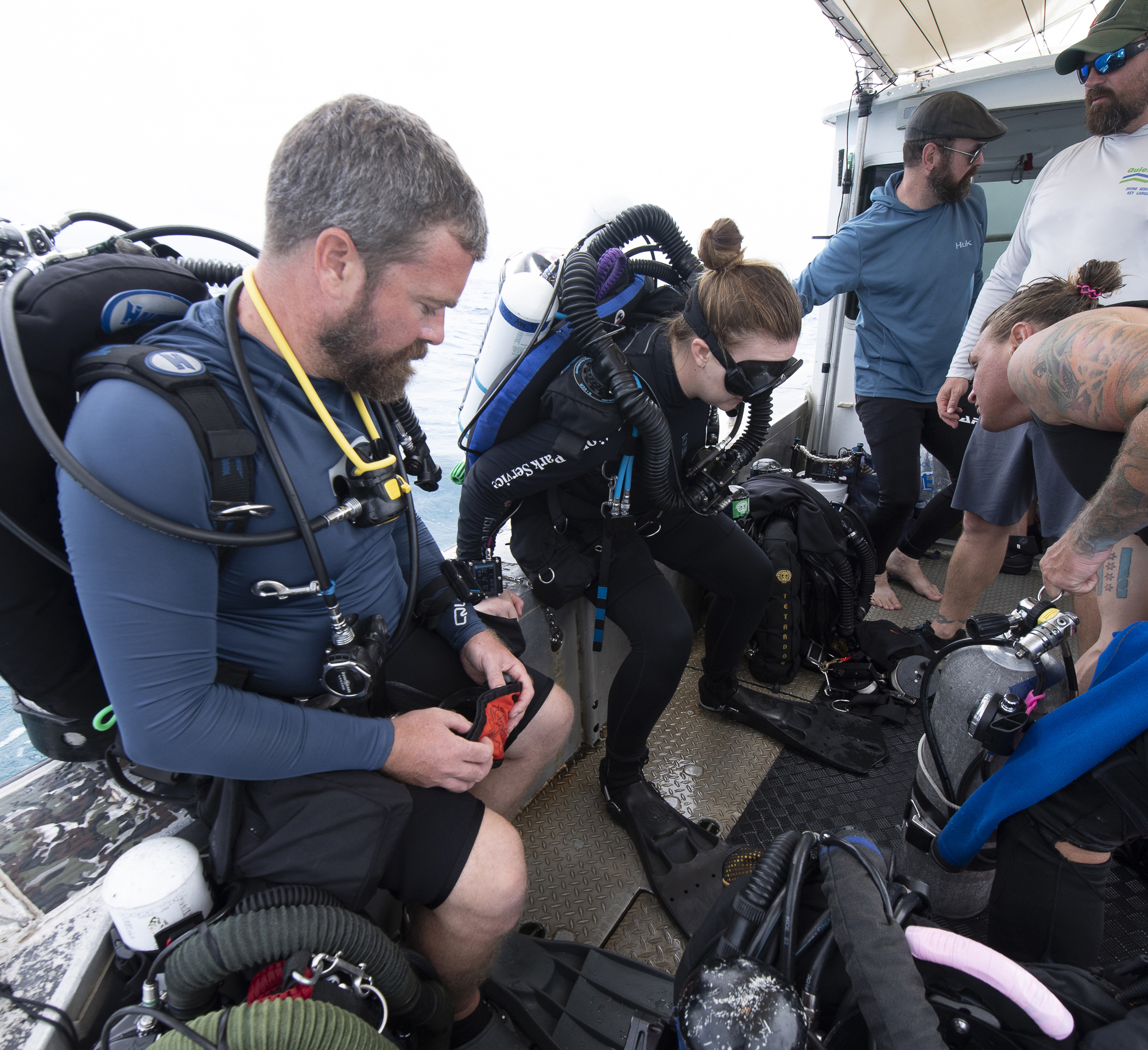
Researchers studying Guam’s World War II (WWII) underwater battlefield returned to the invasion beaches of Asan and Agat between July 16 and August 23, 2023. During their fieldwork, they investigated potential submerged cultural resources, measured coastal elevation, and interviewed local residents.
Searching for WWII Cultural Resources
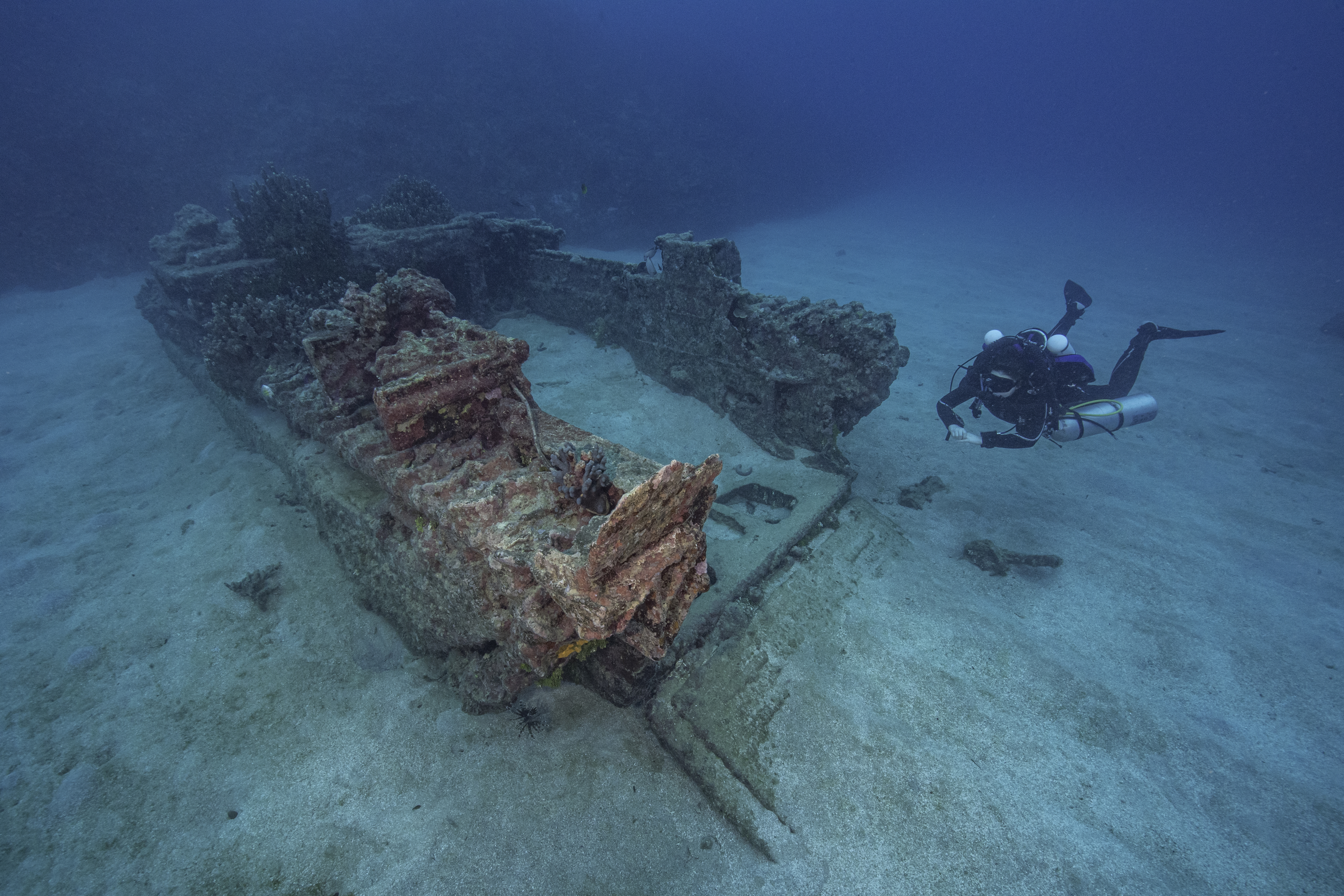
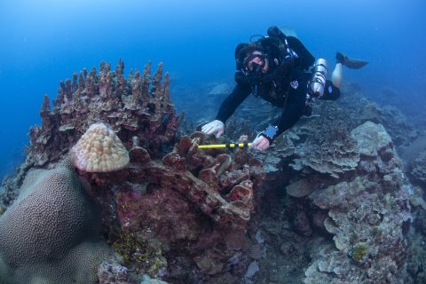
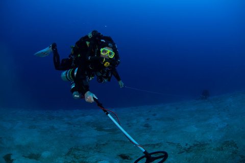
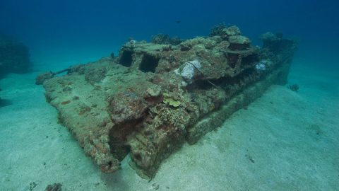
During this visit, divers investigated 161 magnetometer anomalies and side-scan sonar targets in deep water outside the barrier reef off Asan and Agat beaches that were identified during remote sensing operations in February 2023. Some of the targets turned out to be modern debris and trash, but many proved to be underwater remnants from WWII.
Download largest version (jpg, 3.2 MB).
Among the targets was a significant amount of unexploded ordnance (UXO). Some of this UXO was at a known post-war dump site in the water off Asan Beach. This site had previously been surveyed to a depth of 150 feet, but this team investigated targets up to 200 feet in depth, enabling the identification and documentation of previously unknown UXO in the park’s deeper waters. They also found UXO (artillery rounds and mortar shells) outside of the dump site, meaning they may have been used in battle.
Download largest version of the left image (jpg, 532 KB). Download largest version of the right image (jpg, 735 KB).
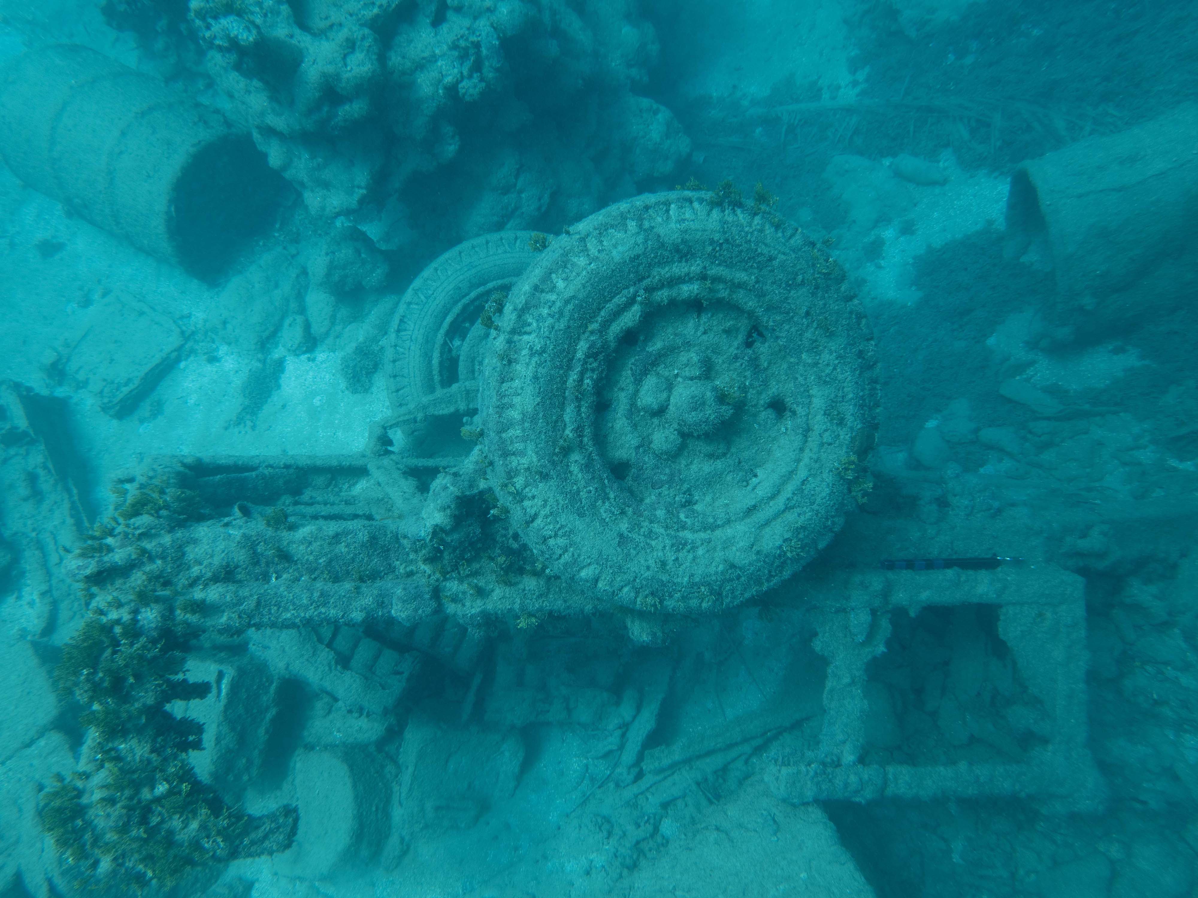
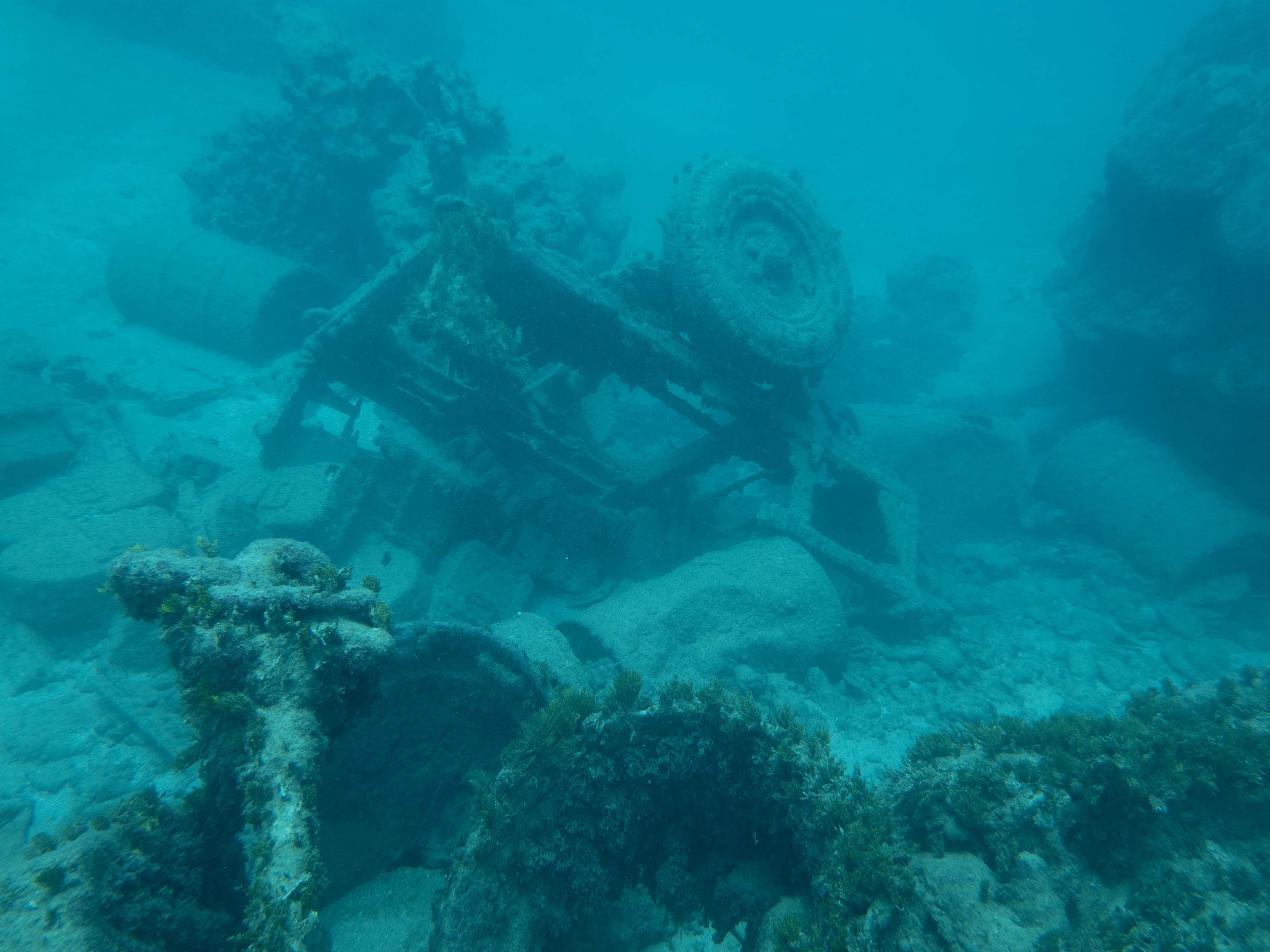
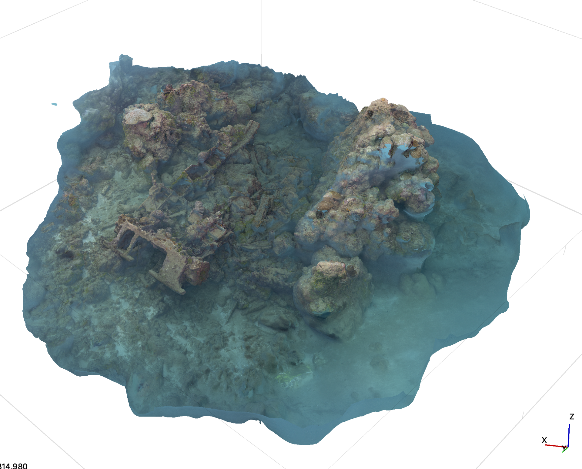
In addition, the team investigated and documented a WWII-era jeep trailer loaded with vehicle parts and equipment, Marston Mats, and what they believe is a Japanese fishing boat. A local diver familiar with the boat shared photos of it from the 1980s and early 2000s, which the team hopes to use to learn more about the boat and track changes to it over time.
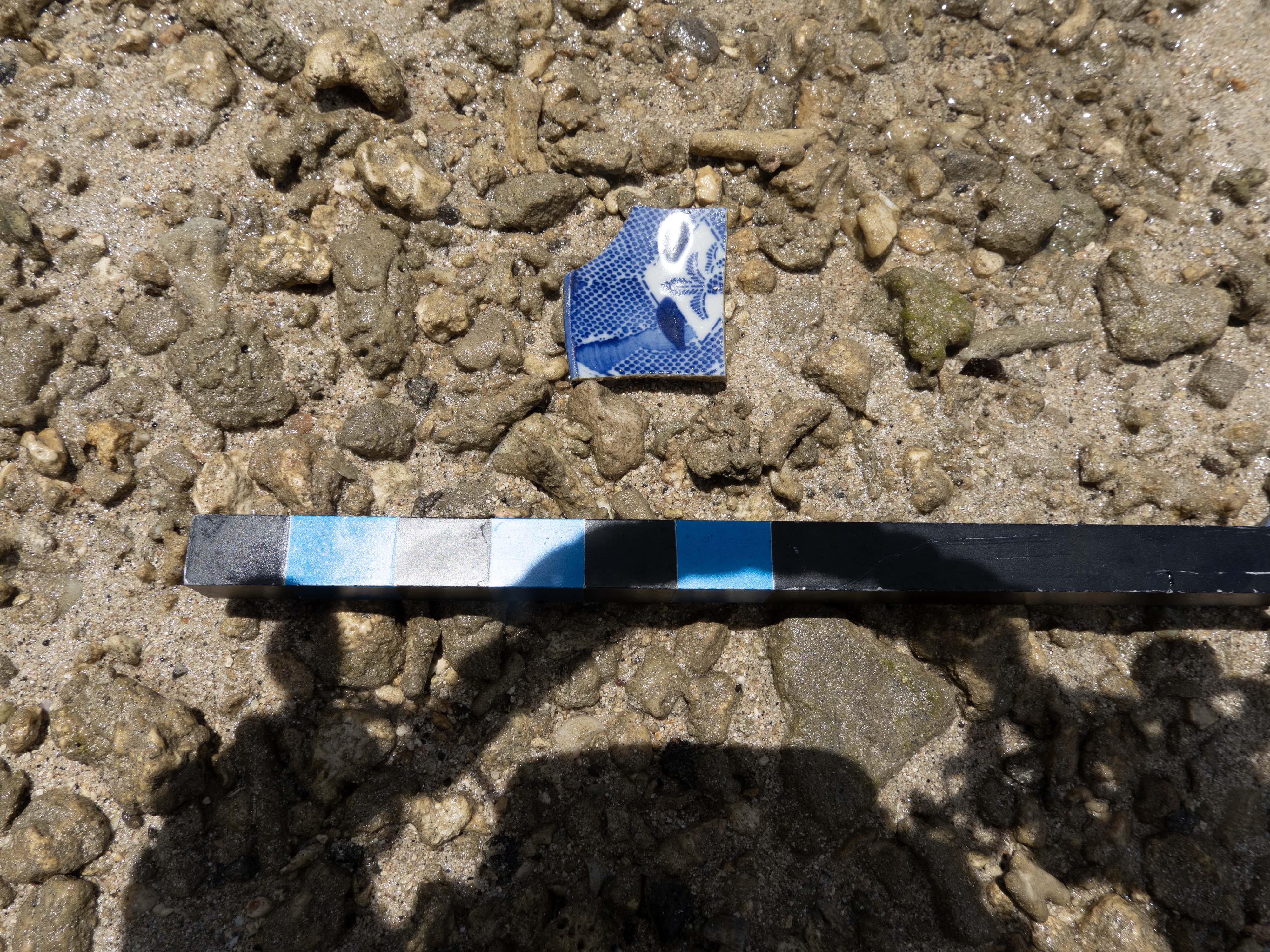
Inside the barrier reef at Asan, the team searched for additional cultural resources. During this walking survey, they found 171 artifacts that may be related to the war, including spent artillery rounds, brass/copper fragments that may have come from artillery rounds and mortar shells, pipe fragments, and Japanese pottery shards.
Download largest version (jpg, 1.53 MB).
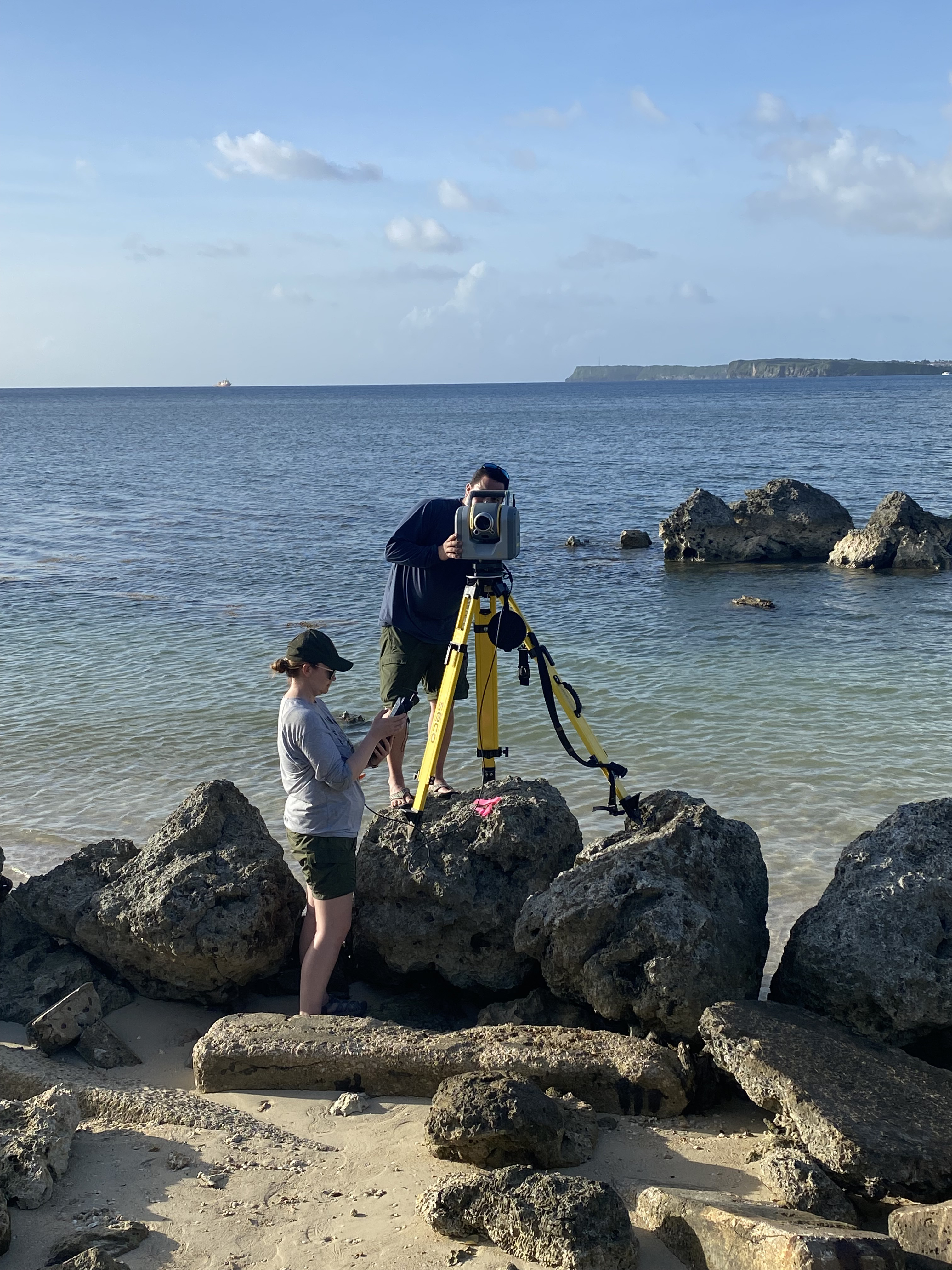
Measuring Coastal Elevation
The team also continued collection of high-resolution elevation data. They used a Trimble SX10 scanning total station and R12i global navigation satellite system (GNSS) equipment to collect location and elevation data along the coast and generate a detailed “picture” of the landscape.
Download largest version (jpg, 2.9 MB).
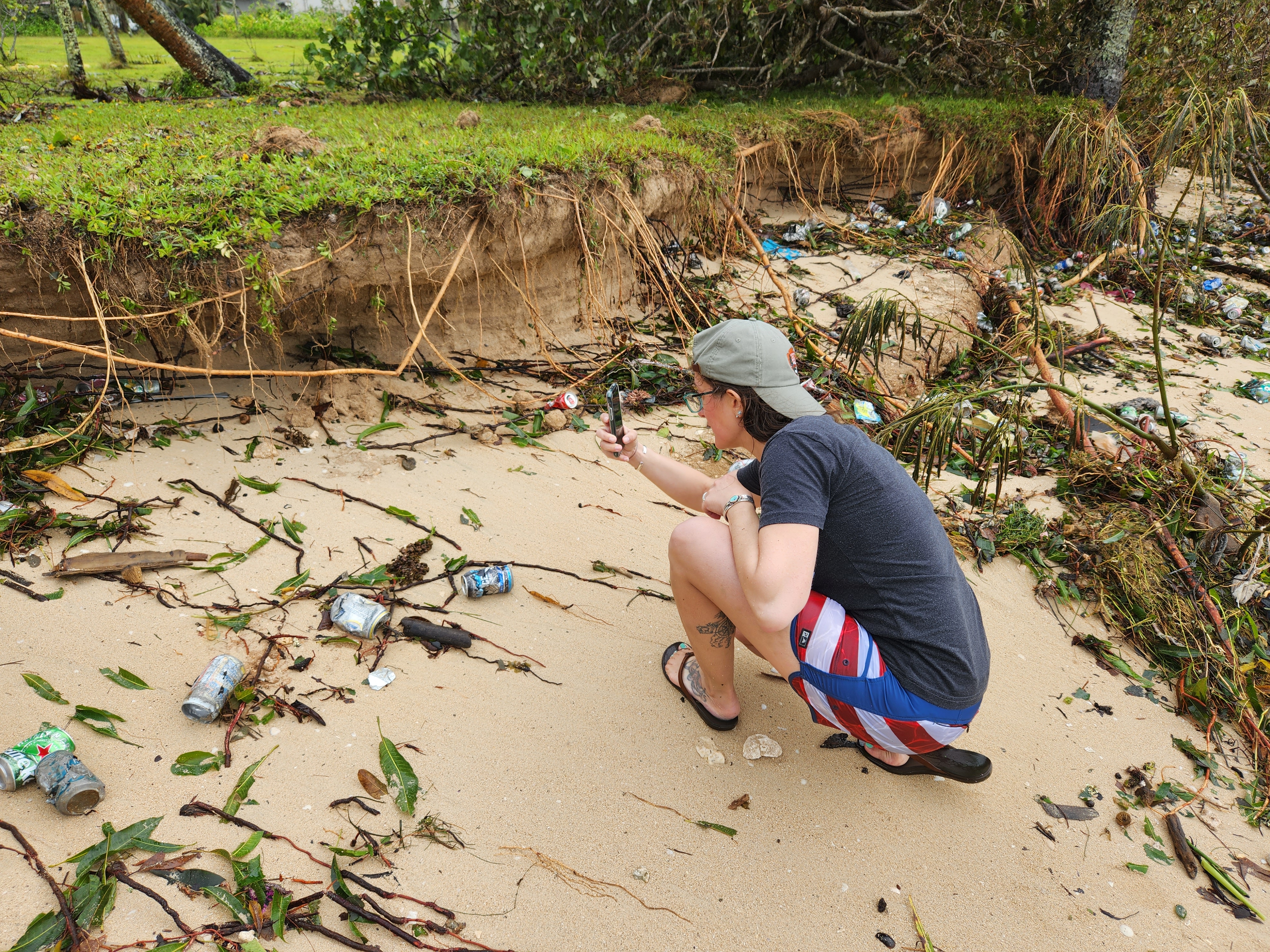
They will use these data to develop a holistic land-to-ocean understanding of the study areas. Specifically, they seek to understand if WWII-related activities, such as the blasting of the reef, may have altered Guam’s coral reef ecosystem and coastal processes, like erosion that can make the island and its inhabitants more vulnerable to storms, like May’s Category 4 Typhoon Mawar, and sea level rise.
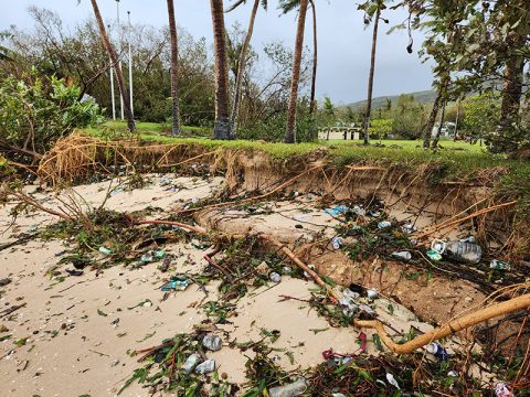
Members of the team were on Guam when Mawar struck, and they photo-documented the study areas immediately before and after the storm and used GNSS equipment to map the erosion it caused. Among the storm impacts were shoreline and bank erosion, redistribution of sand along the beaches and intertidal zones, and reconfiguration of the Asan River mouth. By comparing data collected this summer to the data collected the previous winter, the team will be able to visually and quantitatively assess the short-term coastal change caused by the storm and consider how that change may have been influenced by WWII impacts to the reef.
Download largest version (jpg, 2.9 MB).
Conducting Oral History Interviews
To support the other elements of this project, the team also interviewed residents from the village of Asan, adjacent to Asan Beach. Questions focused on past and present community use of the reef; their opinion on how the war may have affected how the community uses the reef; and undocumented submerged WWII artifacts.
Download largest version (png, 2.85 MB).
During these interviews, they learned about a section of the reef that collects significantly more trash than elsewhere on the reef. Interestingly and unbeknownst to the interviewees, this site is a blasting area created by U.S. underwater demolition teams off Agat Beach to provide access to tank landing ships (LSTs). They also learned about, and subsequently documented, a submerged Amtrac (an amphibious tractor) off Asan Beach that had been minimally documented and tracks embedded in coral that may have come from American equipment deployed during the invasion.

Download largest version (jpg, 4.78 MB).
Bringing It All Together
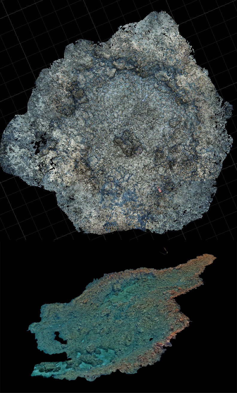
With the conclusion of the fieldwork, team members are now analyzing their data to produce 3D photogrammetric models of artifacts, reconstruct the battlescape, and assess the impacts of battle-related reef damage. Along with technical reports and maps, the team will produce outreach and education materials for the public based on project findings.
Ultimately, this project will contribute to the nation’s military and maritime history, help us understand how war-related activities may have shaped the natural environment in the area today, and illustrate the importance and evolution of Guam’s maritime culture at Asan and Agat beaches. These outcomes will inform federal resource management decisions (e.g., use of the area and conservation and protection of artifacts) as well as future research on human impacts to coral reefs and how reefs affect coastal resilience.
Published October 12, 2023
Features
View Less
Multimedia
Featured multimedia assets associated with this project.
Education
Our Learn & Discover page provides the best of what the NOAA Ocean Exploration website has to offer to support educators in the classroom during this expedition. Each theme page includes expedition features, lessons, multimedia, career information, and associated past expeditions. Below are related top education themes for this expedition.
Meet the Exploration Team
Learn more about the team members and their contributions to this project.


Resources & Contacts
-
Emily Crum
Communication Specialist, NOAA Ocean Exploration
ocean-explore-comms@noaa.gov -
Anne E. Wright
Principal Investigator, Submerged Resources Center, National Park Service
anne_wright@nps.gov -
Monique LaFrance Bartley
Co-Principal Investigator, Ocean and Coastal Resources Branch, Water Resources Division, National Park Service
monique_lafrancebartley@nps.gov