An official website of the United States government
Here’s how you know
Official websites use .gov A
.gov website belongs to an official government
organization in the United States.
Secure .gov websites use HTTPS A
lock (
) or https:// means you’ve safely connected to
the .gov website. Share sensitive information only on official,
secure websites.
From April 22 to May 14, 2023, researchers searched for, investigated, and documented remains of the World War II (WWII) Battle for Saipan’s underwater battlefield, including aircraft and amphibious vehicles.
The 1944 U.S. victory over Japan in the Battle for Saipan in the Northern Mariana Islands was the largest U.S. amphibious invasion in the Pacific theater at the time and a decisive moment for WWII in the Pacific. Today, the landing beaches for the invasion are part of a U.S. National Historic Landmark District (Landing Beaches, Aslito/Isely Field and Marpi Point, Saipan Island).
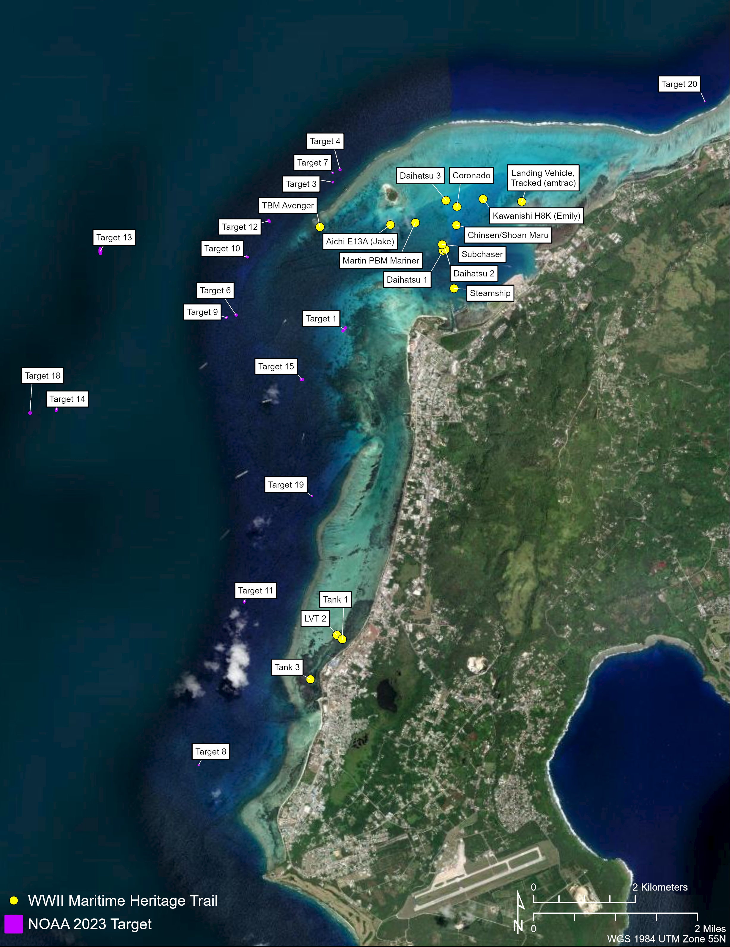
Map of the targets and known sites visited. Most of the numbered targets were identified using NOAA lidar data (Targets 19 and 20 were known by a few local divers but undocumented). The known sites, indicated with yellow dots, are part of the Battle for Saipan WWII Maritime Heritage Trail, and include U.S. and Japanese aircraft, shipwrecks, and assault vehicles that tourists actively dive on and require regular monitoring to assess their status and preservation. Map courtesy of Ships of Discovery. Download largest version (jpg, 2.7 MB).
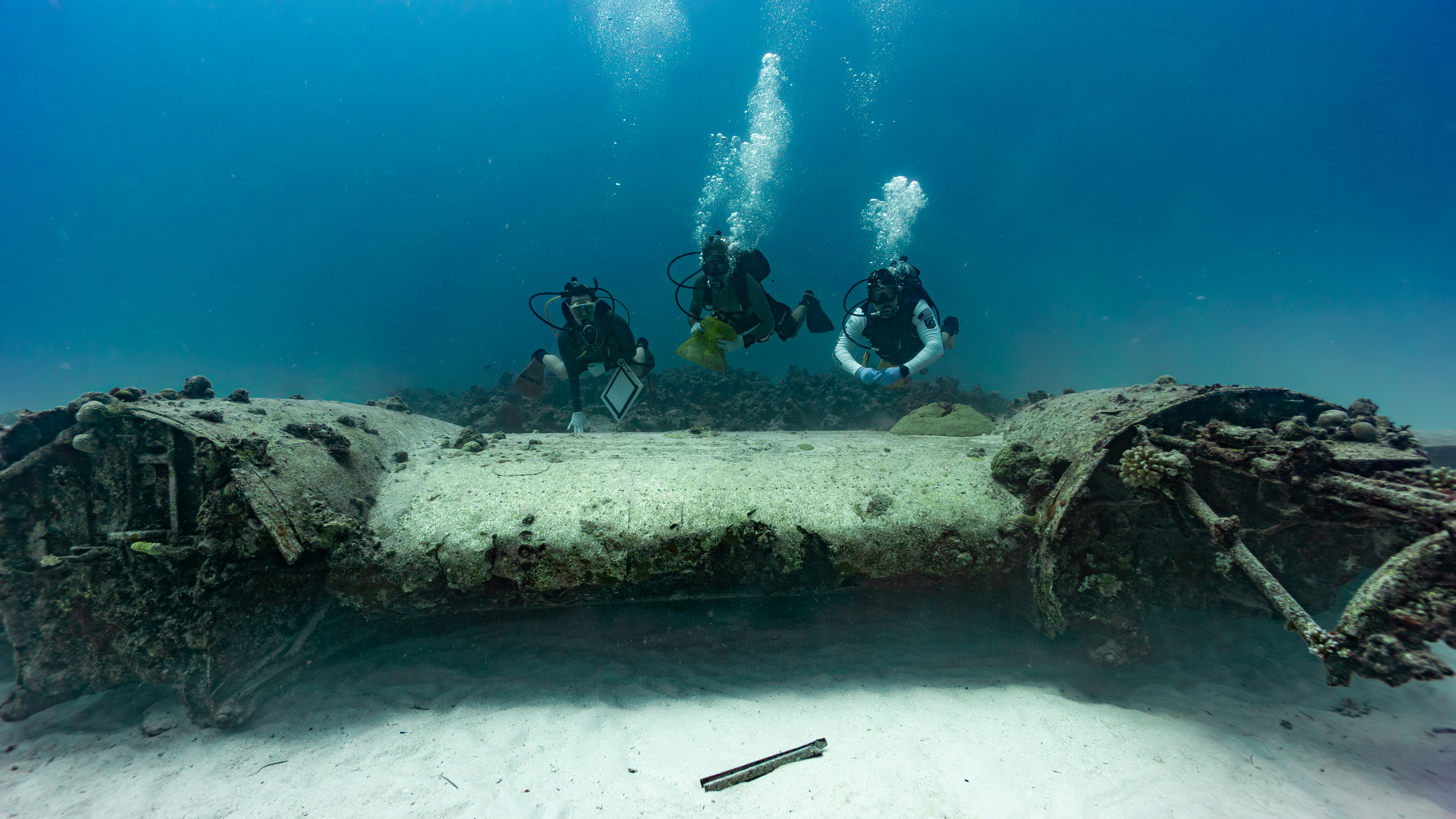
Researchers diving on the wing of a U.S. PBY Coronado seaplane sunk in approximately 24 meters (80 feet) of water outside Saipan’s barrier reef. Only a few local divers are aware of the site, and it has never before been archaeologically recorded. The team conducted a photogrammetric survey of the site to create a 3D model and collected eDNA samples to compare this deepwater Coronado to a shallow water Coronado in 6 meters (20 feet) of water inside the lagoon. Image courtesy of Ships of Discovery. Download largest version (jpg, 12.9 MB).
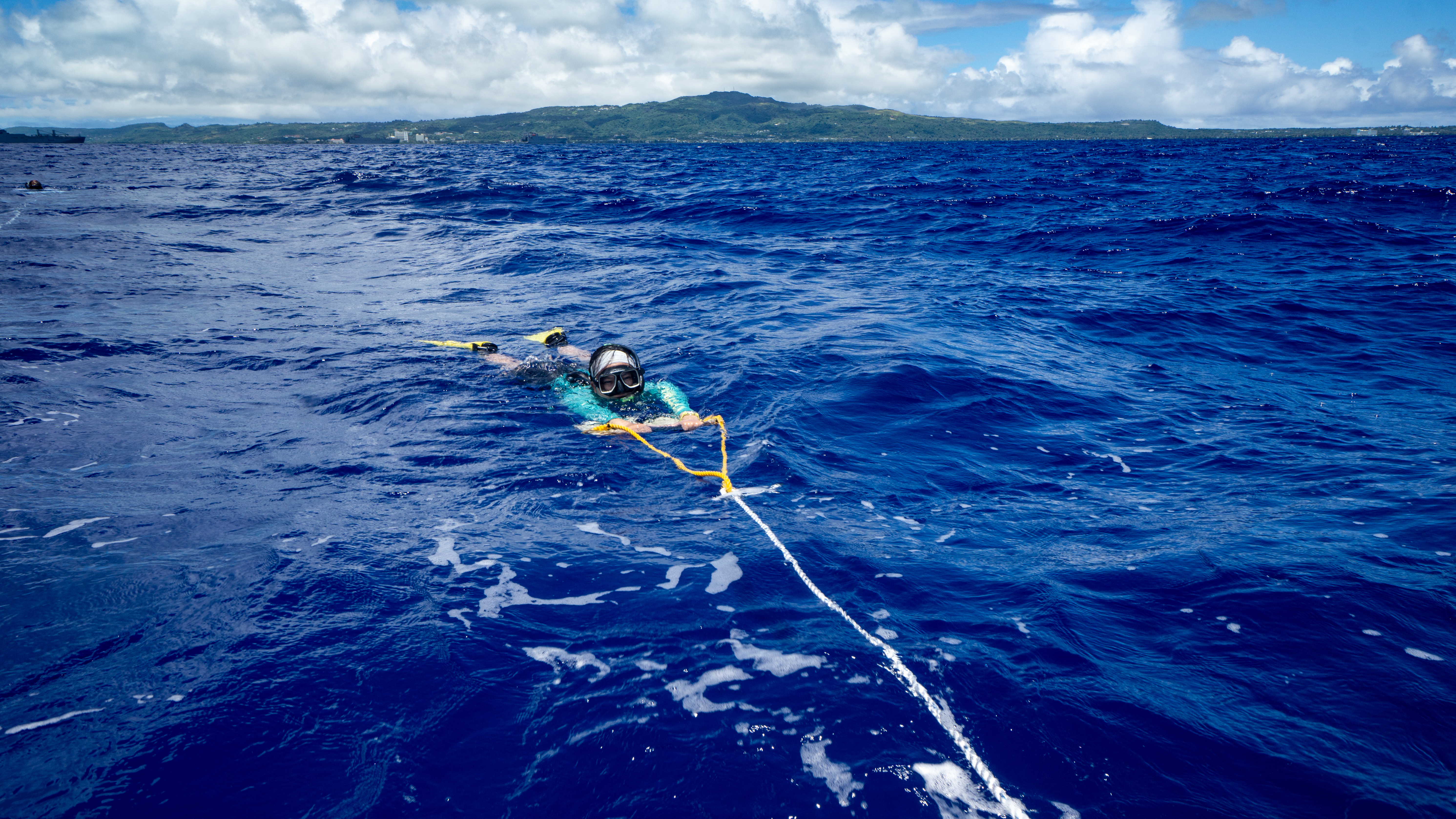
Team member tow boarding in approximately 30 meters (100 feet) of water. During tow boarding, two snorkelers are typically towed behind the vessel in clear waters where the bottom is visible. If they see something of interest, they let go of the tow board, and the vessel returns to the location for a closer look and possible dive. Tow boarding is very effective in clear water where coral growth is extensive. Archaeologists look for straight lines and shapes that do not look like natural objects. Image courtesy of Ships of Discovery. Download largest version (jpg, 15.9 MB).
This research team sought to enhance our knowledge about this historic battlefield and the preservation status of the tangible reminders of an important moment in U.S. history.
To find previously unknown sites (e.g., shipwrecks, tanks, amphibious vehicles, aircraft) on this largely unexplored battlefield, the team tested a new approach. They used artificial intelligence to find potential sites in lidar data. With targets identified, they deployed technical divers to ground truth the data.
The divers investigated 14 lidar-detected targets outside of Saipan Lagoon at depths ranging from roughly 10 to 50 meters (33-164 feet). While lidar proved effective for detecting sites in shallower water, it was less effective at these greater depths, where most of the targets turned out to be natural features. Nevertheless, the team did discover a number of sites, including a large amount of iron anchor chain and an amphibious vehicle (a Landing Vehicle Tracked, or LVT).
Additional operations in this deep water included documenting, for the first time, a U.S. PBM Coronado seaplane and a multivehicle WWII LVT dump site, known only to a few local divers, and a tow board survey. During this survey, they documented a number of artifacts associated with WWII that were not evident in the lidar data, including iron plating, a possible LVT, ordnance, a potential mooring, and other battle-related items.
The team also visited 15 known sites in the shallower water of the lagoon (up to 12 meters [40 feet] in depth) that are on the Battle for Saipan Maritime Heritage Trail. Here, they conducted conservation surveys and photogrammetric surveys to create 3D models of the sites.
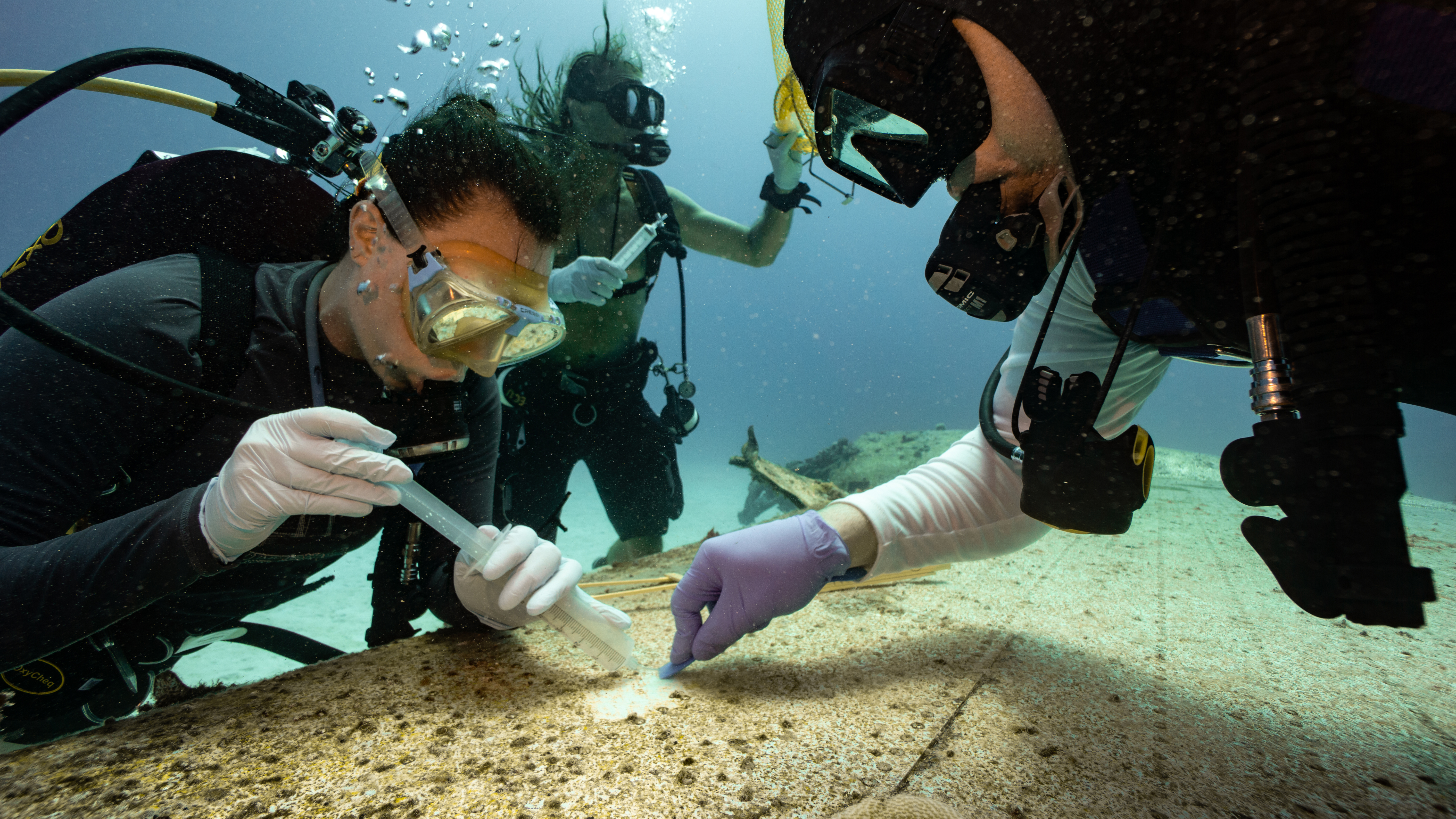
At six sites, inside and outside of the lagoon, they collected environmental DNA (eDNA) biofilm, water, and sediment samples to learn about the marine life associated with the sites.
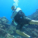
Joining the project team were 8 U.S. military veteran divers from Saipan, who participated in this project as part of a citizen science rehabilitative therapy training program, as well as 12 veterans and family members from Task Force Dagger Special Operations Foundation. These individuals assisted with the investigation of potential targets, site documentation, and sample collection. Notably, veteran rebreather divers did most of the deepwater investigation of potential targets.
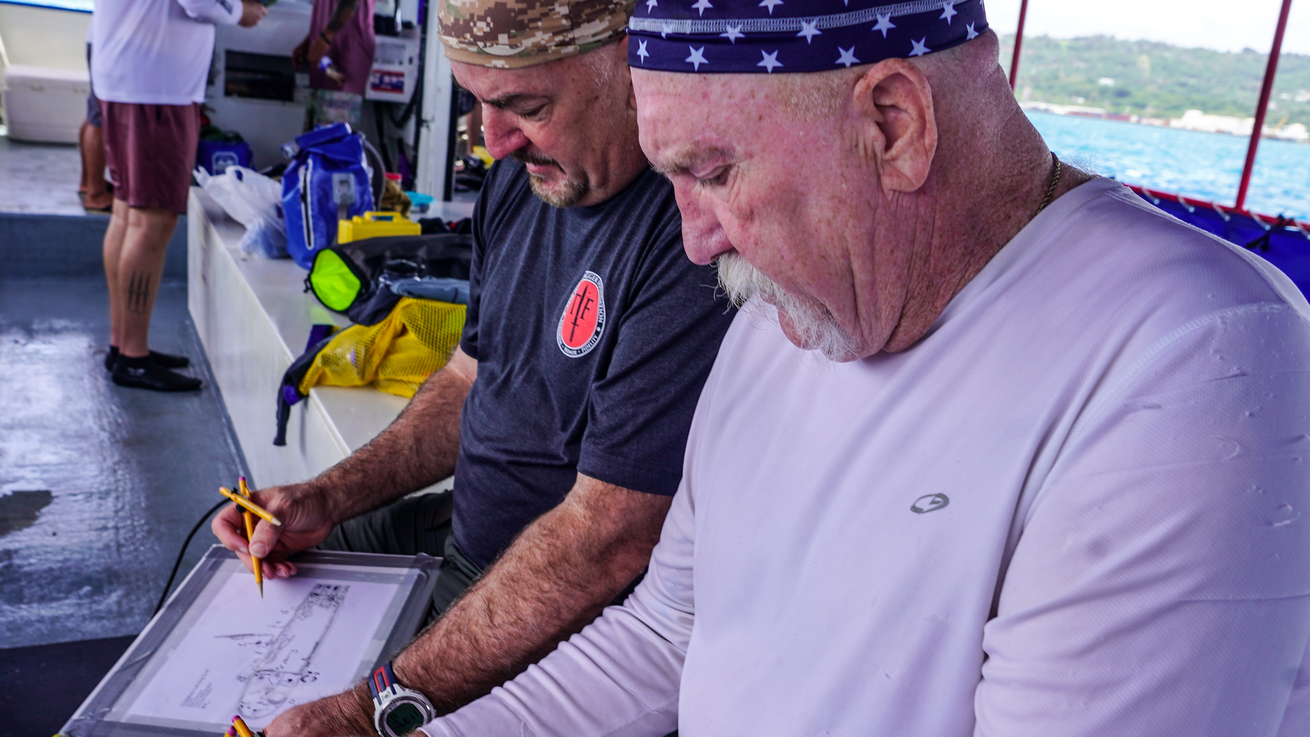
Veterans from Task Force Dagger Special Operations Foundation discussing a site assessment and the current condition of a Japanese Daihatsu landing craft. Veterans used dive site plans to note where changes have occurred on the site since the last monitoring of the site in 2017. In the six years between visits, some small changes to the landing craft have occurred: portions of the gunwale have collapsed, and artifacts have been moved around by tourists. Image courtesy of Ships of Discovery. Download largest version (jpg, 3.81 MB).
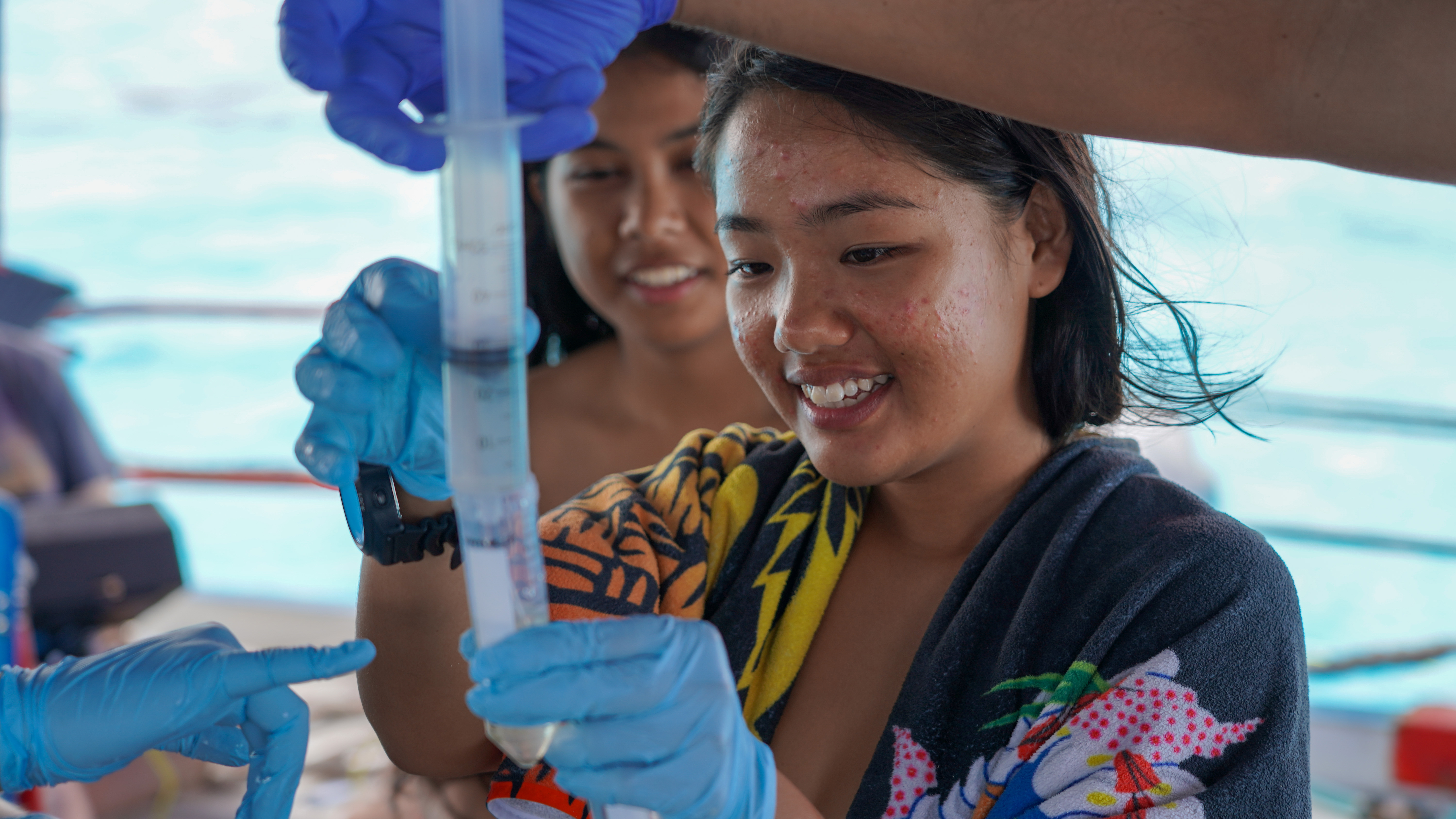
Other participants included Mariana Islands Nature Alliance rangers, recent high school graduates in training to become community conservation messengers. The rangers assisted with the processing of eDNA samples aboard the research vessel.
While the fieldwork is complete, more work remains to be done. It will take several months to build photogrammetric models from the diver- and ROV-collected imagery, process the eDNA data, and analyze the corrosion measurements collected during the conservation surveys. In addition, work will continue to refine the use of lidar for the detection of underwater cultural heritage sites.
All the data collected and processed during this project will provide a current snapshot of the condition of each site that can be used to track its health over time. They will also provide important insights into the factors that affect site integrity. eDNA data will shed light on site-specific species diversity, abundance, and sustainability. Together, these data will help marine resource managers understand the socioeconomic value of these important archaeological and biological resources (e.g., for historical, tourism, and fisheries purposes) to inform their protection and increase public appreciation and understanding of WWII maritime heritage.
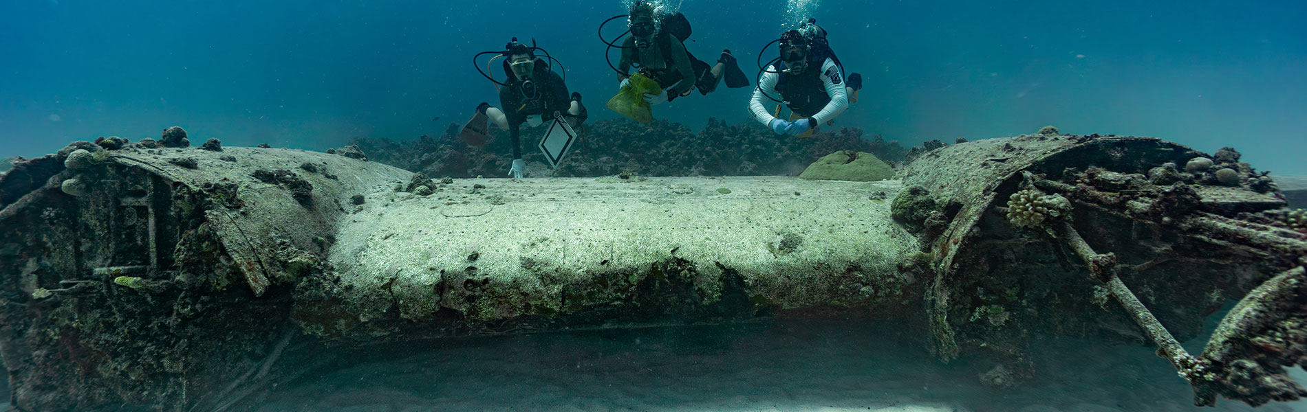
Divers collecting eDNA biofilm from the wreck of a U.S. PBY Coronado seaplane wreck in approximately 24 meters (80 feet) of water. eDNA will be used to look at the health of this and other sites from both a biological and preservation perspective. This is the first time eDNA has been collected on World War II aircraft in Saipan. Image courtesy of Ships of Discovery. Download largest version (jpg, 12.1 MB).
Two young Mariana Islands Nature Alliance (MINA) rangers helping process eDNA samples aboard the research vessel. MINA’s Tasi-Watch Program recruits recent high school graduates and trains them to become community conservation messengers. In the Chamorro language, I mattan I tasi means the face of the sea — Tasi-Watch facilitates stewardship of the sea. Image courtesy of Ships of Discovery. Download largest version (jpg, 5.62 MB).
It takes a lot of people, with a lot of different expertise and skills, to pull off a project like Exploring Deepwater World War II Battlefields in the Pacific Using Emerging Technologies.
July 5, 2023
Multimedia
Featured multimedia assets associated with this project.
Our Learn & Discover page provides the best of what the NOAA Ocean Exploration website has to offer to support educators in the classroom during this expedition. Each theme page includes expedition features, lessons, multimedia, career information, and associated past expeditions. Below are related top education themes for this expedition.