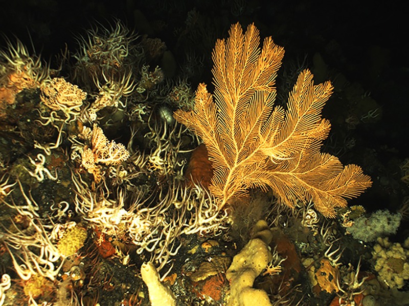
Exploring Attu’s Underwater Battlefield and Offshore Environment
Past Expedition
Overview
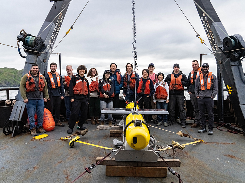
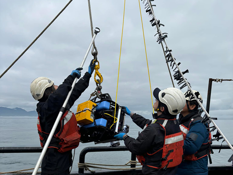
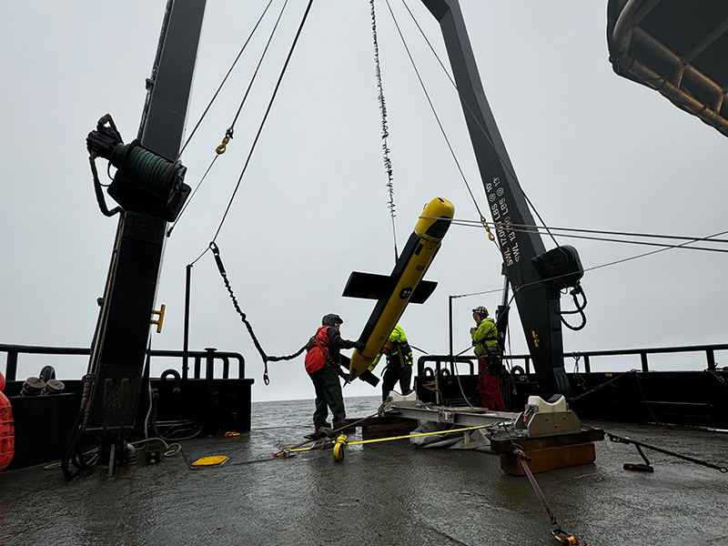
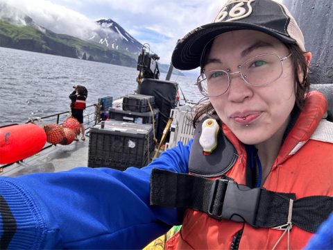
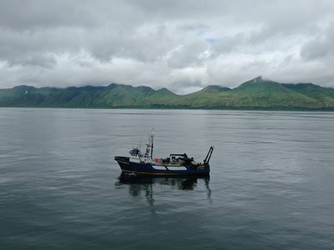
On July 17, 2024, the expedition team, consisting of archaeologists, hydrographers, and engineers, boarded the research vessel Norseman II at the Aleutian island of Adak. From there, the converted crabbing ship made the 49-hour steam to Attu, arriving in the early morning hours. Aided by years of archival research that preceded the expedition, the team wasted no time in getting started. A total of 12 synthetic aperture sonar (SAS) and multibeam surveys were conducted, including two aimed at imaging a specific wreck following its initial discovery. In all, the research team performed nearly 36.4 hours of sonar operations, corresponding to 435 linear kilometers and 35.3 km2 surveyed. The team focused on 11 locations around Attu, with water depths ranging from 15 meters (~40 feet) to 90 meters (~300 feet). The acoustic imaging was complimented by 21 deployments of the camera-equipped remotely operated vehicle (ROV), sent to photograph sonar targets of interest. Following the final SAS survey on July 24, with five days of extensive survey operations completed and terabytes of data, the expedition team bid Attu farewell, successfully completing the first underwater archaeology project in the island’s history.
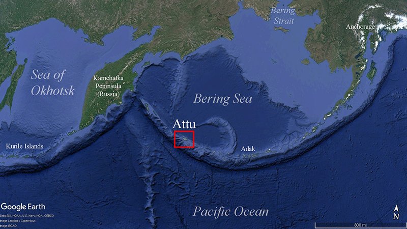
Download largest version (jpg, 476 KB).
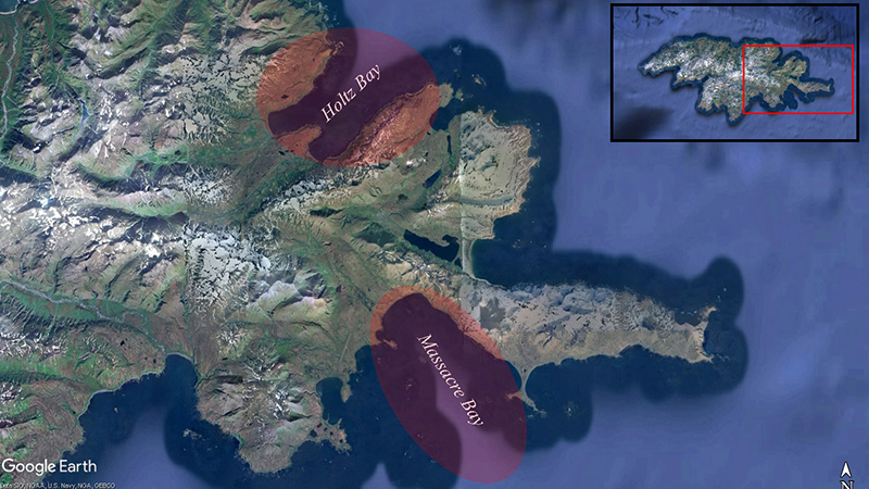
Download largest version (jpg, 471 KB).
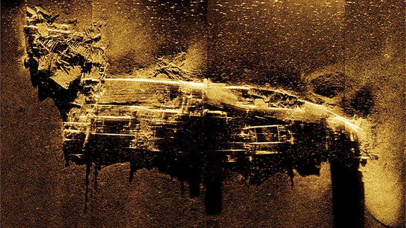
The initial survey work focused on the suspected location of the SS Dellwood, a U.S. Army cable layer that sank in July 1943. Hydrographers from ThayerMahan, Inc. deployed their SeaScout Katfish system, equipped with both cutting-edge synthetic aperture sonar (SAS) and more traditional multibeam sonar. Eighty-one years to the day of its sinking, the SS Dellwood was found in about 34 meters (110-115 feet) of water, though its physical state appeared far more disarticulated than expected. While the site is in an area of strong currents and ripping tides, the complete dismantling of the 3,000-ton vessel suggests that it may have been intentionally destroyed in hopes of making it less of a navigational hazard. A research consortium from Japan led by A.P.P.A.R.A.T.U.S., Inc. deployed their ROV and captured video footage of the severely damaged wreck site, while Norseman II’s captain held the research vessel in place. The optical imagery not only helped to validate the identification of the wreck as the remains of Dellwood, but will also be used to characterize the wreck’s ecology and serve as a valuable education product.
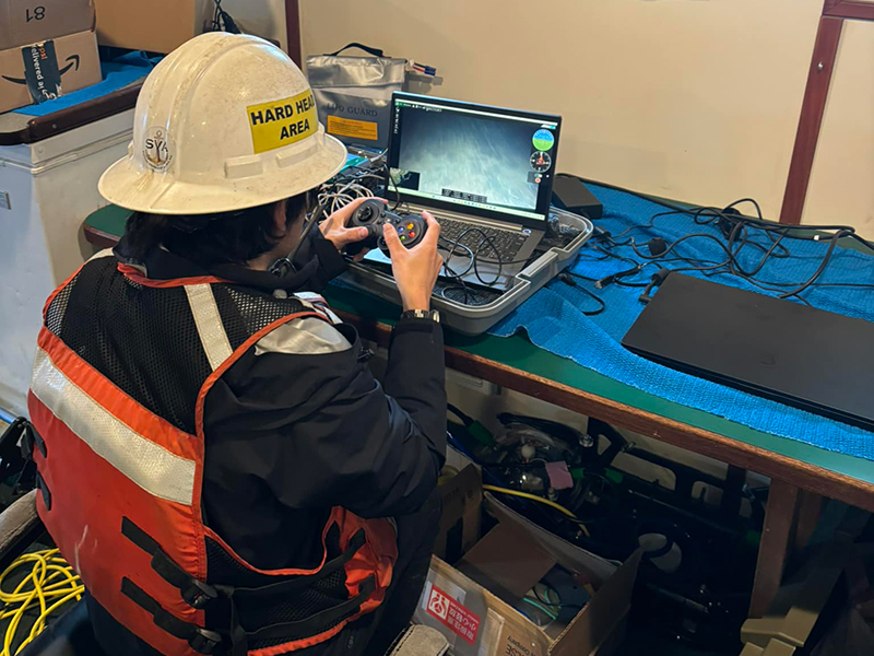
Download largest version (jpg, 732 KB).
Download largest version (jpg, 591 KB).
Download largest version (jpg, 5.15 MB).
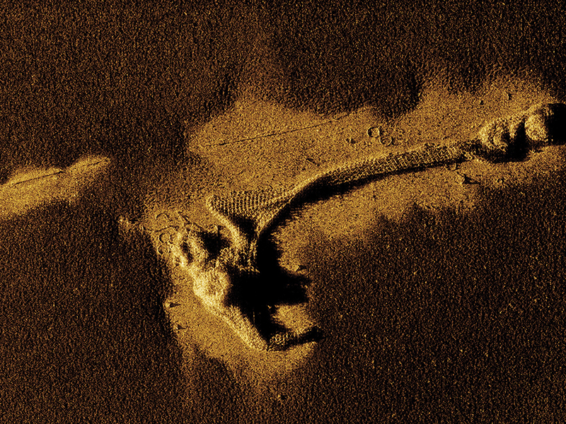
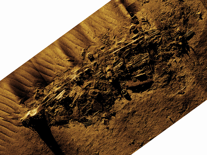
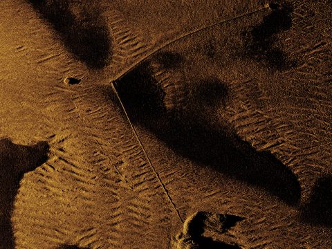
Subsequent survey work shifted to various locations within Massacre Bay, which served as the main landing site for the U.S. military during the Battle of Attu (1943), and later, became a hub for postwar military activity. While no wrecks were definitively identified in the field, the seafloor is littered with vestiges of World War II activity. This includes dozens of anchors, mooring blocks, and sunken buoys, as well as examples of materials used in the construction of infrastructure, such as timbers, piping, and cable. The immediate identification of these objects was made possible by the data’s resolution, demonstrating the benefits of SAS for underwater archaeology surveys. Perhaps the most interesting Massacre Bay find were the numerous examples of anti-submarine netting that could be clearly discerned. With the centimeter-scale resolution offered by SAS imagery, the interconnected metal rings of these nets, resembling chainmail armor, were seen in stunning detail. Often these harbor defenses were completely removed, as bays and ports returned to peacetime use. This does not appear to be the case, as the sunken net segments cover hundreds of meters of seafloor in Massacre Bay. Several targets were further investigated using the ROV, including a suspected landing craft. The photographic documentation revealed that this object was more likely a chassis, potentially for a flatbed trailer used in transporting construction materials. Here, the utility of combining acoustic (sonar) and optimal (ROV) imagery was made especially apparent.
Features
View Less
Multimedia
Featured multimedia assets associated with this project.
Education
Our Learn & Discover page provides the best of what the NOAA Ocean Exploration website has to offer to support educators in the classroom during this expedition. Each theme page includes expedition features, lessons, multimedia, career information, and associated past expeditions. Below are related top education themes for this expedition.
Meet the Exploration Team
Learn more about the team members and their contributions to this project.



Resources & Contacts
-
Emily Crum
Communications Specialist
NOAA Ocean Exploration
ocean-explore-comms@noaa.gov -
Lacy Gray
Director of Marketing & Communications, Thomas Harriot College of Arts & Sciences
East Carolina University
grayl@ecu.edu

