2019 Southeastern U.S. Deep-sea Exploration - Remotely Operated Vehicle and Mapping Operations

2019 Southeastern U.S. Deep-sea Exploration – Remotely Operated Vehicle and Mapping Operations

Past Expedition

Dates
October 31 through November 20, 2019
Location
Atlantic Ocean
Vessel
NOAA Ship Okeanos Explorer

Overview

From October 31 through November 20, 2019, NOAA and partners conducted mapping and remotely operated vehicle operations from NOAA Ship Okeanos Explorer to collect baseline information about unknown and poorly understood deepwater areas of the Southeastern U.S. continental margin.

Features
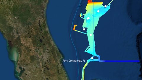
The 2019 Southeastern U.S. Deep-sea Exploration was a 43-day, two-part expedition led by the NOAA Office of Ocean Exploration and Research (OER) on NOAA Ship Okeanos Explorer. Its purpose was to collect critical baseline information about largely unexplored deepwater areas of the Southeastern U.S. continental margin.
February 3, 2020
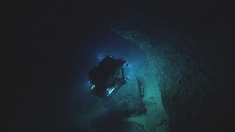
Imaged by its camera sled ROV Seirios, ROV Deep Discoverer explores some interesting, yet potentially dangerous, geology on the Pourtalès Terrace during Dive 10 of the 2019 Southeastern U.S. Deep-sea Exploration.
Whenever NOAA Ship Okeanos Explorer plans to explore off the southeast coast of the United States, we know there will be challenges.
November 18, 2019
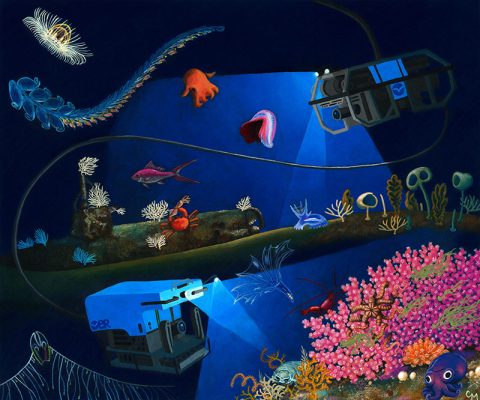
In this illustration, remotely operated vehicles Deep Discoverer and Seirios explore the seafloor and water column. Illustration courtesy of Christine Machinski.
If you have been following along with our expeditions, you know that almost every time we dive, we find something new and unexpected.
November 14, 2019
View More View Less
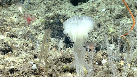
This glass sponge (Aphrocallistes beatrix) was seen during Dive 02 of the 2019 Southeastern U.S. Deep-sea Exploration.
This has been quite an exciting expedition when it comes to sponges.
November 11, 2019
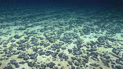
Most of the seafloor explored during Dive 07 of the 2019 Southeastern U.S. Deep-sea Exploration was covered with these manganese nodules, the subject of the Deep Sea Ventures pilot test nearly five decades ago.
Fifty years ago, the company Deep Sea Ventures Inc. performed extensive exploration and a pilot test of deep-sea mining technology on the Blake Plateau, deploying a system to collect seafloor sediment and manganese nodules by airlift pumping through a pipe to the surface.
November 7, 2019
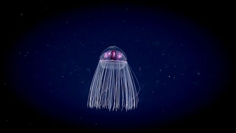
A colorful jelly extends its tentacles to feed in the water column during a Windows to the Deep 2019 midwater transect.
Today is World Jellyfish Day. In honor of the occasion, let’s review a few fun facts about jellyfish.
November 3, 2019
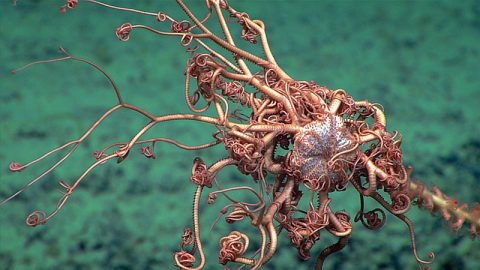
This basket star perched on a bamboo coral was observed during Windows to the Deep 2018.
Today is the first remotely operated vehicle (ROV) dive of the 2019 Southeastern U.S. Deep-sea Exploration.
November 1, 2019
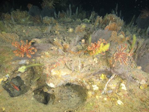
A dense community of black corals, octocorals, and crinoids at 122 meters (400 feet) depth on Elvers Bank in the northwestern Gulf of Mexico. The image was taken during a 2017 SEDCI-supported expedition aboard R/V Manta.
In 2016, NOAA launched a new four-year initiative to study deep-sea coral and sponge ecosystems across the Southeast United States, a region that includes the U.S. federal waters of the Gulf of Mexico, South Atlantic Bight, and Caribbean Sea.
October 24, 2019
These exposed fossil Lophelia pertusa remains were documented on the Namibian coral mounds. These mounds are considered inactive due to the presence of little-to-no live corals within this mound province off the coast of Namibia. The current system that supplies the necessary oxygen levels to these corals was shut down, halting production of mound development. Image courtesy of remotely operated vehicle Squid, MARUM (Center for Marine Environmental Sciences), University of Bremen.
As corals begin to grow, reefs form and begin to alter the morphology of the seafloor. This is where deep-sea biology meets geology. The scale of seafloor alteration depends heavily on the current systems and the sediments that drift along with the particulate organic matter that the corals feed on.
October 24, 2019
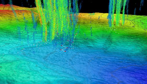
Three-dimensional perspective of a ROV Deep Discoverer dive track (white lines) and waypoints (red points) with superposed water column bubble plumes (multi-colored point clouds) imaged by NOAA Ship Okeanos Explorer during a previous mission. Methane bubble plumes at Norfolk Seeps have been imaged rising over 900 meters (2,950 feet) above the seafloor in previous surveys. Bathymetric data were collected with the Okeanos Explorer multibeam sonar and are contoured at 10-meter (about 3-feet) intervals. The locations of previously identified seeps are indicated with white points. All data shown at two times vertical exaggeration.
NOAA Ship Okeanos Explorer expeditions are most well-known for capturing never-before-seen footage of the deep sea and creating beautiful maps of the seafloor. But did you know that these videos and maps are only part of the data that is collected during Okeanos Explorer expeditions?
October 24, 2019
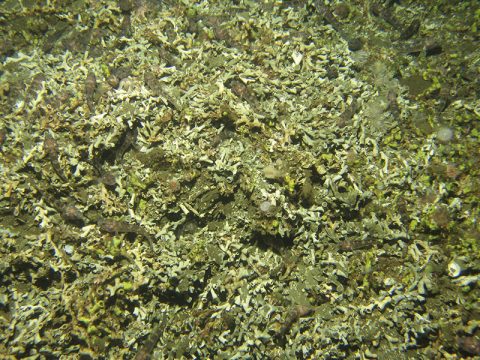
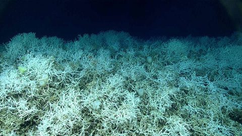
Dense fields of Lophelia pertusa, a common reef-building coral, have been found on the Blake Plateau knolls. The white coloring is healthy - deep-sea corals don’t rely on symbiotic algae, so they can’t bleach. Similar areas will be targeted for ROV dives on the upcoming expedition.
From October 31 through November 20, 2019, NOAA and partners will conduct mapping and remotely operated vehicle (ROV) operations from NOAA Ship Okeanos Explorer to collect critical baseline information about unknown and poorly understood deepwater areas of the Southeastern U.S. continental margin.
October 24, 2019

Multimedia

Featured multimedia assets associated with this project.

Dive Summary Map

The map below shows the location of dives during the expedition. Click on a dive number to access the update from that day.

Education

Our Learn & Discover page provides the best of what the NOAA Ocean Exploration website has to offer to support educators in the classroom during this expedition. Each theme page includes expedition features, lessons, multimedia, career information, and associated past expeditions. Below are related top education themes for this expedition.

Meet the Exploration Team

Learn more about the team members and their contributions to this project.
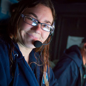
Biology Science Lead, Harbor Branch Oceanographic Institute at Florida Atlantic University
Geology Science Lead, Rosenstiel School for Marine and Atmospheric Science at the University of Miami
Global Foundation for Ocean Exploration
Video Producer, Global Foundation for Ocean Exploration
Video Engineer, Global Foundation for Ocean Exploration
Network Systems Engineer, Global Foundation for Ocean Exploration

Resources & Contacts

Media Contacts
    • NOAA Office of Ocean Exploration and Research
      Emily Crum
      Email Address: emily.crum@noaa.gov
    • NOAA Office of National Marine Sanctuaries
      Vernon Smith
      National Media Coordinator
      Office: (240) 533-0662
      Email Address: vernon.smith@noaa.gov
    • NOAA National Marine Fisheries Service
      John Ewald
      Director of Public Affairs
      Office: (301) 427 – 8029
      Email Address: john.ewald@noaa.gov
    • NOAA Office of Marine and Aviation Operations
      David Hall
      Public Affairs Officer
      Office: (301) 713 – 7671
      Email Address: david.l.hall@noaa.gov

    View all media resources