

2022 Caribbean Mapping
Past Expedition
Expedition Summary
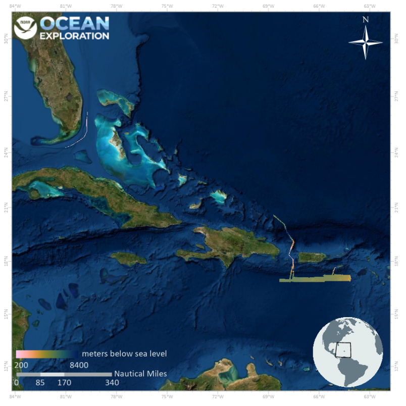
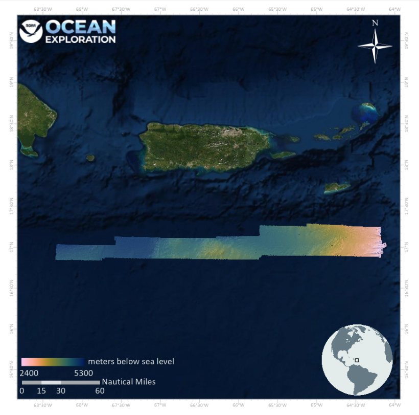
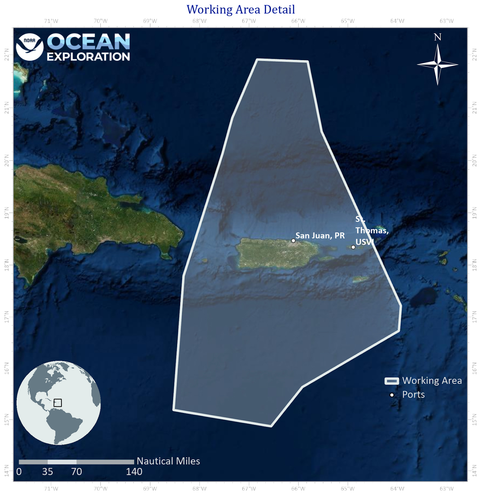
From March 10 – 28, 2022, NOAA Ocean Exploration conducted an exploratory ocean mapping expedition on NOAA Ship Okeanos Explorer focused on U.S. waters south of Puerto Rico deeper than 200 meters (656 feet).
During the expedition, the team put the sonars on Okeanos Explorer to work, including the ship’s recently upgraded Kongsberg EM 304 multibeam sonar. After departing Key West, Florida, mapping data were collected during the transit to the primary exploration area south of Puerto Rico. Over the course of the expedition, the expedition team mapped a total of 8,398 linear kilometers (5,218 miles) and 18,580 square kilometers (7,174 square miles) of seafloor, an area approximately twice the size of Puerto Rico. These mapping efforts resulted in the collection of high-resolution data needed to fill critical mapping gaps in the region and revealed never-before seen morphologic features of the seafloor south of Puerto Rico, including small seamounts.
In addition to meeting mapping objectives, outreach activities conducted during the 2022 Caribbean Mapping expedition contributed to NOAA Ocean Exploration’s goals of engaging the public in exploration and training the next generation of ocean explorers. These activities included hosting three Explorers-in-Training, hosting a live seminar with the Environmental Studies and Biology departments at University of North Carolina, Asheville and conducting one in port media tour with Telemundo, Puerto Rico.
View the initial Expedition Overview.
Download largest version (jpg, 350 KB).
Download largest version (jpg, 278 KB).
Operations
Download largest version (jpg, 866 KB).
Multimedia
Featured multimedia assets associated with this project.
Education
Our Learn & Discover page provides the best of what the NOAA Ocean Exploration website has to offer to support educators in the classroom during this expedition. Each theme page includes expedition features, lessons, multimedia, career information, and associated past expeditions. Below are related top education themes for this expedition.
Meet the Exploration Team
Learn more about the team members and their contributions to this project.


Expedition Data
Data collected during the expedition will be available in NOAA’s public data archives within 60-90 days of its completion and will be accessible via the NOAA Ocean Exploration Data Atlas.
Resources & Contacts
-
NOAA Ocean Exploration
Emily Crum
Communications Specialist
Email Address: emily.crum@noaa.gov -
NOAA Office of Marine and Aviation Operations
David Hall
Public Affairs Officer
Email Address: david.l.hall@noaa.gov