
Beyond the Blue: 2025 ROV and Mapping Shakedown
Past Expedition
Overview
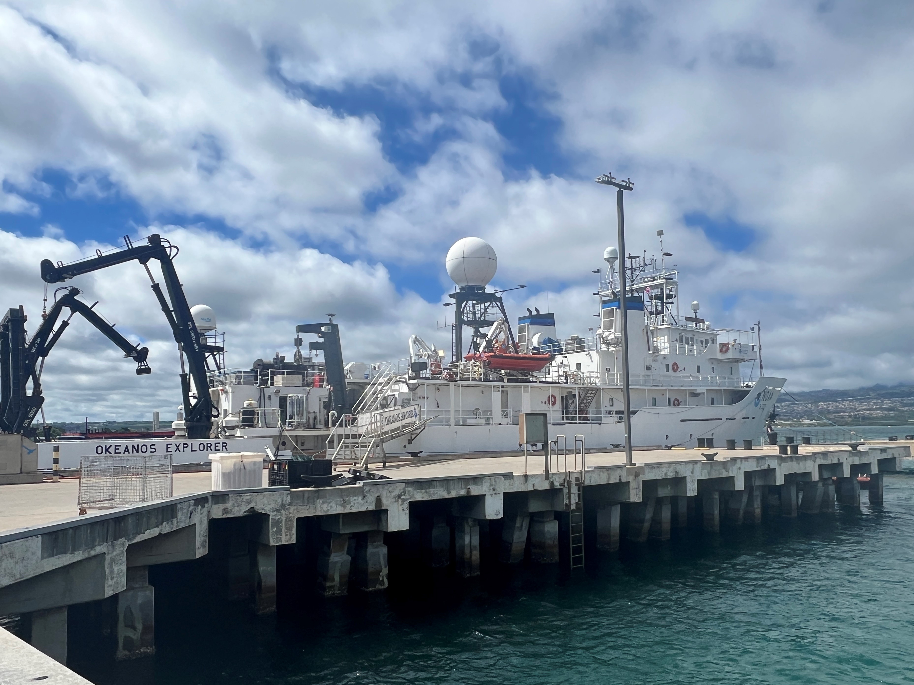
From March 17-27, 2025, NOAA Ocean Exploration and partners will conduct a telepresence-enabled expedition on NOAA Ship Okeanos Explorer in deep waters off Hawai‘i. During the Beyond the Blue: 2025 ROV and Mapping Shakedown expedition, the team will assess the readiness of remotely operated vehicles (ROV) Deep Discoverer and Seirios along with the ship’s mapping, telepresence, and other systems needed to conduct scientific activities. This “shakedown” ensures that these systems are ready to go for the remainder of the year and provides an opportunity to train staff while ensuring that collected data are of the highest quality.
The waters in the region span a diverse range of ecosystems and dynamic geological environments. They contain some of the last relatively pristine marine ecosystems on the planet and harbor numerous protected species, as well as undiscovered shipwrecks and cultural landscapes. During the expedition, the team will also collect critical baseline information to support further exploration and research and inform resource management decisions and activities in the region.
Download largest version (jpg, 2.65 MB).
A large part of the expedition will focus on calibrating, testing, and assessing the ship’s acoustic mapping systems and associated equipment. The team will also conduct dives to address engineering objectives as part of the ROV system “shakedown.” This shakedown period will include training of new personnel, review of operations to ensure safety and efficiency, and a series of five ROV dives. During these dives, ROVs Deep Discoverer and Seirios will be deployed at varying depths to assess and troubleshoot their mechanical, electrical, and software systems.
In the latter part of the expedition, as time and objectives allow, ROV dives will be conducted to explore deep-sea coral and sponge habitats, maritime heritage sites, and the water column.
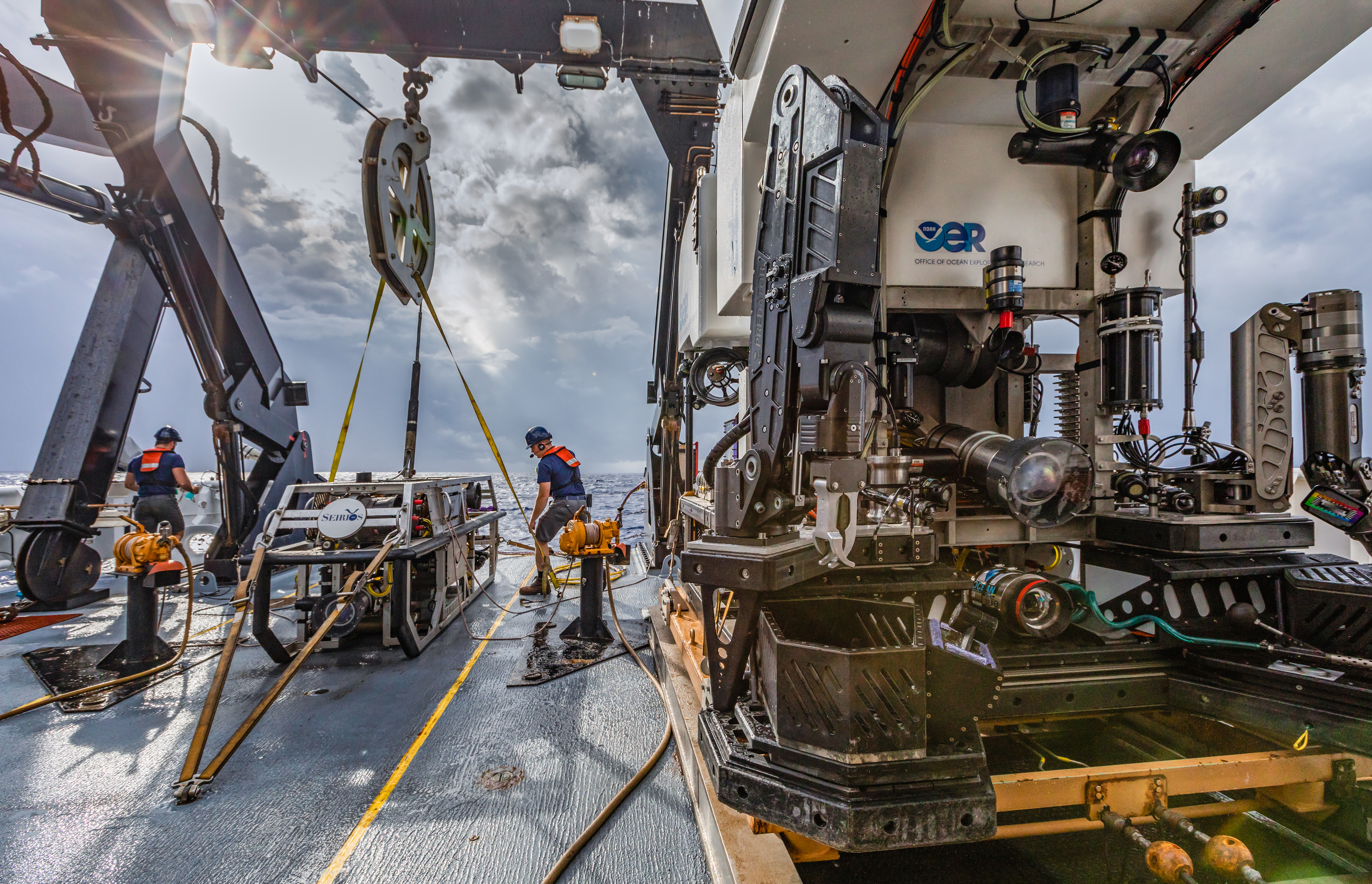
Download largest version (jpg 17.9 MB).
Throughout the expedition, when dives are not taking place, we will conduct CTD (conductivity, temperature, and depth) profile casts, with eDNA (environmental DNA) collection as well as mapping operations to collect acoustic data of seafloor and sub-seafloor geomorphology and water column habitats in the region. The collection of high-resolution mapping data is a key element of every NOAA Ocean Exploration expedition on Okeanos Explorer, and mapping data will be instrumental to planning subsequent ROV dives.
All data collected during the expedition will contribute to Beyond the Blue: Illuminating the Pacific, a multifaceted science campaign designed to increase knowledge about deep ocean waters in the Pacific Islands region. The campaign directly supports National Strategy for Ocean Mapping, Exploration, and Characterization (NOMEC) goals to close gaps in understanding of a region critical to U.S. national security, fisheries, mineral and energy resources, and biodiversity.
Operations
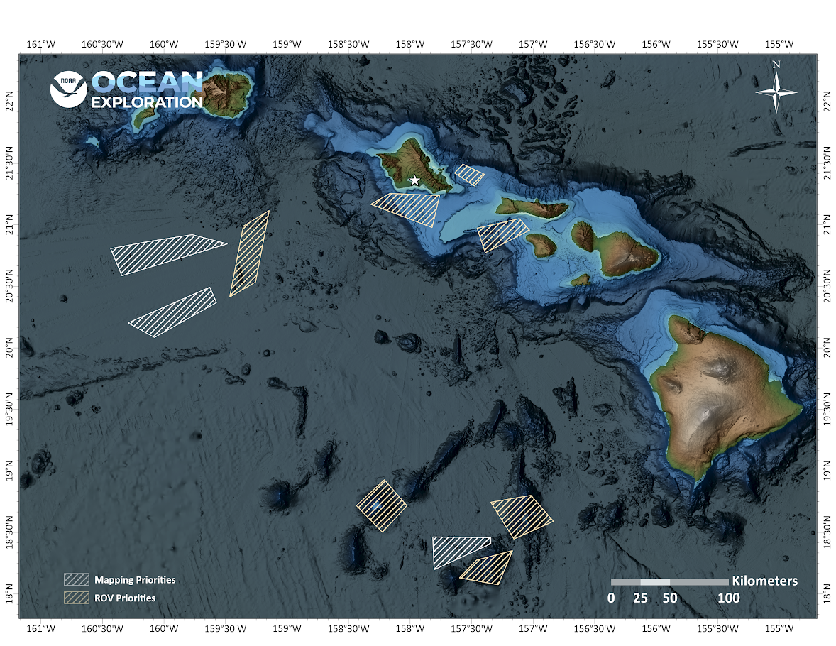
Download largest version (jpg 1.52 MB).
Live Track/Current Position Map
Map data courtesy of NOAA’s National Centers for Environmental Information (NCEI).
Education
Our Learn & Discover page provides the best of what the NOAA Ocean Exploration website has to offer to support educators in the classroom during this expedition. Each theme page includes expedition features, lessons, multimedia, career information, and associated past expeditions. Below are related top education themes for this expedition.
Meet the Exploration Team
Learn more about the team members and their contributions to this project.


Resources & Contacts
-
Emily Crum
Communication Specialist
NOAA Ocean Exploration
ocean-explore-comms@noaa.gov -
Keeley Belva
Public Affairs Officer
NOAA Office of Marine and Aviation Operations
keeley.belva@noaa.gov