
image
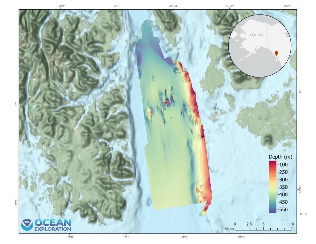
Bathymetric Map
Bathymetric map produced from multibeam sonar data collected from NOAA Ship Okeanos Explorer during the Seascape Alaska 6 expedition with over 100 million soundings. Image courtesy of NOAA Ocean Exploration, Seascape Alaska