
image
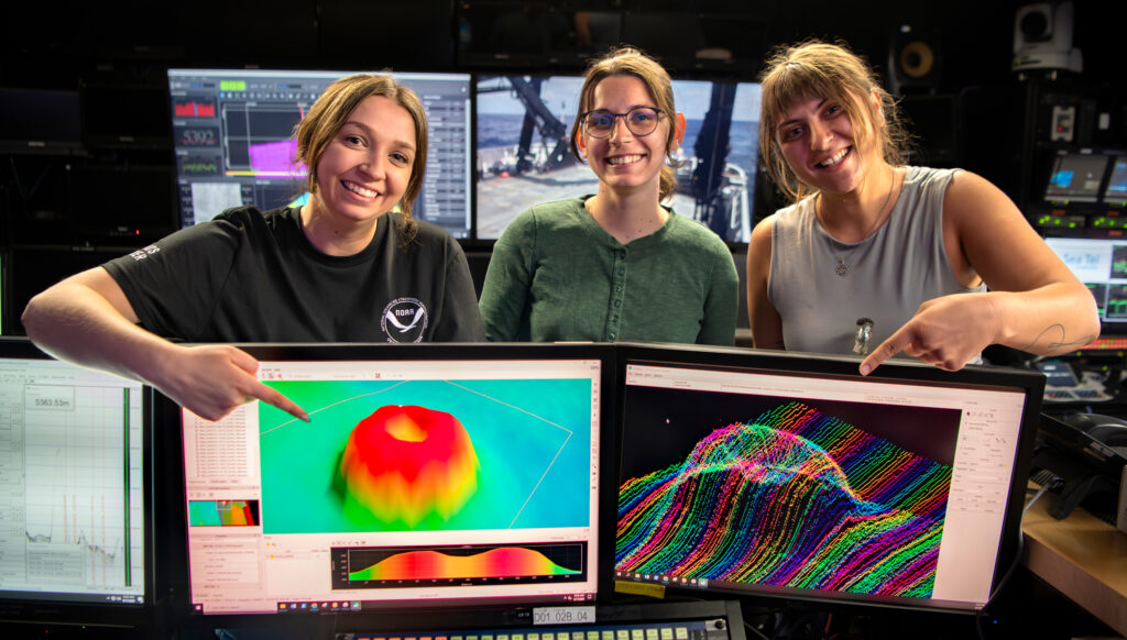
Bathymetry of a Caldera
Alex Dawson, Jordan Schweizer, and Teodora Mitroi with bathymetry of a caldera that was mapped south of Hawai‘i during the Beyond the Blue: Hawai‘i Mapping expedition. The expedition focused on the collection of bathymetric, sub-bottom, and water column data in waters deeper than 200 meters (656 feet) within the U.S. Exclusive Economic Zone surrounding the Hawaiian Islands. Image courtesy of Caitlin Bailey, Global Foundation for Ocean Exploration, 2024 Beyond the Blue.