

image
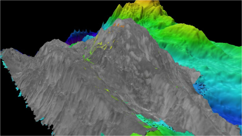
September 26, 2020: Backscatter Mosaic
During exploration missions where there is as much interest in geology and geophysics as in biology and habitat, multibeam backscatter has become an invaluable tool. This image shows a backscatter mosaic draped on top of multibeam data collected during the Mid-Cayman Rise Expedition 2011. Backscatter data is particularly useful in determining bottom type, because different bottom types “scatter” sound energy differently; for example, a softer bottom such as mud will typically return a weaker signal than a harder surface, like rock.