
image
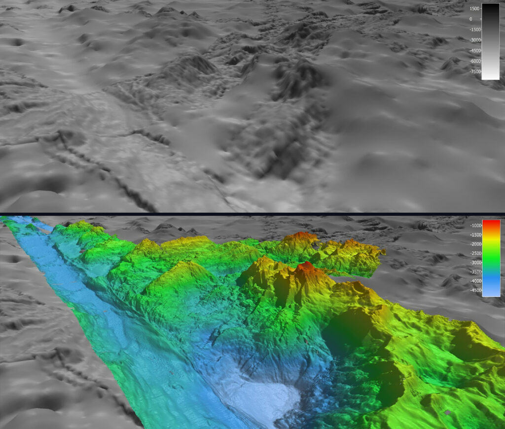
Satellite Versus High-Resolution Bathymetry Data
In May, during the first Voyage to the Ridge 2022 expedition, NOAA Ocean Exploration completed the largest continuous mapping survey effort to date over the Charlie-Gibbs Fracture Zone, collecting bathymetric data along this geologically fascinating and ecologically exceptional region. These images show satellite-derived bathymetry data (top) in comparison to the high-resolution bathymetry data (bottom) collected during Voyage to the Ridge 2022 using the multibeam system on NOAA Ship Okeanos Explorer.