
image
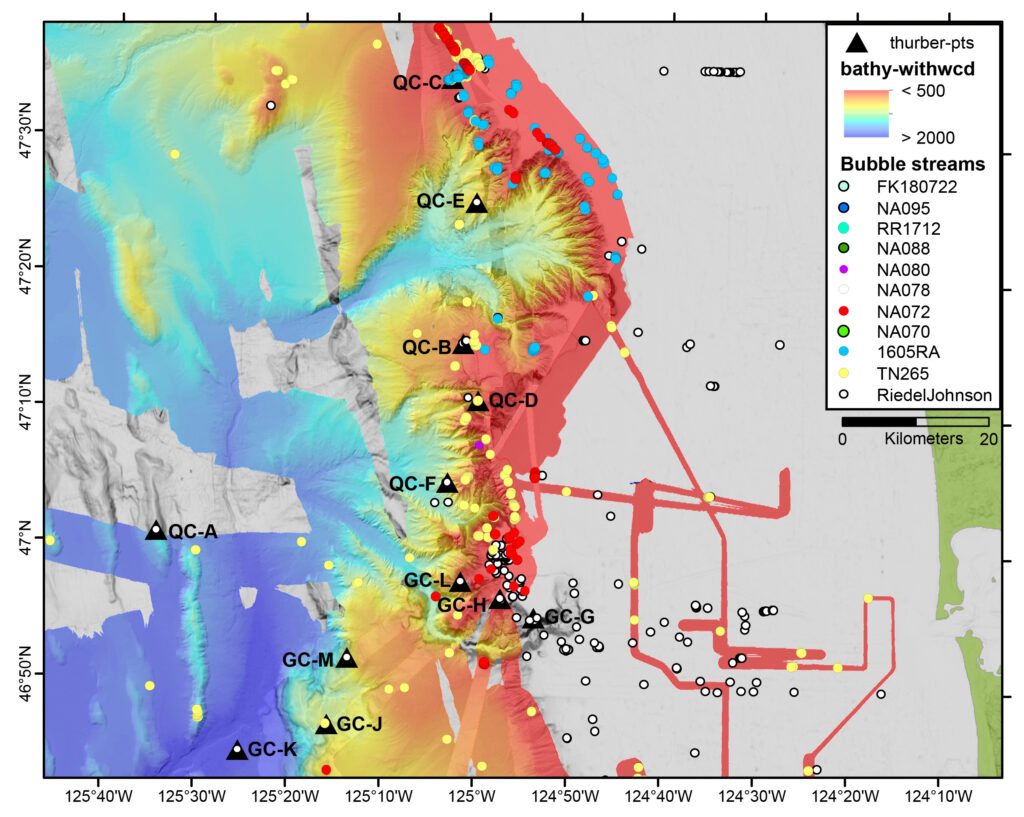
Expedition Map
Map of the two canyons which we will explore on this expedition. Each dot is an area where a plume of methane is being released from the seafloor. The triangles are potential dive sites that we will visit on this expedition.