
image
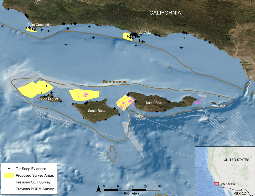
Regional Map
Map developed by Amy Gusick.
Regional location of the Paleolandscapes, Paleoecology, and Cultural Heritage on the Southern California Continental Shelf expedition. Brown lines indicate the extent of Santarosae approximately 16,000 years ago. Map shows previously collected remote-sensed data in areas of interest and the survey areas for the current research. Locations of known tar seeps are noted.