
image
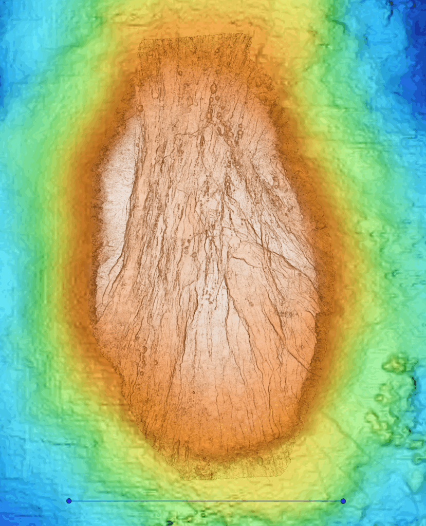
Map of Puy des Folles Seamount
A full map of Puy des Folles Seamount based on 1-meter resolution data collected by an autonomous underwater vehicle during the In Search of Hydrothermal Lost Cities expedition.