
image
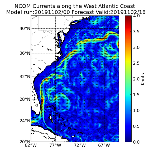
Gulf Stream Model
The Gulf Stream direction and magnitude is modeled by the U.S. Navy Coastal Ocean Model (NCOM), which is a high-resolution model that offers ocean current data at a 2 nautical mile (2.3 mile) resolution every 24 hours. The navigator, dive supervisor, and ship operators use this model output to very roughly estimate expected currents at each dive site.