
image
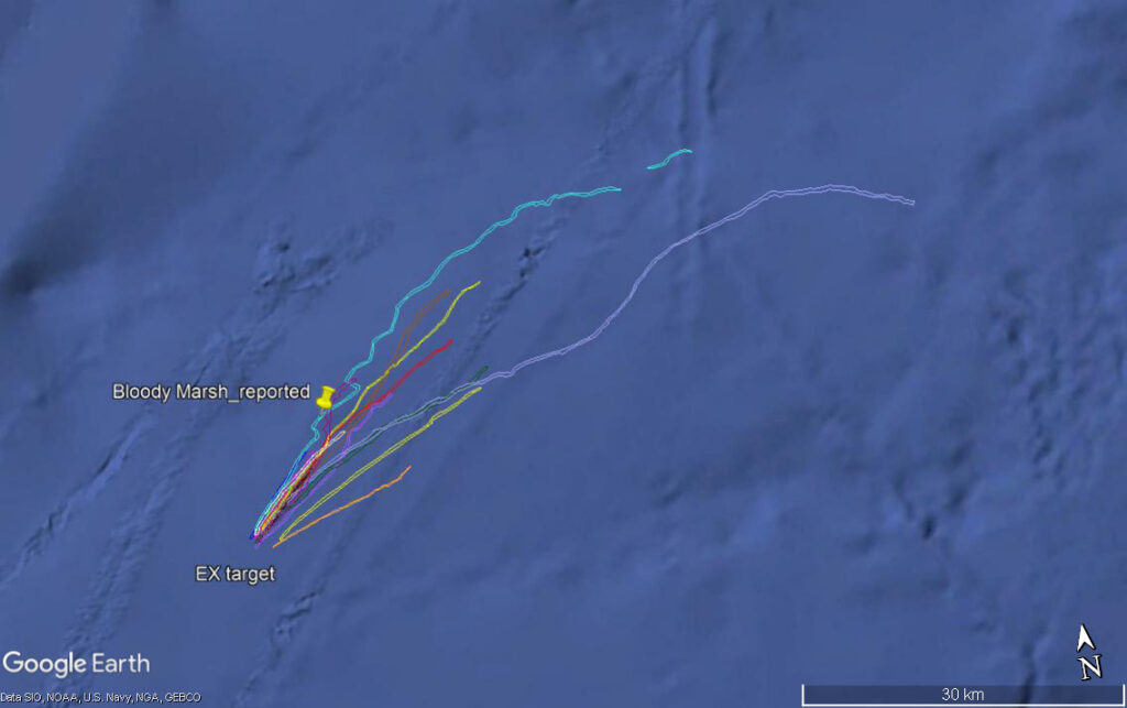
Reported Oil Slicks
This Google Earth map shows surface oil slick plots reported from satellite imagery from 1997 to 2019 along with the historic reported sinking position of SS Bloody Marsh and the target ultimately found during Dive 02 of Windows to the Deep 2021.