
image
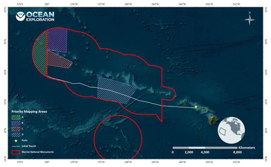
Operations Map for Beyond the Blue: Papahānaumokuākea Mapping 2
This map shows the general operating area during the Beyond the Blue: Papahānaumokuākea Mapping 2 expedition, with the approximate track of NOAA Ship Okeanos Explorer into Papahānaumokuākea Marine National Monument shown as a white line and the boundaries of marine national monuments shown in red. The four shaded areas represent priority mapping targets.