
image
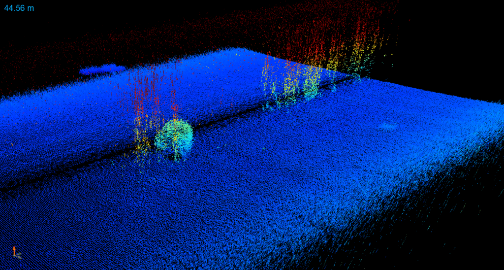
Side-Scan Sonar Plume Imagery
Sidescan sonar imagery from a VT690 autonomous underwater vehicle used during the 2023 expedition showing distinct acoustic scattering features, including rising bubble plumes at methane seeps (bubble curtains) and a school of fish (round ball near the seafloor). Data is colored by depth; blue is deeper and red is shallower.