
Industry (BOEM Wreck Site 15563)
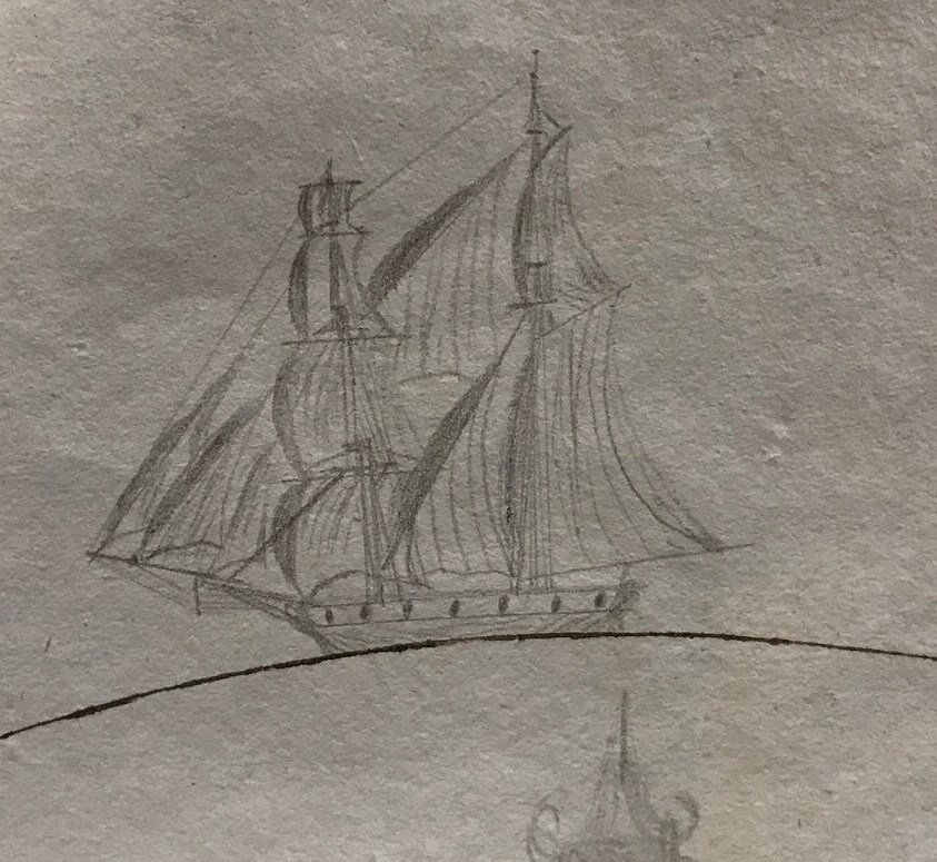
Sketch of the two-masted brig Industry from the ship’s 1828 logbook. Image courtesy of the New Bedford Whaling Museum Library and Archives.
Download largest version (jpg, 277 KB).
Background
Industry was an American-built whaling brig active in the Gulf of Mexico from 1816 until it sank in 1836. Master carpenter Issac Cory, Jr., son of the brig’s owner, Issac Cory, Sr., began construction of the brig in Westport, Massachusetts, in 1815, and completed it in 1816.
Industry had an overall length of 19.5 meters, a beam of 6.1 meters, an 2.6 meters depth of hold, and a registered tonnage of 94.3 tons. It was constructed with a single deck and had two masts. Designed to serve as a whaler, it operated as such for approximately 20 years in the Atlantic Ocean, the Caribbean Sea, and the Gulf of Mexico. On May 26, 1836, a storm damaged one of Industry’s masts and its hull, causing it to take on water and sink. The location of its sinking was recorded approximately 70 miles south of the mouth of the Mississippi River.
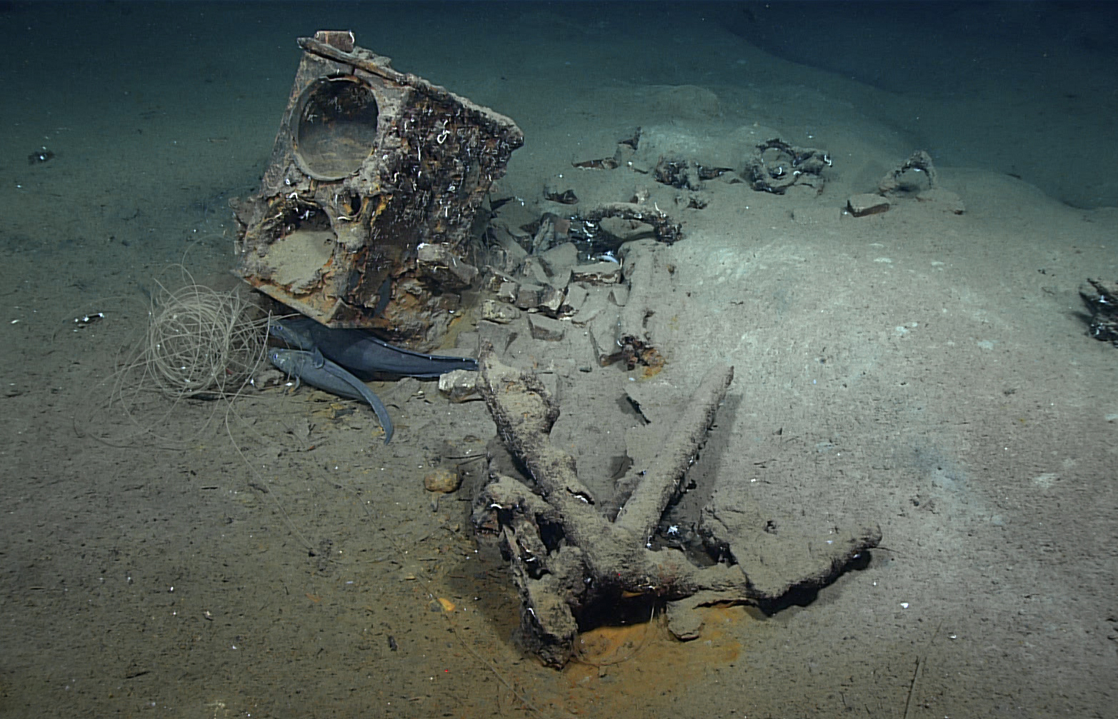
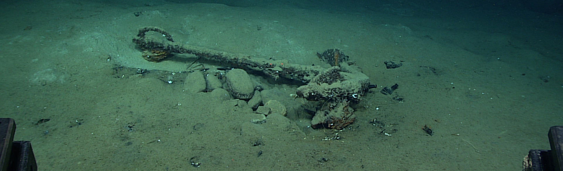
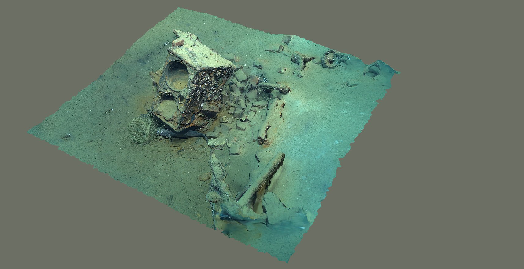
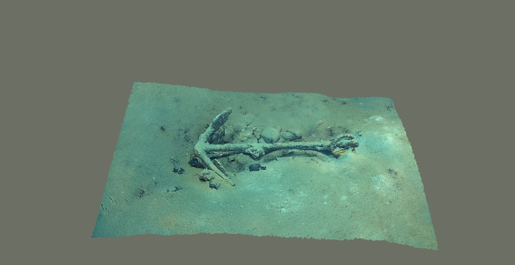
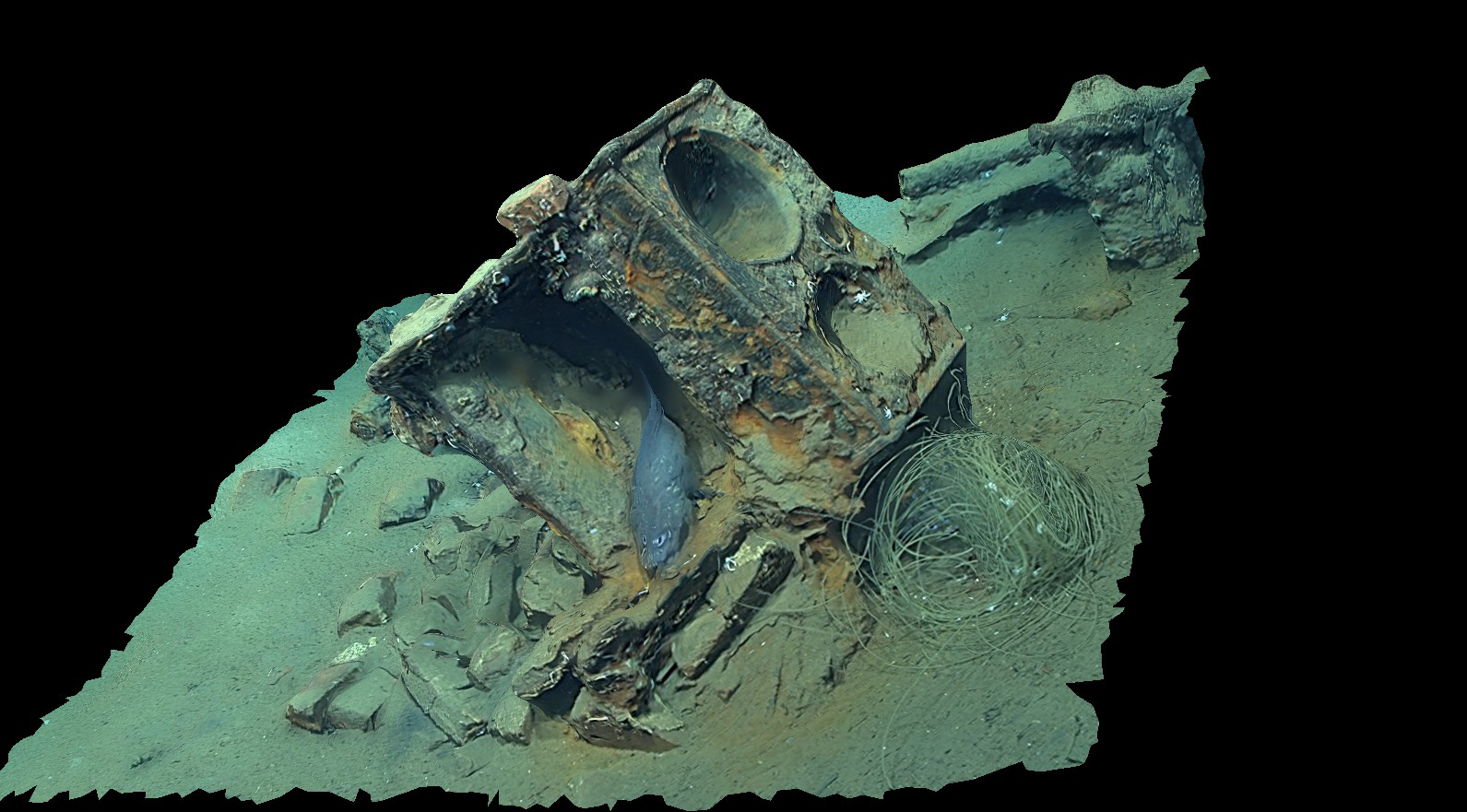
Remains of what is most likely the whaling brig Industry, including the tryworks, a furnace that was used to render whale blubber into oil, and an anchor. Image courtesy of NOAA Ocean Exploration, 2022 ROV and Mapping Shakedown.
Download largest version (jpg, 878 KB)
Exploration
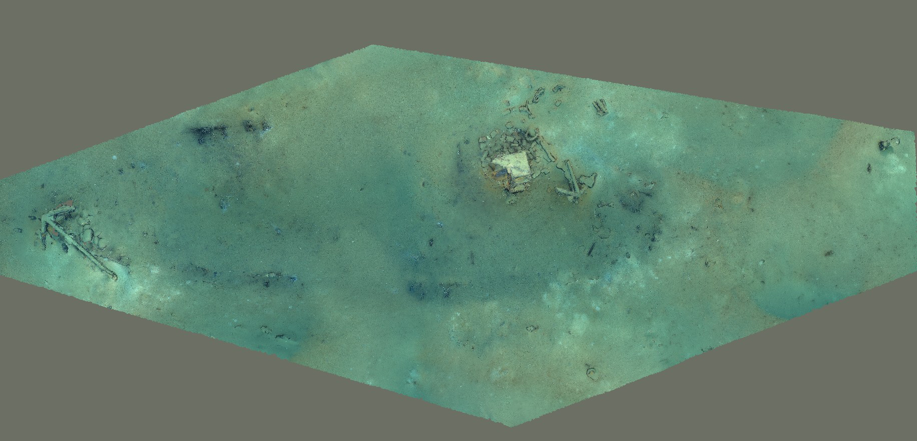
Identified as Site 15563 by the Bureau of Ocean Energy Management (BOEM) after it was first located by an energy company in 2011, this shipwreck site was explored for the first time — and determined to most likely be Industry — on February 25, 2022, during a NOAA Ocean Exploration shakedown expedition aboard NOAA Ship Okeanos Explorer. Remotely operated vehicle (ROV) Deep Discoverer — equipped with an Insite Pacific Zeus Plus camera capable of collecting high-definition footage — was used to document the site, which is at a depth of approximately 1,845 meters and is approximately 22 meters long and 7 meters wide.
Modeling
A model of what is thought to be Industry (BOEM Wreck Site 15563) from NOAA Ocean Exploration is based on the ROV dive footage from timestamps 20:35 to 23:00. This footage was exported into 4,636 still images in VLC Player. Three individual models were made (the entirety of the site, the stove, and an anchor) and then stitched together in Rhinoceros 8 and uploaded to Construkted Reality. An additional photogrammetric model of this site is available on BOEM’s Virtual Underwater Museum.
Model Navigation Basics
Desktop:
- To zoom in and out: Use the scroll wheel on the mouse.
- To move around: Left click on the model with the mouse and drag.
- To rotate: Right click on the model with the mouse and drag.
Mobile Devices:
- To zoom in and out and rotate: Pinch
- To move around: Tap and drag any direction.
Related Links
Site Metadata
| Site | Data |
|---|---|
| Site Name | BOEM Wreck Site 15563 |
| Type | UCH |
| UCH Vessel Date Built | 1816 |
| UCH Vessel Date Sank | May 26, 1836 |
| Hull Material | Wood |
| Official Number | N/A |
| Location | Northern Gulf of Mexico |
| Depth | 1,845 meters |
| Length | Approximately 22 meters |
| Width | Approximately 7 meters |
Dive Metadata
| Dive | Data |
|---|---|
| Expedition Number | EX2201 |
| Expedition Name | 2022 ROV and Mapping Shakedown |
| ROV Dive Number | 02 |
| ROV Dive Date | February 25, 2022 |
| ROV Used | Deep Discoverer |
| Camera Information | Insite Pacific Zeus Plus HD, 3-CCD color camera with 2/3-inch 2,200,000 pixel 1080i IT CCDs |
| Video or Stills | Video |
Model Metadata
| Model | Data |
|---|---|
| Software | Agisoft Metashape Standard Version 2.0.1, Rhinoceros 8 |
| Number of Images Used/Format | 4,636/JPG |
| Image Alignment Percentage | 83% |
| Number of Tie Points | 1,408,604 |
| Time to Complete | 6 hours |
| Orthomosaic Views Available | No |
| Images Available | Yes |
| Animations Available | Yes |
| Available File Exports/Location/POC | archaeology.oceanexploration@noaa.gov |